Note:
The expiration time in the watch graphic is amended if the watch is
replaced, cancelled or extended.
Note:
Note:
The expiration time in the watch graphic is amended if the watch is
replaced, cancelled or extended.
Note: Click for
Watch Status Reports.
SEL1
URGENT - IMMEDIATE BROADCAST REQUESTED
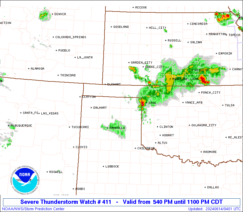
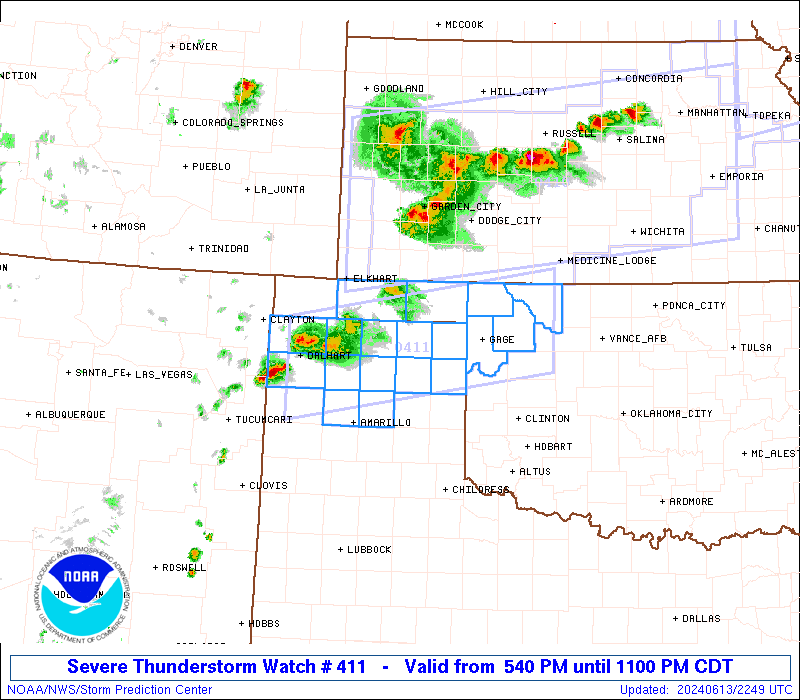
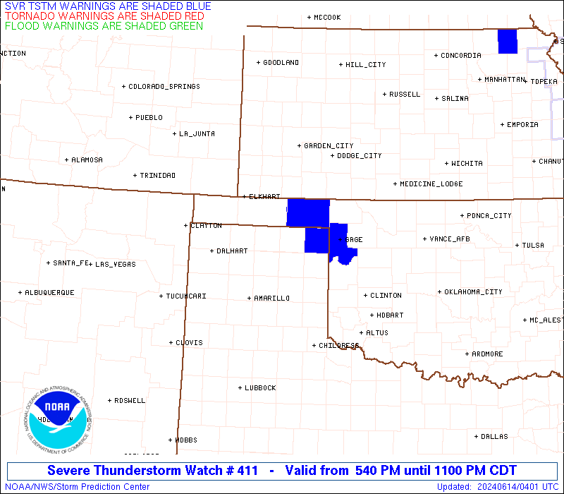
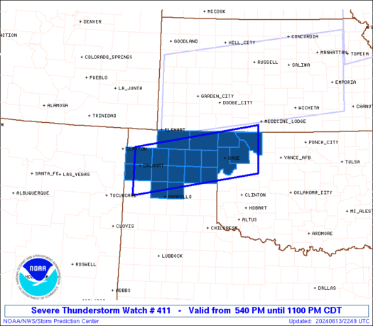
Severe Thunderstorm Watch Number 411
NWS Storm Prediction Center Norman OK
540 PM CDT Thu Jun 13 2024
The NWS Storm Prediction Center has issued a
* Severe Thunderstorm Watch for portions of
Northwest Oklahoma and the Panhandle
Texas Panhandle
* Effective this Thursday afternoon and evening from 540 PM until
1100 PM CDT.
* Primary threats include...
Scattered damaging winds and isolated significant gusts to 75
mph possible
SUMMARY...A few clusters of thunderstorms will likely evolve through
the evening across the Watch area. Evaporatively cooled downdrafts
with the stronger thunderstorm cores will pose a risk for severe
outflow winds. Peak gusts with this thunderstorm activity will
probably range between 60-75 mph.
The severe thunderstorm watch area is approximately along and 45
statute miles north and south of a line from 15 miles southwest of
Dalhart TX to 15 miles south of Alva OK. For a complete depiction of
the watch see the associated watch outline update (WOUS64 KWNS
WOU1).
PRECAUTIONARY/PREPAREDNESS ACTIONS...
REMEMBER...A Severe Thunderstorm Watch means conditions are
favorable for severe thunderstorms in and close to the watch area.
Persons in these areas should be on the lookout for threatening
weather conditions and listen for later statements and possible
warnings. Severe thunderstorms can and occasionally do produce
tornadoes.
&&
OTHER WATCH INFORMATION...CONTINUE...WW 408...WW 409...WW 410...
AVIATION...A few severe thunderstorms with hail surface and aloft to
1 inch. Extreme turbulence and surface wind gusts to 65 knots. A few
cumulonimbi with maximum tops to 500. Mean storm motion vector
32020.
...Smith
 Note:
The Aviation Watch (SAW) product is an approximation to the watch area.
The actual watch is depicted by the shaded areas.
Note:
The Aviation Watch (SAW) product is an approximation to the watch area.
The actual watch is depicted by the shaded areas.
   SAW1
   WW 411 SEVERE TSTM OK TX 132240Z - 140400Z
   AXIS..45 STATUTE MILES NORTH AND SOUTH OF LINE..
   15SW DHT/DALHART TX/ - 15S AVK/ALVA OK/
   ..AVIATION COORDS.. 40NM N/S /59NE TCC - 38WNW END/
   HAIL SURFACE AND ALOFT..1 INCH. WIND GUSTS..65 KNOTS.
   MAX TOPS TO 500. MEAN STORM MOTION VECTOR 32020.

   LAT...LON 36520274 37209867 35909867 35220274

   THIS IS AN APPROXIMATION TO THE WATCH AREA.  FOR A
   COMPLETE DEPICTION OF THE WATCH SEE WOUS64 KWNS
   FOR WOU1.
Watch 411 Status Report Messages:
STATUS REPORT #3 ON WW 411

VALID 140240Z - 140340Z

SEVERE WEATHER THREAT CONTINUES RIGHT OF A LINE FROM 35 ESE AMA
TO 10 ENE LBL.

..THORNTON..06/14/24

ATTN...WFO...AMA...OUN...

&&

STATUS REPORT FOR WS 411

SEVERE WEATHER THREAT CONTINUES FOR THE FOLLOWING AREAS

OKC003-007-045-053-059-093-151-153-140340-

OK
.    OKLAHOMA COUNTIES INCLUDED ARE

ALFALFA 	     BEAVER		 ELLIS
GRANT		     HARPER		 MAJOR
WOODS		     WOODWARD
$$


TXC211-295-357-393-140340-

TX
.    TEXAS COUNTIES INCLUDED ARE

HEMPHILL	     LIPSCOMB		 OCHILTREE
ROBERTS
$$


THE WATCH STATUS MESSAGE IS FOR GUIDANCE PURPOSES ONLY.  PLEASE
REFER TO WATCH COUNTY NOTIFICATION STATEMENTS FOR OFFICIAL
INFORMATION ON COUNTIES...INDEPENDENT CITIES AND MARINE ZONES
CLEARED FROM SEVERE THUNDERSTORM AND TORNADO WATCHES.
$$

STATUS REPORT #2 ON WW 411

VALID 140200Z - 140340Z

SEVERE WEATHER THREAT CONTINUES RIGHT OF A LINE FROM 40 SW DHT TO
15 W BGD TO 10 WNW GUY.

..THORNTON..06/14/24

ATTN...WFO...AMA...OUN...

&&

STATUS REPORT FOR WS 411

SEVERE WEATHER THREAT CONTINUES FOR THE FOLLOWING AREAS

OKC003-007-045-053-059-093-139-151-153-140340-

OK
.    OKLAHOMA COUNTIES INCLUDED ARE

ALFALFA 	     BEAVER		 ELLIS
GRANT		     HARPER		 MAJOR
TEXAS		     WOODS		 WOODWARD
$$


TXC065-195-211-233-295-357-375-393-140340-

TX
.    TEXAS COUNTIES INCLUDED ARE

CARSON		     HANSFORD		 HEMPHILL
HUTCHINSON	     LIPSCOMB		 OCHILTREE
POTTER		     ROBERTS
$$


THE WATCH STATUS MESSAGE IS FOR GUIDANCE PURPOSES ONLY.  PLEASE
REFER TO WATCH COUNTY NOTIFICATION STATEMENTS FOR OFFICIAL
INFORMATION ON COUNTIES...INDEPENDENT CITIES AND MARINE ZONES
CLEARED FROM SEVERE THUNDERSTORM AND TORNADO WATCHES.
$$

STATUS REPORT #1 ON WW 411

VALID 140050Z - 140140Z

THE SEVERE WEATHER THREAT CONTINUES ACROSS THE ENTIRE WATCH AREA.

..THORNTON..06/14/24

ATTN...WFO...AMA...OUN...

&&

STATUS REPORT FOR WS 411

SEVERE WEATHER THREAT CONTINUES FOR THE FOLLOWING AREAS

OKC003-007-045-053-059-093-139-151-153-140140-

OK
.    OKLAHOMA COUNTIES INCLUDED ARE

ALFALFA 	     BEAVER		 ELLIS
GRANT		     HARPER		 MAJOR
TEXAS		     WOODS		 WOODWARD
$$


TXC065-111-195-205-211-233-295-341-357-375-393-421-140140-

TX
.    TEXAS COUNTIES INCLUDED ARE

CARSON		     DALLAM		 HANSFORD
HARTLEY 	     HEMPHILL		 HUTCHINSON
LIPSCOMB	     MOORE		 OCHILTREE
POTTER		     ROBERTS		 SHERMAN
$$


THE WATCH STATUS MESSAGE IS FOR GUIDANCE PURPOSES ONLY.  PLEASE
REFER TO WATCH COUNTY NOTIFICATION STATEMENTS FOR OFFICIAL
INFORMATION ON COUNTIES...INDEPENDENT CITIES AND MARINE ZONES
CLEARED FROM SEVERE THUNDERSTORM AND TORNADO WATCHES.
$$
Note:
Click for Complete Product Text.
Tornadoes
Probability of 2 or more tornadoes
|
Low (<5%)
|
Probability of 1 or more strong (EF2-EF5) tornadoes
|
Low (<2%)
|
Wind
Probability of 10 or more severe wind events
|
Mod (40%)
|
Probability of 1 or more wind events > 65 knots
|
Mod (30%)
|
Hail
Probability of 10 or more severe hail events
|
Low (10%)
|
Probability of 1 or more hailstones > 2 inches
|
Low (<5%)
|
Combined Severe Hail/Wind
Probability of 6 or more combined severe hail/wind events
|
Mod (60%)
|
For each watch, probabilities for particular events inside the watch
(listed above in each table) are determined by the issuing forecaster.
The "Low" category contains probability values ranging from less than 2%
to 20% (EF2-EF5 tornadoes), less than 5% to 20% (all other probabilities),
"Moderate" from 30% to 60%, and "High" from 70% to greater than 95%.
High values are bolded and lighter in color to provide awareness of
an increased threat for a particular event.


 @NWSSPC