 Note:
The expiration time in the watch graphic is amended if the watch is
replaced, cancelled or extended.
Note:
Note:
The expiration time in the watch graphic is amended if the watch is
replaced, cancelled or extended.
Note: Click for
Watch Status Reports.
SEL9
URGENT - IMMEDIATE BROADCAST REQUESTED
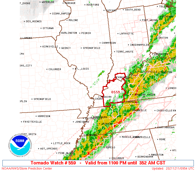
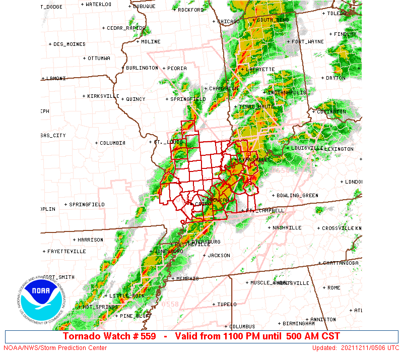
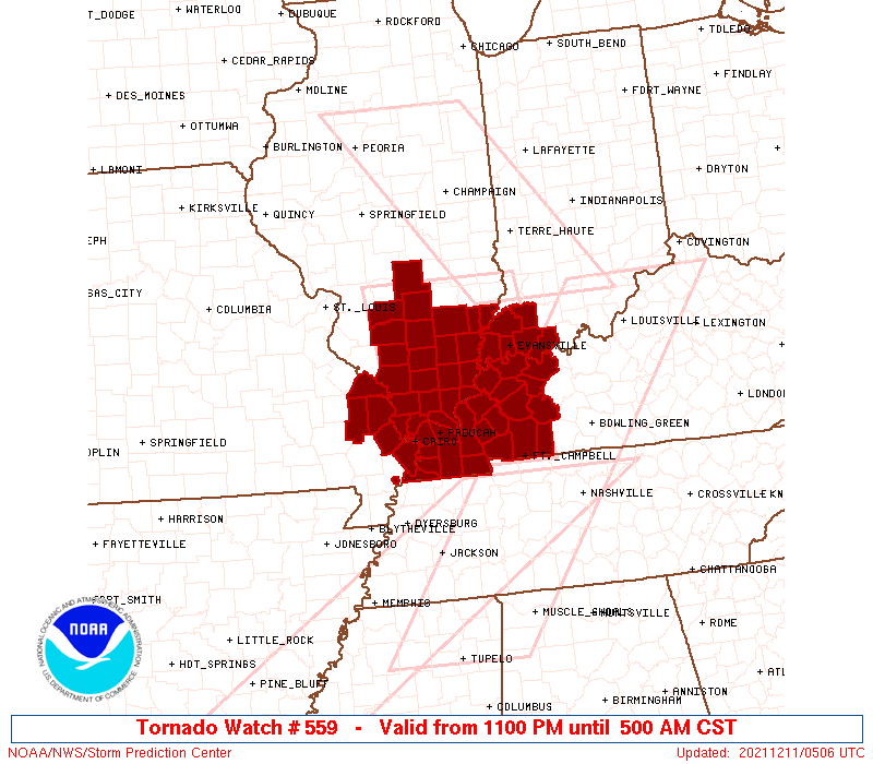
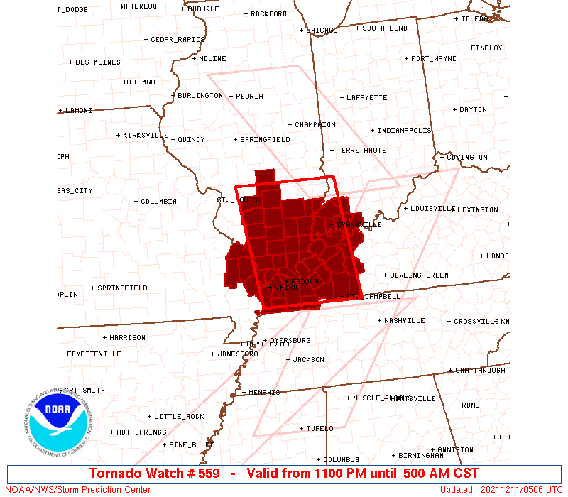
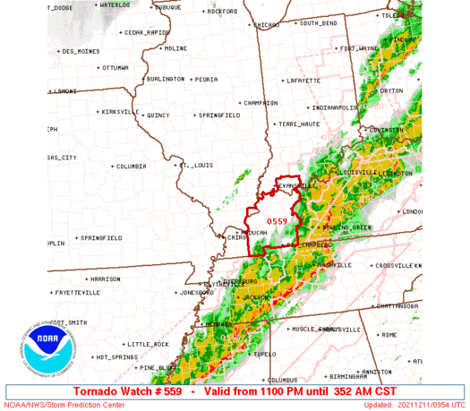
Tornado Watch Number 559
NWS Storm Prediction Center Norman OK
1100 PM CST Fri Dec 10 2021
The NWS Storm Prediction Center has issued a
* Tornado Watch for portions of
Southern Illinois
Southwest Indiana
Western Kentucky
Southeast Missouri
* Effective this Friday night and Saturday morning from 1100 PM
until 500 AM CST.
* Primary threats include...
Several tornadoes and a couple intense tornadoes likely
Scattered damaging wind gusts to 70 mph possible
SUMMARY...Near-term tornado threat will be greatest with a
long-track strong to potentially violent tornado in western
Kentucky. A tornado and wind threat should persist with an upstream
line of storms across southern Illinois into southeast Missouri.
The tornado watch area is approximately along and 65 statute miles
east and west of a line from 30 miles northeast of Salem IL to 45
miles southeast of Paducah KY. For a complete depiction of the watch
see the associated watch outline update (WOUS64 KWNS WOU9).
PRECAUTIONARY/PREPAREDNESS ACTIONS...
REMEMBER...A Tornado Watch means conditions are favorable for
tornadoes and severe thunderstorms in and close to the watch
area. Persons in these areas should be on the lookout for
threatening weather conditions and listen for later statements
and possible warnings.
&&
OTHER WATCH INFORMATION...CONTINUE...WW 552...WW 553...WW
554...WW 555...WW 556...WW 557...WW 558...
AVIATION...Tornadoes and a few severe thunderstorms with hail
surface and aloft to 1 inch. Extreme turbulence and surface wind
gusts to 60 knots. A few cumulonimbi with maximum tops to 450. Mean
storm motion vector 23040.
...Grams
 Note:
The Aviation Watch (SAW) product is an approximation to the watch area.
The actual watch is depicted by the shaded areas.
Note:
The Aviation Watch (SAW) product is an approximation to the watch area.
The actual watch is depicted by the shaded areas.
   SAW9
   WW 559 TORNADO IL IN KY MO 110500Z - 111100Z
   AXIS..65 STATUTE MILES EAST AND WEST OF LINE..
   30NE SLO/SALEM IL/ - 45SE PAH/PADUCAH KY/
   ..AVIATION COORDS.. 55NM E/W /49SSE AXC - 65ENE DYR/
   HAIL SURFACE AND ALOFT..1 INCH. WIND GUSTS..60 KNOTS.
   MAX TOPS TO 450. MEAN STORM MOTION VECTOR 23040.

   LAT...LON 38958737 36598702 36598937 38958978

   THIS IS AN APPROXIMATION TO THE WATCH AREA.  FOR A
   COMPLETE DEPICTION OF THE WATCH SEE WOUS64 KWNS
   FOR WOU9.
Watch 559 Status Report Messages:
STATUS REPORT #3 ON WW 559

VALID 110847Z - 111040Z

SEVERE WEATHER THREAT CONTINUES RIGHT OF A LINE FROM 15 SW HOP TO
30 SW OWB TO 10 SE OWB.

..EDWARDS..12/11/21

ATTN...WFO...PAH...LSX...

&&

STATUS REPORT FOR WT 559

SEVERE WEATHER THREAT CONTINUES FOR THE FOLLOWING AREAS

INC147-111040-

IN
.    INDIANA COUNTIES INCLUDED ARE

SPENCER
$$


KYC047-059-107-149-177-219-111040-

KY
.    KENTUCKY COUNTIES INCLUDED ARE

CHRISTIAN	     DAVIESS		 HOPKINS
MCLEAN		     MUHLENBERG 	 TODD
$$


THE WATCH STATUS MESSAGE IS FOR GUIDANCE PURPOSES ONLY.  PLEASE
REFER TO WATCH COUNTY NOTIFICATION STATEMENTS FOR OFFICIAL
INFORMATION ON COUNTIES...INDEPENDENT CITIES AND MARINE ZONES
CLEARED FROM SEVERE THUNDERSTORM AND TORNADO WATCHES.
$$

STATUS REPORT #2 ON WW 559

VALID 110800Z - 110940Z

SEVERE WEATHER THREAT CONTINUES RIGHT OF A LINE FROM 40 SSW PAH
TO 25 NNE PAH TO 10 SSW EVV TO 35 NE EVV.

..LEITMAN..12/11/21

ATTN...WFO...PAH...LSX...

&&

STATUS REPORT FOR WT 559

SEVERE WEATHER THREAT CONTINUES FOR THE FOLLOWING AREAS

ILC069-127-110940-

IL
.    ILLINOIS COUNTIES INCLUDED ARE

HARDIN		     MASSAC
$$


INC147-173-110940-

IN
.    INDIANA COUNTIES INCLUDED ARE

SPENCER 	     WARRICK
$$


KYC033-035-039-047-055-059-083-101-105-107-139-143-145-149-157-
177-219-221-225-233-110940-

KY
.    KENTUCKY COUNTIES INCLUDED ARE

CALDWELL	     CALLOWAY		 CARLISLE
CHRISTIAN	     CRITTENDEN 	 DAVIESS
GRAVES		     HENDERSON		 HICKMAN
HOPKINS 	     LIVINGSTON 	 LYON
MCCRACKEN	     MCLEAN		 MARSHALL
MUHLENBERG	     TODD		 TRIGG
UNION		     WEBSTER
$$


THE WATCH STATUS MESSAGE IS FOR GUIDANCE PURPOSES ONLY.  PLEASE
REFER TO WATCH COUNTY NOTIFICATION STATEMENTS FOR OFFICIAL
INFORMATION ON COUNTIES...INDEPENDENT CITIES AND MARINE ZONES
CLEARED FROM SEVERE THUNDERSTORM AND TORNADO WATCHES.
$$

STATUS REPORT #1 ON WW 559

VALID 110610Z - 110740Z

SEVERE WEATHER THREAT CONTINUES RIGHT OF A LINE FROM 10 N CGI TO
5 NE MDH TO 5 NNE MVN TO 20 SSW MTO.

..EDWARDS..12/11/21

ATTN...WFO...PAH...LSX...

&&

STATUS REPORT FOR WT 559

SEVERE WEATHER THREAT CONTINUES FOR THE FOLLOWING AREAS

ILC003-047-055-059-065-069-081-087-127-151-153-165-181-185-191-
193-199-110740-

IL
.    ILLINOIS COUNTIES INCLUDED ARE

ALEXANDER	     EDWARDS		 FRANKLIN
GALLATIN	     HAMILTON		 HARDIN
JEFFERSON	     JOHNSON		 MASSAC
POPE		     PULASKI		 SALINE
UNION		     WABASH		 WAYNE
WHITE		     WILLIAMSON
$$


INC051-125-129-147-163-173-110740-

IN
.    INDIANA COUNTIES INCLUDED ARE

GIBSON		     PIKE		 POSEY
SPENCER 	     VANDERBURGH	 WARRICK
$$


KYC007-033-035-039-047-055-059-075-083-101-105-107-139-143-145-
149-157-177-219-221-225-233-110740-

KY
.    KENTUCKY COUNTIES INCLUDED ARE

BALLARD 	     CALDWELL		 CALLOWAY
CARLISLE	     CHRISTIAN		 CRITTENDEN
DAVIESS 	     FULTON		 GRAVES
HENDERSON	     HICKMAN		 HOPKINS
LIVINGSTON	     LYON		 MCCRACKEN
MCLEAN		     MARSHALL		 MUHLENBERG
TODD		     TRIGG		 UNION
WEBSTER
$$


MOC133-201-110740-

MO
.    MISSOURI COUNTIES INCLUDED ARE

MISSISSIPPI	     SCOTT
$$


THE WATCH STATUS MESSAGE IS FOR GUIDANCE PURPOSES ONLY.  PLEASE
REFER TO WATCH COUNTY NOTIFICATION STATEMENTS FOR OFFICIAL
INFORMATION ON COUNTIES...INDEPENDENT CITIES AND MARINE ZONES
CLEARED FROM SEVERE THUNDERSTORM AND TORNADO WATCHES.
$$
Note:
Click for Complete Product Text.
Tornadoes
Probability of 2 or more tornadoes
|
High (80%)
|
Probability of 1 or more strong (EF2-EF5) tornadoes
|
High (70%)
|
Wind
Probability of 10 or more severe wind events
|
Mod (50%)
|
Probability of 1 or more wind events > 65 knots
|
Low (20%)
|
Hail
Probability of 10 or more severe hail events
|
Low (10%)
|
Probability of 1 or more hailstones > 2 inches
|
Low (<5%)
|
Combined Severe Hail/Wind
Probability of 6 or more combined severe hail/wind events
|
Mod (60%)
|
For each watch, probabilities for particular events inside the watch
(listed above in each table) are determined by the issuing forecaster.
The "Low" category contains probability values ranging from less than 2%
to 20% (EF2-EF5 tornadoes), less than 5% to 20% (all other probabilities),
"Moderate" from 30% to 60%, and "High" from 70% to greater than 95%.
High values are bolded and lighter in color to provide awareness of
an increased threat for a particular event.


 @NWSSPC