 Note:
The expiration time in the watch graphic is amended if the watch is
replaced, cancelled or extended.
Note:
Note:
The expiration time in the watch graphic is amended if the watch is
replaced, cancelled or extended.
Note: Click for
Watch Status Reports.
SEL7
URGENT - IMMEDIATE BROADCAST REQUESTED
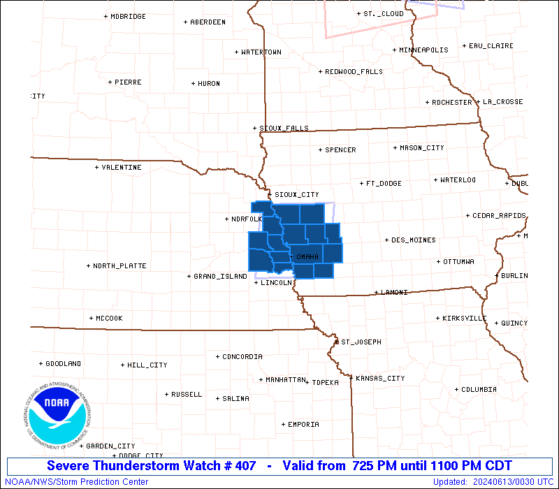
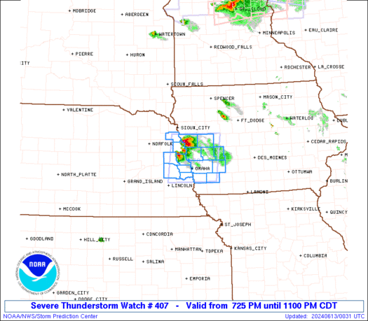
Severe Thunderstorm Watch Number 407
NWS Storm Prediction Center Norman OK
725 PM CDT Wed Jun 12 2024
The NWS Storm Prediction Center has issued a
* Severe Thunderstorm Watch for portions of
Western Iowa
Eastern Nebraska
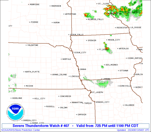
* Effective this Wednesday evening from 725 PM until 1100 PM CDT.
* Primary threats include...
Scattered large hail and isolated very large hail events to 3.5
inches in diameter possible
Scattered damaging wind gusts to 70 mph possible
A tornado or two possible
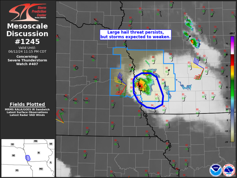
SUMMARY...A couple of severe supercells are possible over the Watch
area this evening. The stronger storms will potentially be capable
of very large to giant hail (2 to 3.5 inches in diameter), localized
severe gusts, and perhaps a tornado.
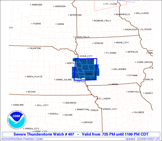
The severe thunderstorm watch area is approximately along and 45
statute miles east and west of a line from 25 miles northwest of
Denison IA to 25 miles south of Omaha NE. For a complete depiction
of the watch see the associated watch outline update (WOUS64 KWNS
WOU7).
PRECAUTIONARY/PREPAREDNESS ACTIONS...
REMEMBER...A Severe Thunderstorm Watch means conditions are
favorable for severe thunderstorms in and close to the watch area.
Persons in these areas should be on the lookout for threatening
weather conditions and listen for later statements and possible
warnings. Severe thunderstorms can and occasionally do produce
tornadoes.
&&
OTHER WATCH INFORMATION...CONTINUE...WW 405...WW 406...
AVIATION...A few severe thunderstorms with hail surface and aloft to
3.5 inches. Extreme turbulence and surface wind gusts to 60 knots. A
few cumulonimbi with maximum tops to 500. Mean storm motion vector
33020.
...Smith
   SEL7

   URGENT - IMMEDIATE BROADCAST REQUESTED
   Severe Thunderstorm Watch Number 407
   NWS Storm Prediction Center Norman OK
   725 PM CDT Wed Jun 12 2024

   The NWS Storm Prediction Center has issued a

   * Severe Thunderstorm Watch for portions of
     Western Iowa
     Eastern Nebraska

   * Effective this Wednesday evening from 725 PM until 1100 PM CDT.

   * Primary threats include...
     Scattered large hail and isolated very large hail events to 3.5
       inches in diameter possible
     Scattered damaging wind gusts to 70 mph possible
     A tornado or two possible

   SUMMARY...A couple of severe supercells are possible over the Watch
   area this evening.  The stronger storms will potentially be capable
   of very large to giant hail (2 to 3.5 inches in diameter), localized
   severe gusts, and perhaps a tornado.

   The severe thunderstorm watch area is approximately along and 45
   statute miles east and west of a line from 25 miles northwest of
   Denison IA to 25 miles south of Omaha NE. For a complete depiction
   of the watch see the associated watch outline update (WOUS64 KWNS
   WOU7).

   PRECAUTIONARY/PREPAREDNESS ACTIONS...

   REMEMBER...A Severe Thunderstorm Watch means conditions are
   favorable for severe thunderstorms in and close to the watch area.
   Persons in these areas should be on the lookout for threatening
   weather conditions and listen for later statements and possible
   warnings. Severe thunderstorms can and occasionally do produce
   tornadoes.

   &&

   OTHER WATCH INFORMATION...CONTINUE...WW 405...WW 406...

   AVIATION...A few severe thunderstorms with hail surface and aloft to
   3.5 inches. Extreme turbulence and surface wind gusts to 60 knots. A
   few cumulonimbi with maximum tops to 500. Mean storm motion vector
   33020.

   ...Smith
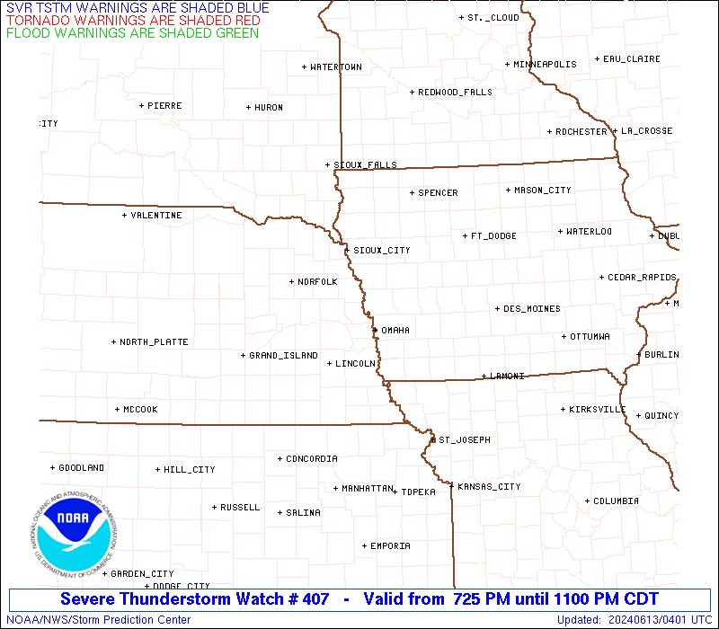
 Note:
The Aviation Watch (SAW) product is an approximation to the watch area.
The actual watch is depicted by the shaded areas.
Note:
The Aviation Watch (SAW) product is an approximation to the watch area.
The actual watch is depicted by the shaded areas.
   SAW7
   WW 407 SEVERE TSTM IA NE 130025Z - 130400Z
   AXIS..45 STATUTE MILES EAST AND WEST OF LINE..
   25NW DNS/DENISON IA/ - 25S OMA/OMAHA NE/
   ..AVIATION COORDS.. 40NM E/W /64N OVR - 16SSW OVR/
   HAIL SURFACE AND ALOFT..3.5 INCHES. WIND GUSTS..60 KNOTS.
   MAX TOPS TO 500. MEAN STORM MOTION VECTOR 33020.

   LAT...LON 42239485 40939504 40939676 42239661

   THIS IS AN APPROXIMATION TO THE WATCH AREA.  FOR A
   COMPLETE DEPICTION OF THE WATCH SEE WOUS64 KWNS
   FOR WOU7.
Watch 407 Status Report Messages:
STATUS REPORT #2 ON WW 407

VALID 130305Z - 130440Z

SEVERE WEATHER THREAT CONTINUES RIGHT OF A LINE FROM 25 SE OLU TO
45 NNW LWD.

..JEWELL..06/13/24

ATTN...WFO...DMX...OAX...

&&

STATUS REPORT FOR WS 407

SEVERE WEATHER THREAT CONTINUES FOR THE FOLLOWING AREAS

IAC129-137-130440-

IA
.    IOWA COUNTIES INCLUDED ARE

MILLS		     MONTGOMERY
$$


NEC153-155-130440-

NE
.    NEBRASKA COUNTIES INCLUDED ARE

SARPY		     SAUNDERS
$$


THE WATCH STATUS MESSAGE IS FOR GUIDANCE PURPOSES ONLY.  PLEASE
REFER TO WATCH COUNTY NOTIFICATION STATEMENTS FOR OFFICIAL
INFORMATION ON COUNTIES...INDEPENDENT CITIES AND MARINE ZONES
CLEARED FROM SEVERE THUNDERSTORM AND TORNADO WATCHES.
$$

STATUS REPORT #1 ON WW 407

VALID 130200Z - 130340Z

SEVERE WEATHER THREAT CONTINUES RIGHT OF A LINE FROM 30 NE OLU TO
15 W TQE TO 15 ENE TQE TO 40 E DNS.

..JEWELL..06/13/24

ATTN...WFO...DMX...OAX...

&&

STATUS REPORT FOR WS 407

SEVERE WEATHER THREAT CONTINUES FOR THE FOLLOWING AREAS

IAC009-029-085-129-137-155-165-130340-

IA
.    IOWA COUNTIES INCLUDED ARE

AUDUBON 	     CASS		 HARRISON
MILLS		     MONTGOMERY 	 POTTAWATTAMIE
SHELBY
$$


NEC021-053-055-153-155-177-130340-

NE
.    NEBRASKA COUNTIES INCLUDED ARE

BURT		     DODGE		 DOUGLAS
SARPY		     SAUNDERS		 WASHINGTON
$$


THE WATCH STATUS MESSAGE IS FOR GUIDANCE PURPOSES ONLY.  PLEASE
REFER TO WATCH COUNTY NOTIFICATION STATEMENTS FOR OFFICIAL
INFORMATION ON COUNTIES...INDEPENDENT CITIES AND MARINE ZONES
CLEARED FROM SEVERE THUNDERSTORM AND TORNADO WATCHES.
$$
Note:
Click for Complete Product Text.
Tornadoes
Probability of 2 or more tornadoes
|
Low (20%)
|
Probability of 1 or more strong (EF2-EF5) tornadoes
|
Low (<2%)
|
Wind
Probability of 10 or more severe wind events
|
Mod (40%)
|
Probability of 1 or more wind events > 65 knots
|
Low (20%)
|
Hail
Probability of 10 or more severe hail events
|
Mod (40%)
|
Probability of 1 or more hailstones > 2 inches
|
Mod (30%)
|
Combined Severe Hail/Wind
Probability of 6 or more combined severe hail/wind events
|
High (70%)
|
For each watch, probabilities for particular events inside the watch
(listed above in each table) are determined by the issuing forecaster.
The "Low" category contains probability values ranging from less than 2%
to 20% (EF2-EF5 tornadoes), less than 5% to 20% (all other probabilities),
"Moderate" from 30% to 60%, and "High" from 70% to greater than 95%.
High values are bolded and lighter in color to provide awareness of
an increased threat for a particular event.


 @NWSSPC