|
| Mesoscale Discussion 1245 |
|
< Previous MD Next MD >
|
|
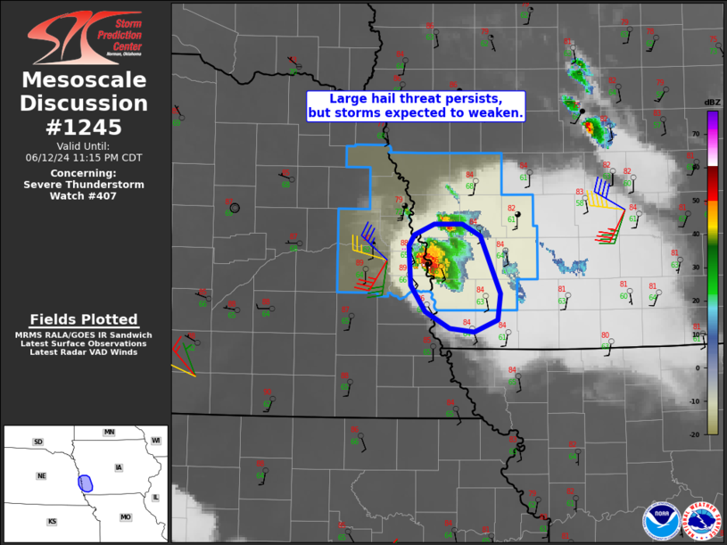
   Mesoscale Discussion 1245
   NWS Storm Prediction Center Norman OK
   0911 PM CDT Wed Jun 12 2024

   Areas affected...far eastern Nebraska into western Iowa

   Concerning...Severe Thunderstorm Watch 407...

   Valid 130211Z - 130415Z

   The severe weather threat for Severe Thunderstorm Watch 407
   continues.

   SUMMARY...The threat of large hail persists over a small area of
   eastern Nebraska into western Iowa in the near term. Storms will
   likely shrink in size during the next 1-2 hours.

   DISCUSSION...A pair of large supercells with history of very large
   hail remain over western IA into far eastern NE near the Omaha area.
   The 00Z sounding from OAX shows a rather deep moist layer up to
   nearly 700 mb, not far from the LFC, with favorable deep-layer
   shear.

   Given the loss of heating, the cooling boundary layer will gain
   convective inhibition relatively quickly, perhaps in the next hour,
   which should result in a weakening trend with these cells. Until
   then, hail will remain likely through about 03-04Z, with locally
   gusty winds as well prior to

   ..Jewell.. 06/13/2024

   ...Please see www.spc.noaa.gov for graphic product...

   ATTN...WFO...OAX...

   LAT...LON   41439612 41529605 41629584 41619552 41529532 41039511
               40829514 40729539 40749566 40889593 41119610 41439612
|
|
Top/All Mesoscale Discussions/Forecast Products/Home
|
|


 @NWSSPC