 Note:
The expiration time in the watch graphic is amended if the watch is
replaced, cancelled or extended.
Note:
Note:
The expiration time in the watch graphic is amended if the watch is
replaced, cancelled or extended.
Note: Click for
Watch Status Reports.
SEL6
URGENT - IMMEDIATE BROADCAST REQUESTED
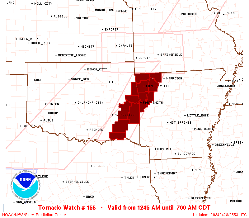
Tornado Watch Number 156
NWS Storm Prediction Center Norman OK
1245 AM CDT Sun Apr 28 2024
The NWS Storm Prediction Center has issued a
* Tornado Watch for portions of
Eastern Arkansas
Northwest Oklahoma
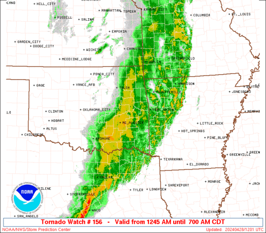
* Effective this Sunday morning from 1245 AM until 700 AM CDT.
* Primary threats include...
A couple tornadoes possible
Scattered damaging wind gusts to 70 mph possible
Isolated large hail events to 1 inch in diameter possible
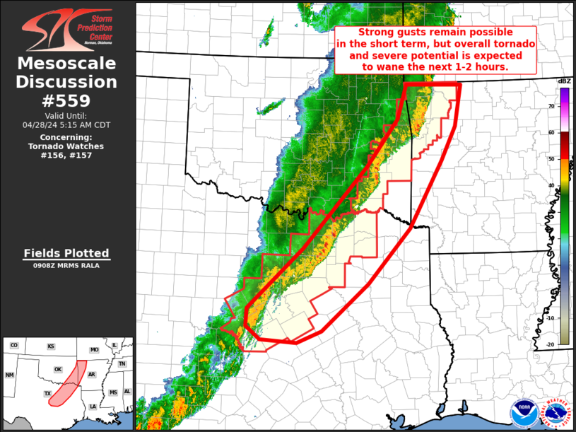
SUMMARY...A squall line with embedded circulations will continue to
pose a threat for a couple of tornadoes, damaging winds of 60-70 mph
and isolated large hail up to 1 inch diameter through the early
morning hours across eastern Oklahoma into northwest Arkansas.
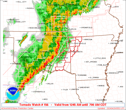
The tornado watch area is approximately along and 45 statute miles
east and west of a line from 35 miles north northeast of
Fayetteville AR to 70 miles south of Mcalester OK. For a complete
depiction of the watch see the associated watch outline update
(WOUS64 KWNS WOU6).
PRECAUTIONARY/PREPAREDNESS ACTIONS...
REMEMBER...A Tornado Watch means conditions are favorable for
tornadoes and severe thunderstorms in and close to the watch
area. Persons in these areas should be on the lookout for
threatening weather conditions and listen for later statements
and possible warnings.
&&
OTHER WATCH INFORMATION...CONTINUE...WW 152...WW 153...WW
154...WW 155...
AVIATION...Tornadoes and a few severe thunderstorms with hail
surface and aloft to 1 inch. Extreme turbulence and surface wind
gusts to 60 knots. A few cumulonimbi with maximum tops to 500. Mean
storm motion vector 24040.
...Thompson
   SEL6

   URGENT - IMMEDIATE BROADCAST REQUESTED
   Tornado Watch Number 156
   NWS Storm Prediction Center Norman OK
   1245 AM CDT Sun Apr 28 2024

   The NWS Storm Prediction Center has issued a

   * Tornado Watch for portions of
     Eastern Arkansas
     Northwest Oklahoma

   * Effective this Sunday morning from 1245 AM until 700 AM CDT.

   * Primary threats include...
     A couple tornadoes possible
     Scattered damaging wind gusts to 70 mph possible
     Isolated large hail events to 1 inch in diameter possible

   SUMMARY...A squall line with embedded circulations will continue to
   pose a threat for a couple of tornadoes, damaging winds of 60-70 mph
   and isolated large hail up to 1 inch diameter through the early
   morning hours across eastern Oklahoma into northwest Arkansas.

   The tornado watch area is approximately along and 45 statute miles
   east and west of a line from 35 miles north northeast of
   Fayetteville AR to 70 miles south of Mcalester OK. For a complete
   depiction of the watch see the associated watch outline update
   (WOUS64 KWNS WOU6).

   PRECAUTIONARY/PREPAREDNESS ACTIONS...

   REMEMBER...A Tornado Watch means conditions are favorable for
   tornadoes and severe thunderstorms in and close to the watch
   area. Persons in these areas should be on the lookout for
   threatening weather conditions and listen for later statements
   and possible warnings.

   &&

   OTHER WATCH INFORMATION...CONTINUE...WW 152...WW 153...WW
   154...WW 155...

   AVIATION...Tornadoes and a few severe thunderstorms with hail
   surface and aloft to 1 inch. Extreme turbulence and surface wind
   gusts to 60 knots. A few cumulonimbi with maximum tops to 500. Mean
   storm motion vector 24040.

   ...Thompson
 Note:
The Aviation Watch (SAW) product is an approximation to the watch area.
The actual watch is depicted by the shaded areas.
Note:
The Aviation Watch (SAW) product is an approximation to the watch area.
The actual watch is depicted by the shaded areas.
   SAW6
   WW 156 TORNADO AR OK 280545Z - 281200Z
   AXIS..45 STATUTE MILES EAST AND WEST OF LINE..
   35NNE FYV/FAYETTEVILLE AR/ - 70S MLC/MCALESTER OK/
   ..AVIATION COORDS.. 40NM E/W /16NE RZC - 59S MLC/
   HAIL SURFACE AND ALOFT..1 INCH. WIND GUSTS..60 KNOTS.
   MAX TOPS TO 500. MEAN STORM MOTION VECTOR 24040.

   LAT...LON 36479312 33869500 33869656 36479474

   THIS IS AN APPROXIMATION TO THE WATCH AREA.  FOR A
   COMPLETE DEPICTION OF THE WATCH SEE WOUS64 KWNS
   FOR WOU6.
Watch 156 Status Report Messages:
STATUS REPORT #1 ON WW 156

VALID 280730Z - 280840Z

THE SEVERE WEATHER THREAT CONTINUES ACROSS THE ENTIRE WATCH AREA.

..LEITMAN..04/28/24

ATTN...WFO...TSA...

&&

STATUS REPORT FOR WT 156

SEVERE WEATHER THREAT CONTINUES FOR THE FOLLOWING AREAS

ARC007-015-033-047-087-131-143-280840-

AR
.    ARKANSAS COUNTIES INCLUDED ARE

BENTON		     CARROLL		 CRAWFORD
FRANKLIN	     MADISON		 SEBASTIAN
WASHINGTON
$$


OKC001-023-061-077-079-127-135-280840-

OK
.    OKLAHOMA COUNTIES INCLUDED ARE

ADAIR		     CHOCTAW		 HASKELL
LATIMER 	     LE FLORE		 PUSHMATAHA
SEQUOYAH
$$


THE WATCH STATUS MESSAGE IS FOR GUIDANCE PURPOSES ONLY.  PLEASE
REFER TO WATCH COUNTY NOTIFICATION STATEMENTS FOR OFFICIAL
INFORMATION ON COUNTIES...INDEPENDENT CITIES AND MARINE ZONES
CLEARED FROM SEVERE THUNDERSTORM AND TORNADO WATCHES.
$$
Note:
Click for Complete Product Text.
Tornadoes
Probability of 2 or more tornadoes
|
Mod (40%)
|
Probability of 1 or more strong (EF2-EF5) tornadoes
|
Low (20%)
|
Wind
Probability of 10 or more severe wind events
|
Mod (40%)
|
Probability of 1 or more wind events > 65 knots
|
Low (20%)
|
Hail
Probability of 10 or more severe hail events
|
Low (20%)
|
Probability of 1 or more hailstones > 2 inches
|
Low (10%)
|
Combined Severe Hail/Wind
Probability of 6 or more combined severe hail/wind events
|
Mod (60%)
|
For each watch, probabilities for particular events inside the watch
(listed above in each table) are determined by the issuing forecaster.
The "Low" category contains probability values ranging from less than 2%
to 20% (EF2-EF5 tornadoes), less than 5% to 20% (all other probabilities),
"Moderate" from 30% to 60%, and "High" from 70% to greater than 95%.
High values are bolded and lighter in color to provide awareness of
an increased threat for a particular event.


 @NWSSPC