|
Notice:
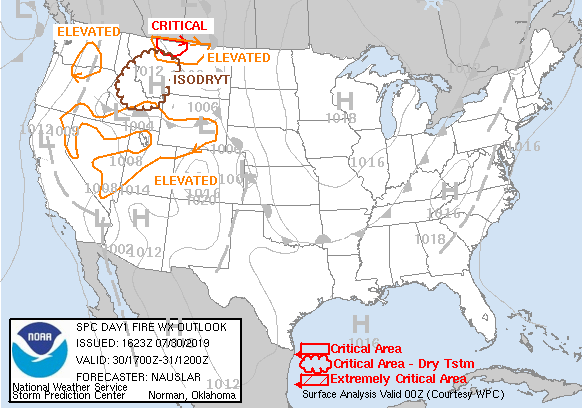
Starting November 26 2013, the SPC replaces the current SEE TEXT reference in its Day 1 and Day 2 Fire Weather Outlook
products with graphical depictions of areas of Elevated Risk and areas of Isolated Dry Thunderstorms. (Updated: November 26 2013)
|
|
The SPC will be replacing the current SEE TEXT reference in its Day 1 and Day 2 Fire Weather Outlook products with graphical depictions
of areas of Elevated Risk and areas of Isolated Dry Thunderstorms.
Starting on September 24, 2013 at 1500 UTC, previews of these changes will be available on the Fire Weather Outlook page.
Click here for the
Service Change Notice. (Updated: September 16 2013)
|
|
The NWS is undertaking its annual research to better serve the public's needs and request that you take the NWS 2013 Customer Satisfaction Survey at:
https://cfigroup.qualtrics.com/SE/?SID=SV_bCyQV2ZNlA8IRNj&LOC=1
The core section of the survey takes about 20 minutes to complete and does not need to be finished all at once.
You are also encouraged to take a moment and complete one or more of the additional sections covering Climate, Fire Weather, Hydrology, and Hurricane Services. (Updated: September 10 2013)
|
|
Starting June 25, 2013, the SPC will issue
Experimental Dry Thunderstorm Fire Weather Outlooks for Days 4 through 8 with individual web graphics.
(Updated: June 25 2013)
|
|
The SPC Mesoanalysis Page now has an option to incorporate the experimental ESRL Rapid Refresh
version 2 (RAPv2) model as background input for the mesoanalysis fields, in addition to the current operational NCEP
Rapid Refresh (RAP) model.
The RAPv2 is being developed by ESRL as the next version of the RAP.
More details about the RAP and RAPv2 are found at: rapidrefresh.noaa.gov.
(Updated: April 30 2013)
|
|
On April 9th, 2013 at 1500 UTC responsibility for Heavy Rain Mesoscale Discussions will transfer to the Weather
Prediction Center (WPC).
Click here for the Service Change Notice.
(Updated: April 5 2013)
|
|
We added population information potentially impacted by the categorical convective and fire weather outlooks.
The information is derived based on 2010 Census data and the NDFD outlook grids.
All information should be considered experimental and approximate.
(Updated: March 13 2013)
|
|
The Storm Prediction Center in cooperation with NOAA teamed up with the State of Oklahoma Insurance Department
to hold the 2013 National Severe Weather Workshop at the National Tornado Symposium, March 10-12, 2013, in Oklahoma City.
Details can be found on the National Severe Weather Workshop website at:
www.norman.noaa.gov/nsww/
(Updated: March 13 2013)
|
|
Notice:
Enhanced bulleted format of SPC Public Watch Notification Messages (SEL) (CONUS Only) effective April 16, 2013.
Click here for more details.
(Updated: January 30 2013)
|
|
A tornado environment browser for the contiguous United States is now available.
A tornado environment—convective mode sample (2003-2011) displays statistical information of supercell-related
convective parameters accompanied by smoothed tornadic convective mode climatology images.
(Updated: January 22 2013)
|
|
We mourn the loss of Jon Racy, SPC Lead Forecaster, who passed away on 8 January 2013 after a long and courageous battle with colorectal cancer. Click here for more details.
(Updated: January 8 2013)
|
|
The experimental SPC Storm-Scale Ensemble of Opportunity (SSEO) is produced by postprocessing seven (7) deterministic convection-allowing model runs. Special emphasis is placed on hourly maximum storm-attribute fields.
(Updated: November 13 2012)
|
|
Effective September 26, 2012, the SPC Thunderstorm Outlook becomes operational.
Here is the Service Change Notice 12-29.
(Updated: September 26 2012)
|
|
Effective September 25, 2012, the Day 3 Outlook includes general thunderstorm information. Please see Service Change Notice 12-26 for more information.
(Updated: September 26 2012)
|
|
Severe Weather GIS (SVRGIS)
page has been updated with preliminary January - June 2012 tornado data.
Visit http://www.spc.noaa.gov/gis/svrgis/ for details. (Updated: September 21 2012)
|
|
From June 5, 2012 to January 30, 2013, SPC will issue Experimental Probabilistic Fire Weather Dry Thunder and Strong Wind
Outlooks for Day 3 to 8 with individual web graphics.
Please read the Product Description Document (PDD)
and provide feedback using this link:
http://www.weather.gov/survey/nws-survey.php?code=spc38firewx.
(Updated: June 5 2012)
|
|
The Rapid Refresh (RAP) model has replaced the RUC model at 12Z on May 1 2012.
All references to RUC model fields in the Mesoscale Analysis, Fire Weather Analysis, and Compmap pages
have been changed to indicate the RAP model provides background input to the display fields. (Updated: May 1 2012)
|
|
New Meso Analysis Page has been implemented on March 27, 2012.
Changes include: 1) overlay/underlay select buttons moved from the bottom to the side based on user feedback.
2) current SPC products are displayed in a hovered window at the lower-right of the page to facilitate better
situational awareness as new products are issued.
3) A Trends/Forecast section has been added.
This allows the user to view trends in the parameter being examined, and even project the data into the
future for selected parameters.
The images are viewed when you mouseover the selected past/forecast hour.
Past images are of the SfcOA system, while future images are based on RUC model output.
Another use for this function is to compare the SfcOA Analysis of a selected parameter to the RUC
forecast for the same parameter at 00H.
This may provide useful information regarding the performance of the model. (Updated: Mar 27 2012)
|
|
New SREF Page has been implemented on March 27, 2012. Go to www.spc.noaa.gov/exper/sref/index_old.html to access the legacy version. (Updated: Mar 27 2012)
|
|
The 2011 SPC Severe Weather Database files are now available for download at http://www.spc.noaa.gov/wcm/#data. (Updated: Mar 26 2012)
|
|
Two new RSS feeds have been added:
For Particularly Dangerous Situation (PDS) tornado/severe thunderstorm watches only: http://www.spc.noaa.gov/products/spcpdswwrss.xml.
For Public Severe Weather Outlook (PWO) experimental multimedia briefings: http://www.spc.noaa.gov/products/spcmbrss.xml. (Updated: Mar 8 2012)
|
|
Top News Archive (updated:
February 01, 2024)
|


 @NWSSPC