 Note:
The expiration time in the watch graphic is amended if the watch is
replaced, cancelled or extended.
Note:
Note:
The expiration time in the watch graphic is amended if the watch is
replaced, cancelled or extended.
Note: Click for
Watch Status Reports.
SEL5
URGENT - IMMEDIATE BROADCAST REQUESTED
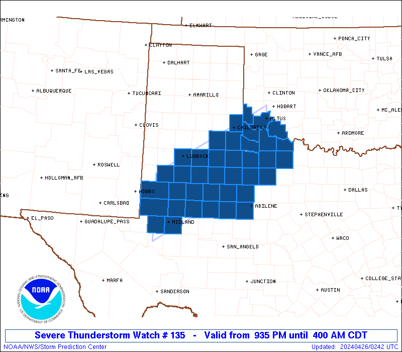
Severe Thunderstorm Watch Number 135
NWS Storm Prediction Center Norman OK
935 PM CDT Thu Apr 25 2024
The NWS Storm Prediction Center has issued a
* Severe Thunderstorm Watch for portions of
Southwestern Oklahoma
West and northwest Texas
* Effective this Thursday night and Friday morning from 935 PM
until 400 AM CDT.
* Primary threats include...
Scattered large hail and isolated very large hail events to 3
inches in diameter likely
Scattered damaging winds likely with isolated significant gusts
to 75 mph possible
A tornado or two possible
SUMMARY...Thunderstorms initially developing near the TX/NM line
over the Permian Basin/South Plains region should move northeastward
and evolve into an organized cluster or complex. Large to very
large hail and sporadic severe gusts are possible the first few
hours, transitioning to more of an organized wind threat with
isolated large hail. A tornado or two also may occur.
The severe thunderstorm watch area is approximately along and 60
statute miles north and south of a line from 35 miles northwest of
Midland TX to 35 miles south of Altus OK. For a complete depiction
of the watch see the associated watch outline update (WOUS64 KWNS
WOU5).
PRECAUTIONARY/PREPAREDNESS ACTIONS...
REMEMBER...A Severe Thunderstorm Watch means conditions are
favorable for severe thunderstorms in and close to the watch area.
Persons in these areas should be on the lookout for threatening
weather conditions and listen for later statements and possible
warnings. Severe thunderstorms can and occasionally do produce
tornadoes.
&&
OTHER WATCH INFORMATION...CONTINUE...WW 133...
AVIATION...A few severe thunderstorms with hail surface and aloft to
3 inches. Extreme turbulence and surface wind gusts to 65 knots. A
few cumulonimbi with maximum tops to 550. Mean storm motion vector
23045.
...Edwards
   SEL5

   URGENT - IMMEDIATE BROADCAST REQUESTED
   Severe Thunderstorm Watch Number 135
   NWS Storm Prediction Center Norman OK
   935 PM CDT Thu Apr 25 2024

   The NWS Storm Prediction Center has issued a

   * Severe Thunderstorm Watch for portions of
     Southwestern Oklahoma
     West and northwest Texas

   * Effective this Thursday night and Friday morning from 935 PM
     until 400 AM CDT.

   * Primary threats include...
     Scattered large hail and isolated very large hail events to 3
       inches in diameter likely
     Scattered damaging winds likely with isolated significant gusts
       to 75 mph possible
     A tornado or two possible

   SUMMARY...Thunderstorms initially developing near the TX/NM line
   over the Permian Basin/South Plains region should move northeastward
   and evolve into an organized cluster or complex.  Large to very
   large hail and sporadic severe gusts are possible the first few
   hours, transitioning to more of an organized wind threat with
   isolated large hail.  A tornado or two also may occur.

   The severe thunderstorm watch area is approximately along and 60
   statute miles north and south of a line from 35 miles northwest of
   Midland TX to 35 miles south of Altus OK. For a complete depiction
   of the watch see the associated watch outline update (WOUS64 KWNS
   WOU5).

   PRECAUTIONARY/PREPAREDNESS ACTIONS...

   REMEMBER...A Severe Thunderstorm Watch means conditions are
   favorable for severe thunderstorms in and close to the watch area.
   Persons in these areas should be on the lookout for threatening
   weather conditions and listen for later statements and possible
   warnings. Severe thunderstorms can and occasionally do produce
   tornadoes.

   &&

   OTHER WATCH INFORMATION...CONTINUE...WW 133...

   AVIATION...A few severe thunderstorms with hail surface and aloft to
   3 inches. Extreme turbulence and surface wind gusts to 65 knots. A
   few cumulonimbi with maximum tops to 550. Mean storm motion vector
   23045.

   ...Edwards
 Note:
The Aviation Watch (SAW) product is an approximation to the watch area.
The actual watch is depicted by the shaded areas.
Note:
The Aviation Watch (SAW) product is an approximation to the watch area.
The actual watch is depicted by the shaded areas.
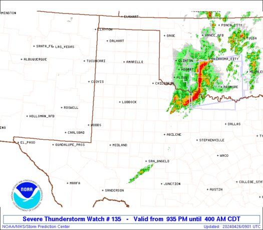
   SAW5
   WW 135 SEVERE TSTM OK TX 260235Z - 260900Z
   AXIS..60 STATUTE MILES NORTH AND SOUTH OF LINE..
   35NW MAF/MIDLAND TX/ - 35S LTS/ALTUS OK/
   ..AVIATION COORDS.. 50NM N/S /28NW MAF - 35WNW SPS/
   HAIL SURFACE AND ALOFT..3 INCHES. WIND GUSTS..65 KNOTS.
   MAX TOPS TO 550. MEAN STORM MOTION VECTOR 23045.

   LAT...LON 33180262 35009927 33289927 31440262

   THIS IS AN APPROXIMATION TO THE WATCH AREA.  FOR A
   COMPLETE DEPICTION OF THE WATCH SEE WOUS64 KWNS
   FOR WOU5.
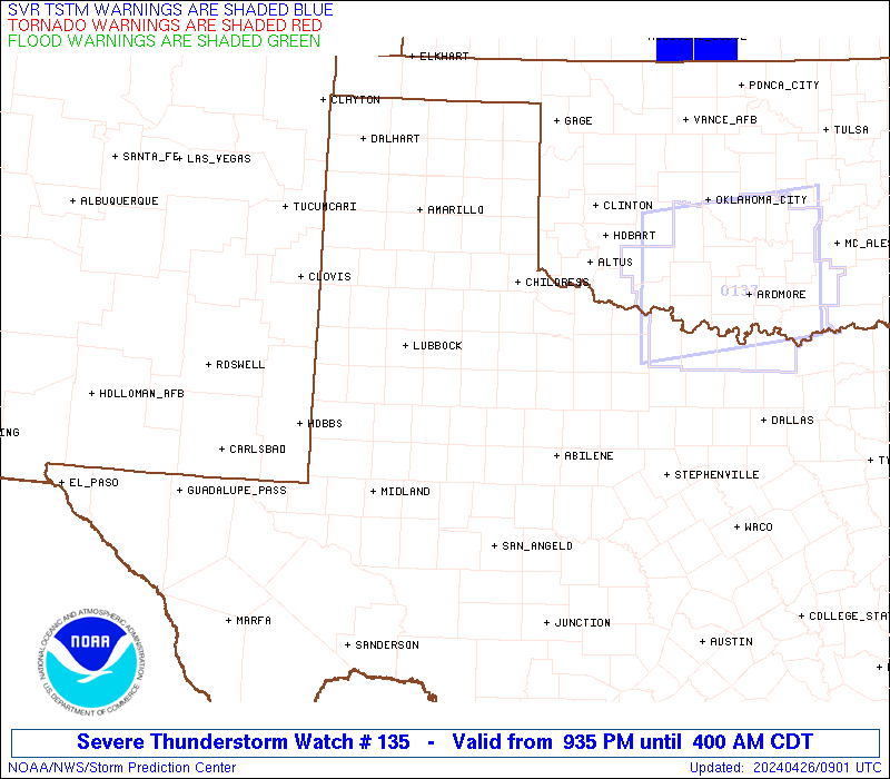
Watch 135 Status Report Messages:
STATUS REPORT #4 ON WW 135
VALID 260750Z - 260840Z
SEVERE WEATHER THREAT CONTINUES RIGHT OF A LINE FROM 30 WSW ABI
TO 75 NW ABI TO 55 S CDS TO 10 NE LTS.
FOR ADDITIONAL INFORMATION SEE MESOSCALE DISCUSSION 522
..THORNTON..04/26/24
ATTN...WFO...OUN...MAF...LUB...SJT...
&&
STATUS REPORT FOR WS 135
SEVERE WEATHER THREAT CONTINUES FOR THE FOLLOWING AREAS
OKC065-141-260840-
OK
. OKLAHOMA COUNTIES INCLUDED ARE
JACKSON TILLMAN
$$
TXC009-023-207-253-275-433-441-447-485-487-260840-
TX
. TEXAS COUNTIES INCLUDED ARE
ARCHER BAYLOR HASKELL
JONES KNOX STONEWALL
TAYLOR THROCKMORTON WICHITA
WILBARGER
$$
THE WATCH STATUS MESSAGE IS FOR GUIDANCE PURPOSES ONLY. PLEASE
REFER TO WATCH COUNTY NOTIFICATION STATEMENTS FOR OFFICIAL
INFORMATION ON COUNTIES...INDEPENDENT CITIES AND MARINE ZONES
CLEARED FROM SEVERE THUNDERSTORM AND TORNADO WATCHES.
$$
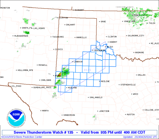
STATUS REPORT #3 ON WW 135
VALID 260650Z - 260740Z
SEVERE WEATHER THREAT CONTINUES RIGHT OF A LINE FROM 55 ENE BGS
TO 65 ESE LBB TO 30 NE CDS.
..GOSS..04/26/24
ATTN...WFO...OUN...MAF...LUB...SJT...
&&
STATUS REPORT FOR WS 135
SEVERE WEATHER THREAT CONTINUES FOR THE FOLLOWING AREAS
OKC057-065-141-260740-
OK
. OKLAHOMA COUNTIES INCLUDED ARE
HARMON JACKSON TILLMAN
$$
TXC009-023-101-125-151-155-197-207-253-263-269-275-353-433-441-
447-485-487-260740-
TX
. TEXAS COUNTIES INCLUDED ARE
ARCHER BAYLOR COTTLE
DICKENS FISHER FOARD
HARDEMAN HASKELL JONES
KENT KING KNOX
NOLAN STONEWALL TAYLOR
THROCKMORTON WICHITA WILBARGER
$$
THE WATCH STATUS MESSAGE IS FOR GUIDANCE PURPOSES ONLY. PLEASE
REFER TO WATCH COUNTY NOTIFICATION STATEMENTS FOR OFFICIAL
INFORMATION ON COUNTIES...INDEPENDENT CITIES AND MARINE ZONES
CLEARED FROM SEVERE THUNDERSTORM AND TORNADO WATCHES.
$$
STATUS REPORT #2 ON WW 135
VALID 260535Z - 260640Z
SEVERE WEATHER THREAT CONTINUES RIGHT OF A LINE FROM 20 SSW BGS
TO 45 SSE LBB TO 40 E PVW.
..GOSS..04/26/24
ATTN...WFO...OUN...MAF...LUB...SJT...
&&
STATUS REPORT FOR WS 135
SEVERE WEATHER THREAT CONTINUES FOR THE FOLLOWING AREAS
OKC057-065-141-260640-
OK
. OKLAHOMA COUNTIES INCLUDED ARE
HARMON JACKSON TILLMAN
$$
TXC009-023-033-075-101-107-125-151-155-165-169-197-207-227-253-
263-269-275-335-345-353-415-433-441-447-485-487-260640-
TX
. TEXAS COUNTIES INCLUDED ARE
ARCHER BAYLOR BORDEN
CHILDRESS COTTLE CROSBY
DICKENS FISHER FOARD
GAINES GARZA HARDEMAN
HASKELL HOWARD JONES
KENT KING KNOX
MITCHELL MOTLEY NOLAN
SCURRY STONEWALL TAYLOR
THROCKMORTON WICHITA WILBARGER
$$
THE WATCH STATUS MESSAGE IS FOR GUIDANCE PURPOSES ONLY. PLEASE
REFER TO WATCH COUNTY NOTIFICATION STATEMENTS FOR OFFICIAL
INFORMATION ON COUNTIES...INDEPENDENT CITIES AND MARINE ZONES
CLEARED FROM SEVERE THUNDERSTORM AND TORNADO WATCHES.
$$
STATUS REPORT #1 ON WW 135
VALID 260425Z - 260540Z
THE SEVERE WEATHER THREAT CONTINUES ACROSS THE ENTIRE WATCH AREA.
..GOSS..04/26/24
ATTN...WFO...OUN...MAF...LUB...SJT...
&&
STATUS REPORT FOR WS 135
SEVERE WEATHER THREAT CONTINUES FOR THE FOLLOWING AREAS
OKC057-065-141-260540-
OK
. OKLAHOMA COUNTIES INCLUDED ARE
HARMON JACKSON TILLMAN
$$
TXC003-009-023-033-075-101-107-115-125-135-151-155-165-169-197-
207-227-253-263-269-275-303-305-317-329-335-345-353-415-433-441-
445-447-485-487-260540-
TX
. TEXAS COUNTIES INCLUDED ARE
ANDREWS ARCHER BAYLOR
BORDEN CHILDRESS COTTLE
CROSBY DAWSON DICKENS
ECTOR FISHER FOARD
GAINES GARZA HARDEMAN
HASKELL HOWARD JONES
KENT KING KNOX
LUBBOCK LYNN MARTIN
MIDLAND MITCHELL MOTLEY
NOLAN SCURRY STONEWALL
TAYLOR TERRY THROCKMORTON
WICHITA WILBARGER
$$
THE WATCH STATUS MESSAGE IS FOR GUIDANCE PURPOSES ONLY. PLEASE
REFER TO WATCH COUNTY NOTIFICATION STATEMENTS FOR OFFICIAL
INFORMATION ON COUNTIES...INDEPENDENT CITIES AND MARINE ZONES
CLEARED FROM SEVERE THUNDERSTORM AND TORNADO WATCHES.
$$
Note:
Click for Complete Product Text.
Tornadoes
Probability of 2 or more tornadoes
|
Low (20%)
|
Probability of 1 or more strong (EF2-EF5) tornadoes
|
Low (5%)
|
Wind
Probability of 10 or more severe wind events
|
High (70%)
|
Probability of 1 or more wind events > 65 knots
|
Mod (30%)
|
Hail
Probability of 10 or more severe hail events
|
Mod (60%)
|
Probability of 1 or more hailstones > 2 inches
|
Mod (60%)
|
Combined Severe Hail/Wind
Probability of 6 or more combined severe hail/wind events
|
High (>95%)
|
For each watch, probabilities for particular events inside the watch
(listed above in each table) are determined by the issuing forecaster.
The "Low" category contains probability values ranging from less than 2%
to 20% (EF2-EF5 tornadoes), less than 5% to 20% (all other probabilities),
"Moderate" from 30% to 60%, and "High" from 70% to greater than 95%.
High values are bolded and lighter in color to provide awareness of
an increased threat for a particular event.


 @NWSSPC