|
| Mesoscale Discussion 444 |
|
< Previous MD Next MD >
|
|
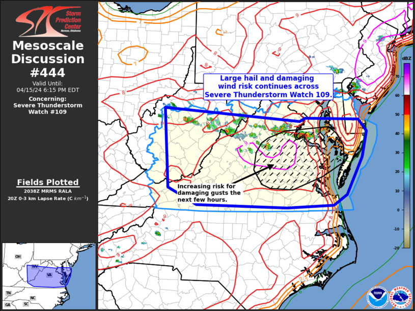
   Mesoscale Discussion 0444
   NWS Storm Prediction Center Norman OK
   0340 PM CDT Mon Apr 15 2024

   Areas affected...portions of WV...VA...MD and DE

   Concerning...Severe Thunderstorm Watch 109...

   Valid 152040Z - 152215Z

   The severe weather threat for Severe Thunderstorm Watch 109
   continues.

   SUMMARY...A severe hail and damaging wind risk will continue into
   the evening across Severe Thunderstorm Watch 109.

   DISCUSSION...Scattered thunderstorms have mainly posed a large hail
   risk through the afternoon across portions of West Virginia through
   northern Virginia as activity has remained more cellular. As
   convection continues to track southeast and additional storms
   develop, an increasing risk for damaging winds is possible across
   parts of of southeast VA toward the Chesapeake Bay vicinity. Some
   clustering via storm interactions is evident in convection from
   Culpeper County VA toward Charles County MD, and this may be the
   beginnings of increased damaging wind potential with south and east
   extent. This area is within a corridor of very steep low-level lapse
   rates and strong DCAPE, supporting damaging wind potential.
   Otherwise, expected convection to continue developing southeastward,
   with an accompany severe risk, through early evening.

   ..Leitman.. 04/15/2024

   ...Please see www.spc.noaa.gov for graphic product...

   ATTN...WFO...PHI...AKQ...LWX...RNK...PBZ...RLX...

   LAT...LON   38867697 38807529 38507505 37877521 36937570 36687612
               36627758 36698038 37118127 39108143 38787716 38867697
|
|
Top/All Mesoscale Discussions/Forecast Products/Home
|
|


 @NWSSPC