 Note:
The expiration time in the watch graphic is amended if the watch is
replaced, cancelled or extended.
Note:
Note:
The expiration time in the watch graphic is amended if the watch is
replaced, cancelled or extended.
Note: Click for
Watch Status Reports.
SEL9
URGENT - IMMEDIATE BROADCAST REQUESTED
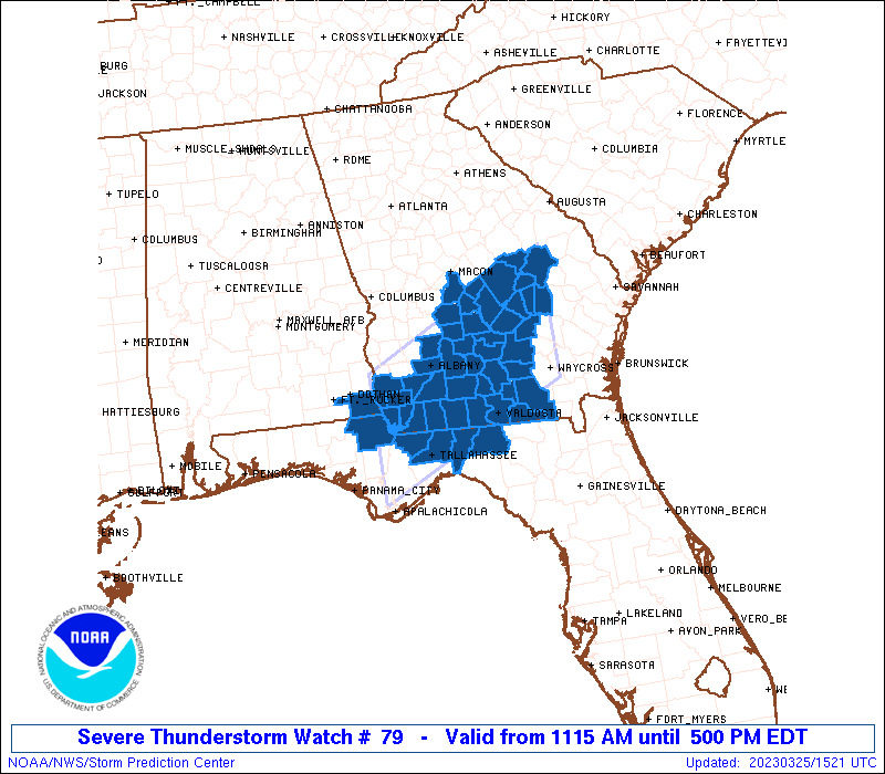
Severe Thunderstorm Watch Number 79
NWS Storm Prediction Center Norman OK
1115 AM EDT Sat Mar 25 2023
The NWS Storm Prediction Center has issued a
* Severe Thunderstorm Watch for portions of
Southeast Alabama
Northern Florida
Southern Georgia
* Effective this Saturday morning and afternoon from 1115 AM
until 500 PM EDT.
* Primary threats include...
Scattered damaging wind gusts to 70 mph possible
Isolated large hail events to 1.5 inches in diameter possible
A tornado or two possible
SUMMARY...Scattered strong to severe thunderstorms are expected to
track across southern Georgia and far northern Florida this
afternoon, posing a risk of locally damaging wind gusts or perhaps a
tornado or two.
The severe thunderstorm watch area is approximately along and 60
statute miles north and south of a line from 50 miles west northwest
of Tallahassee FL to 15 miles south southeast of Vidalia GA. For a
complete depiction of the watch see the associated watch outline
update (WOUS64 KWNS WOU9).
PRECAUTIONARY/PREPAREDNESS ACTIONS...
REMEMBER...A Severe Thunderstorm Watch means conditions are
favorable for severe thunderstorms in and close to the watch area.
Persons in these areas should be on the lookout for threatening
weather conditions and listen for later statements and possible
warnings. Severe thunderstorms can and occasionally do produce
tornadoes.
&&
AVIATION...A few severe thunderstorms with hail surface and aloft to
1.5 inches. Extreme turbulence and surface wind gusts to 60 knots. A
few cumulonimbi with maximum tops to 500. Mean storm motion vector
26030.
...Hart
   SEL9

   URGENT - IMMEDIATE BROADCAST REQUESTED
   Severe Thunderstorm Watch Number 79
   NWS Storm Prediction Center Norman OK
   1115 AM EDT Sat Mar 25 2023

   The NWS Storm Prediction Center has issued a

   * Severe Thunderstorm Watch for portions of
     Southeast Alabama
     Northern Florida
     Southern Georgia

   * Effective this Saturday morning and afternoon from 1115 AM
     until 500 PM EDT.

   * Primary threats include...
     Scattered damaging wind gusts to 70 mph possible
     Isolated large hail events to 1.5 inches in diameter possible
     A tornado or two possible

   SUMMARY...Scattered strong to severe thunderstorms are expected to
   track across southern Georgia and far northern Florida this
   afternoon, posing a risk of locally damaging wind gusts or perhaps a
   tornado or two.

   The severe thunderstorm watch area is approximately along and 60
   statute miles north and south of a line from 50 miles west northwest
   of Tallahassee FL to 15 miles south southeast of Vidalia GA. For a
   complete depiction of the watch see the associated watch outline
   update (WOUS64 KWNS WOU9).

   PRECAUTIONARY/PREPAREDNESS ACTIONS...

   REMEMBER...A Severe Thunderstorm Watch means conditions are
   favorable for severe thunderstorms in and close to the watch area.
   Persons in these areas should be on the lookout for threatening
   weather conditions and listen for later statements and possible
   warnings. Severe thunderstorms can and occasionally do produce
   tornadoes.

   &&

   AVIATION...A few severe thunderstorms with hail surface and aloft to
   1.5 inches. Extreme turbulence and surface wind gusts to 60 knots. A
   few cumulonimbi with maximum tops to 500. Mean storm motion vector
   26030.

   ...Hart
 Note:
The Aviation Watch (SAW) product is an approximation to the watch area.
The actual watch is depicted by the shaded areas.
Note:
The Aviation Watch (SAW) product is an approximation to the watch area.
The actual watch is depicted by the shaded areas.
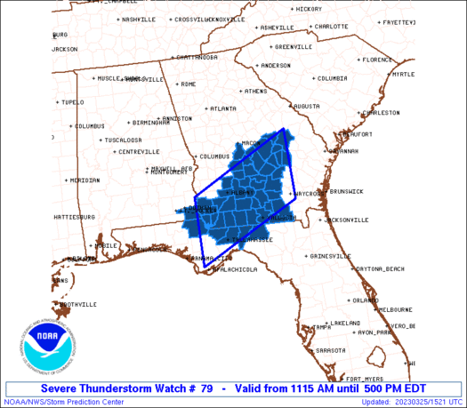
   SAW9
   WW 79 SEVERE TSTM AL FL GA 251515Z - 252100Z
   AXIS..60 STATUTE MILES NORTH AND SOUTH OF LINE..
   50WNW TLH/TALLAHASSEE FL/ - 15SSE VDI/VIDALIA GA/
   ..AVIATION COORDS.. 50NM N/S /40W TLH - 30NNE AMG/
   HAIL SURFACE AND ALOFT..1.5 INCHES. WIND GUSTS..60 KNOTS.
   MAX TOPS TO 500. MEAN STORM MOTION VECTOR 26030.

   LAT...LON 31548513 32868227 31128227 29818513

   THIS IS AN APPROXIMATION TO THE WATCH AREA.  FOR A
   COMPLETE DEPICTION OF THE WATCH SEE WOUS64 KWNS
   FOR WOU9.
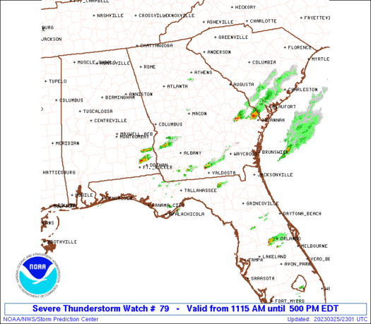
Watch 79 Status Report Messages:
STATUS REPORT #5 ON WW 79
VALID 252045Z - 252140Z
THE SEVERE WEATHER THREAT CONTINUES ACROSS THE ENTIRE WATCH AREA.
FOR ADDITIONAL INFORMATION SEE MESOSCALE DISCUSSION 343
..MOORE..03/25/23
ATTN...WFO...TAE...JAX...FFC...
&&
STATUS REPORT FOR WS 79
SEVERE WEATHER THREAT CONTINUES FOR THE FOLLOWING AREAS
ALC069-252140-
AL
. ALABAMA COUNTIES INCLUDED ARE
HOUSTON
$$
FLC039-063-065-073-079-252140-
FL
. FLORIDA COUNTIES INCLUDED ARE
GADSDEN JACKSON JEFFERSON
LEON MADISON
$$
GAC003-007-017-019-027-065-069-071-075-087-091-095-099-101-131-
155-161-173-185-201-205-209-253-271-275-277-279-283-287-309-321-
252140-
GA
. GEORGIA COUNTIES INCLUDED ARE
ATKINSON BAKER BEN HILL
BERRIEN BROOKS CLINCH
COFFEE COLQUITT COOK
DECATUR DODGE DOUGHERTY
EARLY ECHOLS GRADY
IRWIN JEFF DAVIS LANIER
LOWNDES MILLER MITCHELL
MONTGOMERY SEMINOLE TELFAIR
THOMAS TIFT TOOMBS
TREUTLEN TURNER WHEELER
WORTH
$$
THE WATCH STATUS MESSAGE IS FOR GUIDANCE PURPOSES ONLY. PLEASE
REFER TO WATCH COUNTY NOTIFICATION STATEMENTS FOR OFFICIAL
INFORMATION ON COUNTIES...INDEPENDENT CITIES AND MARINE ZONES
CLEARED FROM SEVERE THUNDERSTORM AND TORNADO WATCHES.
$$
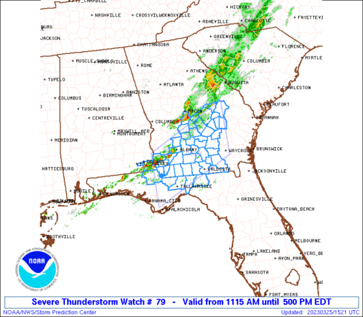
STATUS REPORT #4 ON WW 79
VALID 251935Z - 252040Z
SEVERE WEATHER THREAT CONTINUES RIGHT OF A LINE FROM 10 WNW DHN
TO 15 NNE ABY TO 40 SSW AGS.
FOR ADDITIONAL INFORMATION SEE MESOSCALE DISCUSSION 341
..MOORE..03/25/23
ATTN...WFO...TAE...JAX...FFC...
&&
STATUS REPORT FOR WS 79
SEVERE WEATHER THREAT CONTINUES FOR THE FOLLOWING AREAS
ALC069-252040-
AL
. ALABAMA COUNTIES INCLUDED ARE
HOUSTON
$$
FLC039-063-065-073-079-252040-
FL
. FLORIDA COUNTIES INCLUDED ARE
GADSDEN JACKSON JEFFERSON
LEON MADISON
$$
GAC003-007-017-019-027-065-069-071-075-087-091-095-099-101-131-
155-161-173-185-201-205-209-253-271-275-277-279-283-287-309-321-
252040-
GA
. GEORGIA COUNTIES INCLUDED ARE
ATKINSON BAKER BEN HILL
BERRIEN BROOKS CLINCH
COFFEE COLQUITT COOK
DECATUR DODGE DOUGHERTY
EARLY ECHOLS GRADY
IRWIN JEFF DAVIS LANIER
LOWNDES MILLER MITCHELL
MONTGOMERY SEMINOLE TELFAIR
THOMAS TIFT TOOMBS
TREUTLEN TURNER WHEELER
WORTH
$$
THE WATCH STATUS MESSAGE IS FOR GUIDANCE PURPOSES ONLY. PLEASE
REFER TO WATCH COUNTY NOTIFICATION STATEMENTS FOR OFFICIAL
INFORMATION ON COUNTIES...INDEPENDENT CITIES AND MARINE ZONES
CLEARED FROM SEVERE THUNDERSTORM AND TORNADO WATCHES.
$$
STATUS REPORT #3 ON WW 79
VALID 251840Z - 251940Z
SEVERE WEATHER THREAT CONTINUES RIGHT OF A LINE FROM 40 WNW ABY
TO 45 ENE ABY TO 40 S AGS.
FOR ADDITIONAL INFORMATION SEE MESOSCALE DISCUSSION 341
..MOORE..03/25/23
ATTN...WFO...TAE...JAX...FFC...
&&
STATUS REPORT FOR WS 79
SEVERE WEATHER THREAT CONTINUES FOR THE FOLLOWING AREAS
ALC069-251940-
AL
. ALABAMA COUNTIES INCLUDED ARE
HOUSTON
$$
FLC039-063-065-073-079-251940-
FL
. FLORIDA COUNTIES INCLUDED ARE
GADSDEN JACKSON JEFFERSON
LEON MADISON
$$
GAC003-007-017-019-027-065-069-071-075-087-091-095-099-101-131-
155-161-173-185-201-205-209-253-271-275-277-279-283-287-309-321-
251940-
GA
. GEORGIA COUNTIES INCLUDED ARE
ATKINSON BAKER BEN HILL
BERRIEN BROOKS CLINCH
COFFEE COLQUITT COOK
DECATUR DODGE DOUGHERTY
EARLY ECHOLS GRADY
IRWIN JEFF DAVIS LANIER
LOWNDES MILLER MITCHELL
MONTGOMERY SEMINOLE TELFAIR
THOMAS TIFT TOOMBS
TREUTLEN TURNER WHEELER
WORTH
$$
THE WATCH STATUS MESSAGE IS FOR GUIDANCE PURPOSES ONLY. PLEASE
REFER TO WATCH COUNTY NOTIFICATION STATEMENTS FOR OFFICIAL
INFORMATION ON COUNTIES...INDEPENDENT CITIES AND MARINE ZONES
CLEARED FROM SEVERE THUNDERSTORM AND TORNADO WATCHES.
$$
STATUS REPORT #2 ON WW 79
VALID 251735Z - 251840Z
SEVERE WEATHER THREAT CONTINUES RIGHT OF A LINE FROM 10 ENE DHN
TO 15 NNE ABY TO 45 ENE ABY TO 40 NNE VDI.
FOR ADDITIONAL INFORMATION SEE MESOSCALE DISCUSSION 341
..MOORE..03/25/23
ATTN...WFO...TAE...JAX...FFC...
&&
STATUS REPORT FOR WS 79
SEVERE WEATHER THREAT CONTINUES FOR THE FOLLOWING AREAS
ALC069-251840-
AL
. ALABAMA COUNTIES INCLUDED ARE
HOUSTON
$$
FLC039-063-065-073-079-251840-
FL
. FLORIDA COUNTIES INCLUDED ARE
GADSDEN JACKSON JEFFERSON
LEON MADISON
$$
GAC003-007-017-019-027-065-069-071-075-087-091-095-099-101-131-
155-161-173-185-201-205-209-253-271-275-277-279-283-287-309-321-
251840-
GA
. GEORGIA COUNTIES INCLUDED ARE
ATKINSON BAKER BEN HILL
BERRIEN BROOKS CLINCH
COFFEE COLQUITT COOK
DECATUR DODGE DOUGHERTY
EARLY ECHOLS GRADY
IRWIN JEFF DAVIS LANIER
LOWNDES MILLER MITCHELL
MONTGOMERY SEMINOLE TELFAIR
THOMAS TIFT TOOMBS
TREUTLEN TURNER WHEELER
WORTH
$$
THE WATCH STATUS MESSAGE IS FOR GUIDANCE PURPOSES ONLY. PLEASE
REFER TO WATCH COUNTY NOTIFICATION STATEMENTS FOR OFFICIAL
INFORMATION ON COUNTIES...INDEPENDENT CITIES AND MARINE ZONES
CLEARED FROM SEVERE THUNDERSTORM AND TORNADO WATCHES.
$$
STATUS REPORT #1 ON WW 79
VALID 251655Z - 251740Z
THE SEVERE WEATHER THREAT CONTINUES ACROSS THE ENTIRE WATCH AREA.
..MOORE..03/25/23
ATTN...WFO...TAE...JAX...FFC...
&&
STATUS REPORT FOR WS 79
SEVERE WEATHER THREAT CONTINUES FOR THE FOLLOWING AREAS
ALC069-251740-
AL
. ALABAMA COUNTIES INCLUDED ARE
HOUSTON
$$
FLC039-063-065-073-079-251740-
FL
. FLORIDA COUNTIES INCLUDED ARE
GADSDEN JACKSON JEFFERSON
LEON MADISON
$$
GAC003-007-017-019-027-065-069-071-075-081-087-091-095-099-101-
107-131-155-161-167-173-175-185-201-205-209-253-271-275-277-279-
283-287-309-315-321-251740-
GA
. GEORGIA COUNTIES INCLUDED ARE
ATKINSON BAKER BEN HILL
BERRIEN BROOKS CLINCH
COFFEE COLQUITT COOK
CRISP DECATUR DODGE
DOUGHERTY EARLY ECHOLS
EMANUEL GRADY IRWIN
JEFF DAVIS JOHNSON LANIER
LAURENS LOWNDES MILLER
MITCHELL MONTGOMERY SEMINOLE
TELFAIR THOMAS TIFT
TOOMBS TREUTLEN TURNER
WHEELER WILCOX WORTH
$$
THE WATCH STATUS MESSAGE IS FOR GUIDANCE PURPOSES ONLY. PLEASE
REFER TO WATCH COUNTY NOTIFICATION STATEMENTS FOR OFFICIAL
INFORMATION ON COUNTIES...INDEPENDENT CITIES AND MARINE ZONES
CLEARED FROM SEVERE THUNDERSTORM AND TORNADO WATCHES.
$$
Note:
Click for Complete Product Text.
Tornadoes
Probability of 2 or more tornadoes
|
Low (20%)
|
Probability of 1 or more strong (EF2-EF5) tornadoes
|
Low (5%)
|
Wind
Probability of 10 or more severe wind events
|
Mod (40%)
|
Probability of 1 or more wind events > 65 knots
|
Low (20%)
|
Hail
Probability of 10 or more severe hail events
|
Low (20%)
|
Probability of 1 or more hailstones > 2 inches
|
Low (10%)
|
Combined Severe Hail/Wind
Probability of 6 or more combined severe hail/wind events
|
Mod (60%)
|
For each watch, probabilities for particular events inside the watch
(listed above in each table) are determined by the issuing forecaster.
The "Low" category contains probability values ranging from less than 2%
to 20% (EF2-EF5 tornadoes), less than 5% to 20% (all other probabilities),
"Moderate" from 30% to 60%, and "High" from 70% to greater than 95%.
High values are bolded and lighter in color to provide awareness of
an increased threat for a particular event.


 @NWSSPC