Note:
The expiration time in the watch graphic is amended if the watch is
replaced, cancelled or extended.
Note:
Note:
The expiration time in the watch graphic is amended if the watch is
replaced, cancelled or extended.
Note: Click for
Watch Status Reports.
SEL6
URGENT - IMMEDIATE BROADCAST REQUESTED
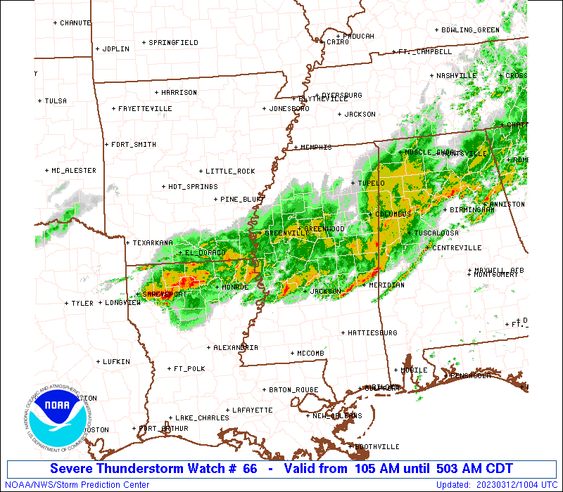
Severe Thunderstorm Watch Number 66
NWS Storm Prediction Center Norman OK
105 AM CDT Sun Mar 12 2023
The NWS Storm Prediction Center has issued a
* Severe Thunderstorm Watch for portions of
southeastern Arkansas
northeastern Louisiana
parts of northern and central Mississippi
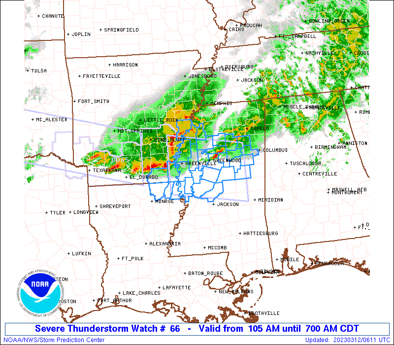
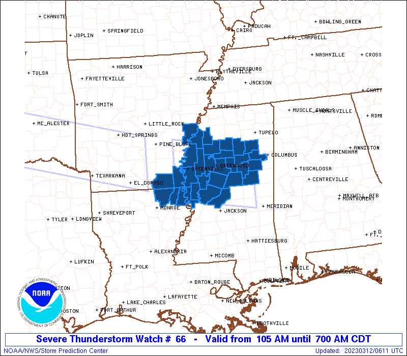
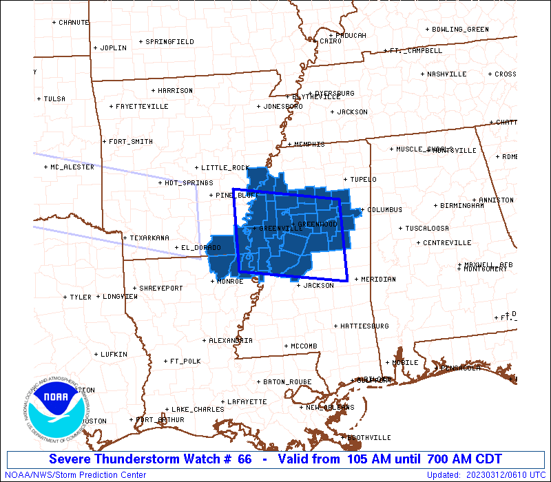
* Effective this Sunday morning from 105 AM until 700 AM CDT.
* Primary threats include...
Scattered damaging wind gusts to 65 mph possible
Isolated large hail events to 1 inch in diameter possible
SUMMARY...A organized/bowing band of thunderstorms will move
east-southeastward into/across parts of northern and central
Mississippi and adjacent southeastern Arkansas/northeastern
Louisiana over the next several hours. Locally strong/damaging
gusts and marginal hail will be the primary risks with these storms.
The severe thunderstorm watch area is approximately along and 55
statute miles north and south of a line from 25 miles west of
Greenville MS to 70 miles east southeast of Greenwood MS. For a
complete depiction of the watch see the associated watch outline
update (WOUS64 KWNS WOU6).
PRECAUTIONARY/PREPAREDNESS ACTIONS...
REMEMBER...A Severe Thunderstorm Watch means conditions are
favorable for severe thunderstorms in and close to the watch area.
Persons in these areas should be on the lookout for threatening
weather conditions and listen for later statements and possible
warnings. Severe thunderstorms can and occasionally do produce
tornadoes.
&&
OTHER WATCH INFORMATION...CONTINUE...WW 65...
AVIATION...A few severe thunderstorms with hail surface and aloft to
1 inch. Extreme turbulence and surface wind gusts to 55 knots. A few
cumulonimbi with maximum tops to 450. Mean storm motion vector
28035.
...Goss
 Note:
The Aviation Watch (SAW) product is an approximation to the watch area.
The actual watch is depicted by the shaded areas.
Note:
The Aviation Watch (SAW) product is an approximation to the watch area.
The actual watch is depicted by the shaded areas.
   SAW6
   WW 66 SEVERE TSTM AR LA MS 120605Z - 121200Z
   AXIS..55 STATUTE MILES NORTH AND SOUTH OF LINE..
   25W GLH/GREENVILLE MS/ - 70ESE GWO/GREENWOOD MS/
   ..AVIATION COORDS.. 50NM N/S /57W SQS - 32SW IGB/
   HAIL SURFACE AND ALOFT..1 INCH. WIND GUSTS..55 KNOTS.
   MAX TOPS TO 450. MEAN STORM MOTION VECTOR 28035.

   LAT...LON 34279141 33908896 32318896 32669141

   THIS IS AN APPROXIMATION TO THE WATCH AREA.  FOR A
   COMPLETE DEPICTION OF THE WATCH SEE WOUS64 KWNS
   FOR WOU6.
Watch 66 Status Report Messages:
STATUS REPORT #4 ON WW 66

VALID 120955Z - 121040Z

SEVERE WEATHER THREAT CONTINUES RIGHT OF A LINE FROM 55 W MEI TO
30 SW CBM.

..BROYLES..03/12/23

ATTN...WFO...JAN...MEG...

&&

STATUS REPORT FOR WS 66

SEVERE WEATHER THREAT CONTINUES FOR THE FOLLOWING AREAS

MSC069-099-103-121040-

MS
.    MISSISSIPPI COUNTIES INCLUDED ARE

KEMPER		     NESHOBA		 NOXUBEE
$$


THE WATCH STATUS MESSAGE IS FOR GUIDANCE PURPOSES ONLY.  PLEASE
REFER TO WATCH COUNTY NOTIFICATION STATEMENTS FOR OFFICIAL
INFORMATION ON COUNTIES...INDEPENDENT CITIES AND MARINE ZONES
CLEARED FROM SEVERE THUNDERSTORM AND TORNADO WATCHES.
$$

STATUS REPORT #3 ON WW 66

VALID 120835Z - 120940Z

SEVERE WEATHER THREAT CONTINUES RIGHT OF A LINE FROM 75 SSW GWO
TO 35 SSE GWO TO 30 SSE UOX.

..BROYLES..03/12/23

ATTN...WFO...JAN...MEG...

&&

STATUS REPORT FOR WS 66

SEVERE WEATHER THREAT CONTINUES FOR THE FOLLOWING AREAS

MSC007-013-017-019-025-069-079-089-097-099-103-105-155-159-
120940-

MS
.    MISSISSIPPI COUNTIES INCLUDED ARE

ATTALA		     CALHOUN		 CHICKASAW
CHOCTAW 	     CLAY		 KEMPER
LEAKE		     MADISON		 MONTGOMERY
NESHOBA 	     NOXUBEE		 OKTIBBEHA
WEBSTER 	     WINSTON
$$


THE WATCH STATUS MESSAGE IS FOR GUIDANCE PURPOSES ONLY.  PLEASE
REFER TO WATCH COUNTY NOTIFICATION STATEMENTS FOR OFFICIAL
INFORMATION ON COUNTIES...INDEPENDENT CITIES AND MARINE ZONES
CLEARED FROM SEVERE THUNDERSTORM AND TORNADO WATCHES.
$$

STATUS REPORT #2 ON WW 66

VALID 120735Z - 120840Z

SEVERE WEATHER THREAT CONTINUES RIGHT OF A LINE FROM 15 SE LLQ TO
10 NNE GLH TO 35 NE GLH TO 45 W UOX.

..BROYLES..03/12/23

ATTN...WFO...JAN...MEG...

&&

STATUS REPORT FOR WS 66

SEVERE WEATHER THREAT CONTINUES FOR THE FOLLOWING AREAS

ARC003-017-120840-

AR
.    ARKANSAS COUNTIES INCLUDED ARE

ASHLEY		     CHICOT
$$


LAC035-067-123-120840-

LA
.    LOUISIANA PARISHES INCLUDED ARE

EAST CARROLL	     MOREHOUSE		 WEST CARROLL
$$


MSC007-013-015-017-019-025-043-051-053-055-083-089-097-105-125-
133-135-151-155-159-161-163-120840-

MS
.    MISSISSIPPI COUNTIES INCLUDED ARE

ATTALA		     CALHOUN		 CARROLL
CHICKASAW	     CHOCTAW		 CLAY
GRENADA 	     HOLMES		 HUMPHREYS
ISSAQUENA	     LEFLORE		 MADISON
MONTGOMERY	     OKTIBBEHA		 SHARKEY
SUNFLOWER	     TALLAHATCHIE	 WASHINGTON
WEBSTER 	     WINSTON		 YALOBUSHA
YAZOO
$$


THE WATCH STATUS MESSAGE IS FOR GUIDANCE PURPOSES ONLY.  PLEASE
REFER TO WATCH COUNTY NOTIFICATION STATEMENTS FOR OFFICIAL
INFORMATION ON COUNTIES...INDEPENDENT CITIES AND MARINE ZONES
CLEARED FROM SEVERE THUNDERSTORM AND TORNADO WATCHES.
$$

STATUS REPORT #1 ON WW 66

VALID 120640Z - 120740Z

SEVERE WEATHER THREAT CONTINUES RIGHT OF A LINE FROM 15 SE LLQ TO
25 N GLH TO 55 E PBF.

..BROYLES..03/12/23

ATTN...WFO...JAN...MEG...

&&

STATUS REPORT FOR WS 66

SEVERE WEATHER THREAT CONTINUES FOR THE FOLLOWING AREAS

ARC003-017-107-120740-

AR
.    ARKANSAS COUNTIES INCLUDED ARE

ASHLEY		     CHICOT		 PHILLIPS
$$


LAC035-067-123-120740-

LA
.    LOUISIANA PARISHES INCLUDED ARE

EAST CARROLL	     MOREHOUSE		 WEST CARROLL
$$


MSC007-011-013-015-017-019-025-027-043-051-053-055-083-089-097-
105-119-125-133-135-151-155-159-161-163-120740-

MS
.    MISSISSIPPI COUNTIES INCLUDED ARE

ATTALA		     BOLIVAR		 CALHOUN
CARROLL 	     CHICKASAW		 CHOCTAW
CLAY		     COAHOMA		 GRENADA
HOLMES		     HUMPHREYS		 ISSAQUENA
LEFLORE 	     MADISON		 MONTGOMERY
OKTIBBEHA	     QUITMAN		 SHARKEY
SUNFLOWER	     TALLAHATCHIE	 WASHINGTON
WEBSTER 	     WINSTON		 YALOBUSHA
YAZOO
$$


THE WATCH STATUS MESSAGE IS FOR GUIDANCE PURPOSES ONLY.  PLEASE
REFER TO WATCH COUNTY NOTIFICATION STATEMENTS FOR OFFICIAL
INFORMATION ON COUNTIES...INDEPENDENT CITIES AND MARINE ZONES
CLEARED FROM SEVERE THUNDERSTORM AND TORNADO WATCHES.
$$
Note:
Click for Complete Product Text.
Tornadoes
Probability of 2 or more tornadoes
|
Low (10%)
|
Probability of 1 or more strong (EF2-EF5) tornadoes
|
Low (5%)
|
Wind
Probability of 10 or more severe wind events
|
Mod (40%)
|
Probability of 1 or more wind events > 65 knots
|
Low (20%)
|
Hail
Probability of 10 or more severe hail events
|
Low (20%)
|
Probability of 1 or more hailstones > 2 inches
|
Low (10%)
|
Combined Severe Hail/Wind
Probability of 6 or more combined severe hail/wind events
|
Mod (60%)
|
For each watch, probabilities for particular events inside the watch
(listed above in each table) are determined by the issuing forecaster.
The "Low" category contains probability values ranging from less than 2%
to 20% (EF2-EF5 tornadoes), less than 5% to 20% (all other probabilities),
"Moderate" from 30% to 60%, and "High" from 70% to greater than 95%.
High values are bolded and lighter in color to provide awareness of
an increased threat for a particular event.


 @NWSSPC