Note:
The expiration time in the watch graphic is amended if the watch is
replaced, cancelled or extended.
Note:
Note:
The expiration time in the watch graphic is amended if the watch is
replaced, cancelled or extended.
Note: Click for
Watch Status Reports.
SEL3
URGENT - IMMEDIATE BROADCAST REQUESTED
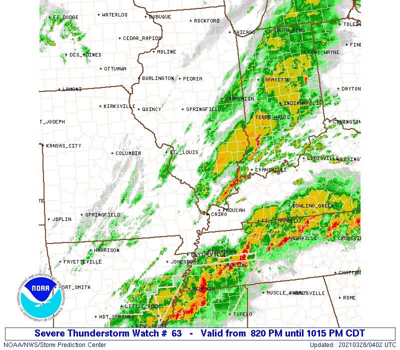
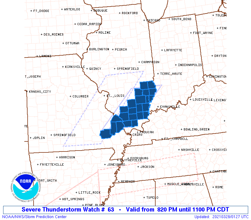
Severe Thunderstorm Watch Number 63
NWS Storm Prediction Center Norman OK
820 PM CDT Sat Mar 27 2021
The NWS Storm Prediction Center has issued a
* Severe Thunderstorm Watch for portions of
Southeast Illinois
Southeast Missouri
* Effective this Saturday evening from 820 PM until 1100 PM CDT.
* Primary threats include...
Scattered damaging wind gusts to 65 mph possible
A tornado or two possible
SUMMARY...A QLCS will spread east across southeast Missouri and
southeast Illinois before weakening during the late evening.
The severe thunderstorm watch area is approximately along and 45
statute miles east and west of a line from 55 miles east northeast
of Salem IL to 45 miles southwest of Carbondale IL. For a complete
depiction of the watch see the associated watch outline update
(WOUS64 KWNS WOU3).
PRECAUTIONARY/PREPAREDNESS ACTIONS...
REMEMBER...A Severe Thunderstorm Watch means conditions are
favorable for severe thunderstorms in and close to the watch area.
Persons in these areas should be on the lookout for threatening
weather conditions and listen for later statements and possible
warnings. Severe thunderstorms can and occasionally do produce
tornadoes.
&&
OTHER WATCH INFORMATION...CONTINUE...WW 59...WW 60...WW 61...WW
62...
AVIATION...A few severe thunderstorms with hail surface and aloft to
1 inch. Extreme turbulence and surface wind gusts to 55 knots. A few
cumulonimbi with maximum tops to 450. Mean storm motion vector
23035.
...Grams
 Note:
The Aviation Watch (SAW) product is an approximation to the watch area.
The actual watch is depicted by the shaded areas.
Note:
The Aviation Watch (SAW) product is an approximation to the watch area.
The actual watch is depicted by the shaded areas.
   SAW3
   WW 63 SEVERE TSTM IL MO 280120Z - 280400Z
   AXIS..45 STATUTE MILES EAST AND WEST OF LINE..
   55ENE SLO/SALEM IL/ - 45SW MDH/CARBONDALE IL/
   ..AVIATION COORDS.. 40NM E/W /48SW TTH - 28SE FAM/
   HAIL SURFACE AND ALOFT..1 INCH. WIND GUSTS..55 KNOTS.
   MAX TOPS TO 450. MEAN STORM MOTION VECTOR 23035.

   LAT...LON 38958719 37328901 37329065 38958886

   THIS IS AN APPROXIMATION TO THE WATCH AREA.  FOR A
   COMPLETE DEPICTION OF THE WATCH SEE WOUS64 KWNS
   FOR WOU3.
Watch 63 Status Report Message has not been issued yet.
Note:
Click for Complete Product Text.
Tornadoes
Probability of 2 or more tornadoes
|
Low (20%)
|
Probability of 1 or more strong (EF2-EF5) tornadoes
|
Low (5%)
|
Wind
Probability of 10 or more severe wind events
|
Mod (40%)
|
Probability of 1 or more wind events > 65 knots
|
Low (20%)
|
Hail
Probability of 10 or more severe hail events
|
Low (10%)
|
Probability of 1 or more hailstones > 2 inches
|
Low (<5%)
|
Combined Severe Hail/Wind
Probability of 6 or more combined severe hail/wind events
|
Mod (60%)
|
For each watch, probabilities for particular events inside the watch
(listed above in each table) are determined by the issuing forecaster.
The "Low" category contains probability values ranging from less than 2%
to 20% (EF2-EF5 tornadoes), less than 5% to 20% (all other probabilities),
"Moderate" from 30% to 60%, and "High" from 70% to greater than 95%.
High values are bolded and lighter in color to provide awareness of
an increased threat for a particular event.


 @NWSSPC