 Note:
The expiration time in the watch graphic is amended if the watch is
replaced, cancelled or extended.
Note:
Note:
The expiration time in the watch graphic is amended if the watch is
replaced, cancelled or extended.
Note: Click for
Watch Status Reports.
SEL5
URGENT - IMMEDIATE BROADCAST REQUESTED
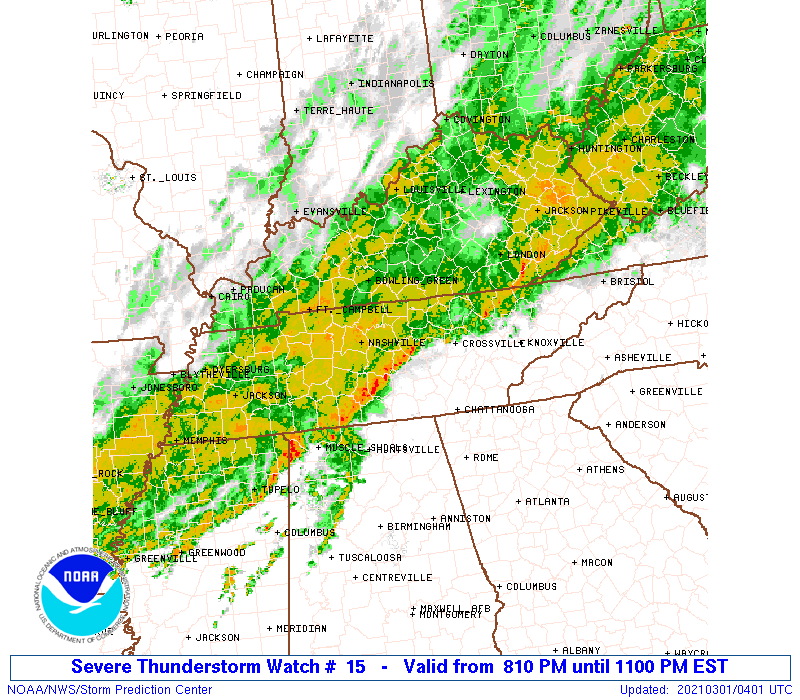
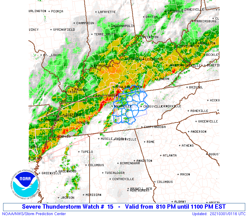
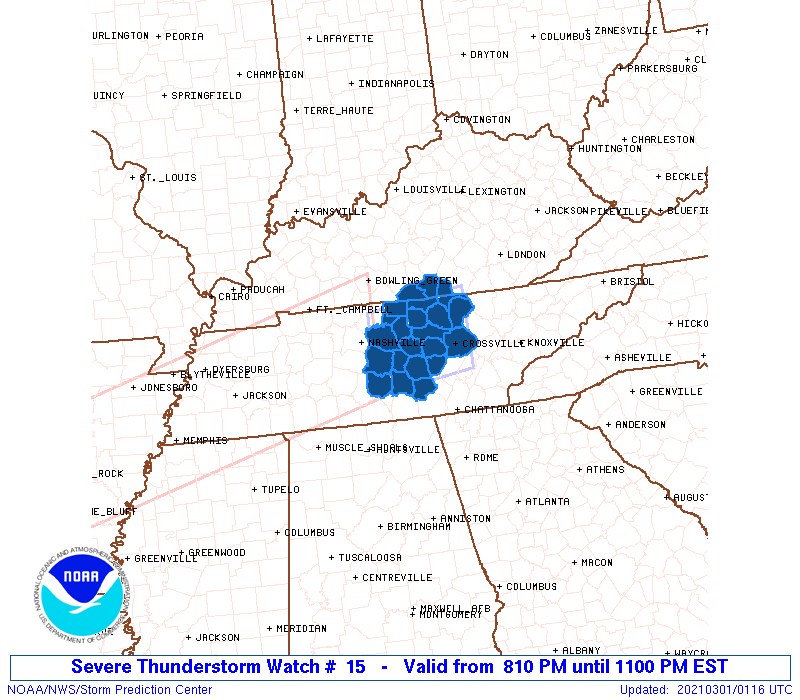
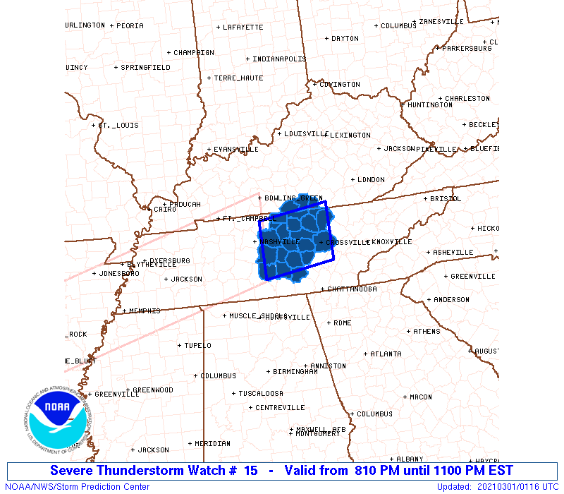
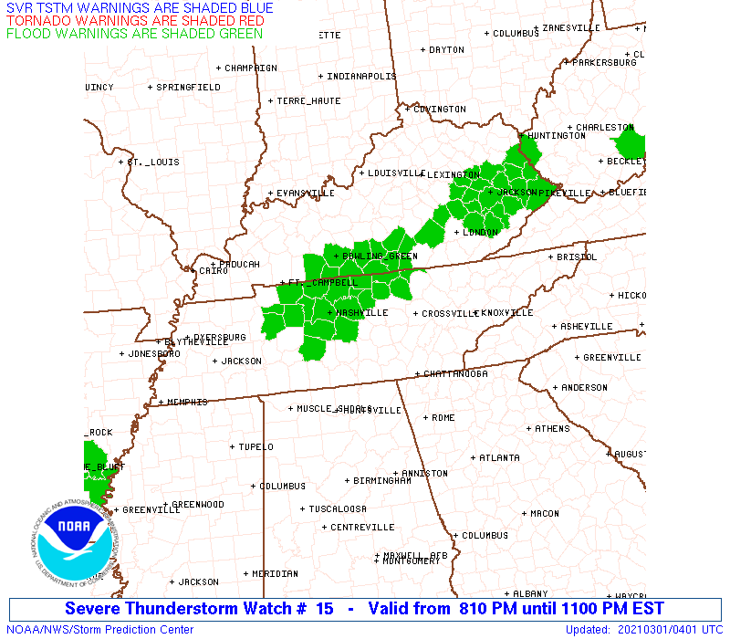
Severe Thunderstorm Watch Number 15
NWS Storm Prediction Center Norman OK
810 PM EST Sun Feb 28 2021
The NWS Storm Prediction Center has issued a
* Severe Thunderstorm Watch for portions of
Far south-central Kentucky
Middle Tennessee
* Effective this Sunday evening from 810 PM until 1100 PM EST.
* Primary threats include...
Scattered damaging wind gusts to 70 mph possible
A tornado or two possible
SUMMARY...Cluster of strong to severe storms may produce damaging
winds and a brief tornado before it weakens later this evening.
The severe thunderstorm watch area is approximately along and 40
statute miles north and south of a line from 80 miles west of
Crossville TN to 20 miles northeast of Crossville TN. For a complete
depiction of the watch see the associated watch outline update
(WOUS64 KWNS WOU5).
PRECAUTIONARY/PREPAREDNESS ACTIONS...
REMEMBER...A Severe Thunderstorm Watch means conditions are
favorable for severe thunderstorms in and close to the watch area.
Persons in these areas should be on the lookout for threatening
weather conditions and listen for later statements and possible
warnings. Severe thunderstorms can and occasionally do produce
tornadoes.
&&
OTHER WATCH INFORMATION...CONTINUE...WW 13...WW 14...
AVIATION...A few severe thunderstorms with hail surface and aloft to
1 inch. Extreme turbulence and surface wind gusts to 60 knots. A few
cumulonimbi with maximum tops to 500. Mean storm motion vector
26045.
...Grams
 Note:
The Aviation Watch (SAW) product is an approximation to the watch area.
The actual watch is depicted by the shaded areas.
Note:
The Aviation Watch (SAW) product is an approximation to the watch area.
The actual watch is depicted by the shaded areas.
   SAW5
   WW 15 SEVERE TSTM KY TN 010110Z - 010400Z
   AXIS..40 STATUTE MILES NORTH AND SOUTH OF LINE..
   80W CSV/CROSSVILLE TN/ - 20NE CSV/CROSSVILLE TN/
   ..AVIATION COORDS.. 35NM N/S /14SE BNA - 48WNW VXV/
   HAIL SURFACE AND ALOFT..1 INCH. WIND GUSTS..60 KNOTS.
   MAX TOPS TO 500. MEAN STORM MOTION VECTOR 26045.

   LAT...LON 36528651 36738483 35588483 35368651

   THIS IS AN APPROXIMATION TO THE WATCH AREA.  FOR A
   COMPLETE DEPICTION OF THE WATCH SEE WOUS64 KWNS
   FOR WOU5.
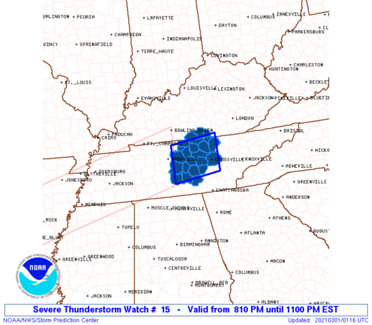
Watch 15 Status Report Messages:
STATUS REPORT #1 ON WW 15

VALID 010340Z - 010440Z

THE SEVERE WEATHER THREAT CONTINUES ACROSS THE ENTIRE WATCH AREA.

..BROYLES..03/01/21

ATTN...WFO...LMK...OHX...

&&

STATUS REPORT FOR WS 15

SEVERE WEATHER THREAT CONTINUES FOR THE FOLLOWING AREAS

KYC053-057-171-010440-

KY
.    KENTUCKY COUNTIES INCLUDED ARE

CLINTON 	     CUMBERLAND 	 MONROE
$$


TNC003-015-027-031-035-041-049-061-087-111-133-137-141-149-159-
169-175-177-185-189-010440-

TN
.    TENNESSEE COUNTIES INCLUDED ARE

BEDFORD 	     CANNON		 CLAY
COFFEE		     CUMBERLAND 	 DE KALB
FENTRESS	     GRUNDY		 JACKSON
MACON		     OVERTON		 PICKETT
PUTNAM		     RUTHERFORD 	 SMITH
TROUSDALE	     VAN BUREN		 WARREN
WHITE		     WILSON
$$


THE WATCH STATUS MESSAGE IS FOR GUIDANCE PURPOSES ONLY.  PLEASE
REFER TO WATCH COUNTY NOTIFICATION STATEMENTS FOR OFFICIAL
INFORMATION ON COUNTIES...INDEPENDENT CITIES AND MARINE ZONES
CLEARED FROM SEVERE THUNDERSTORM AND TORNADO WATCHES.
$$
Note:
Click for Complete Product Text.
Tornadoes
Probability of 2 or more tornadoes
|
Low (20%)
|
Probability of 1 or more strong (EF2-EF5) tornadoes
|
Low (10%)
|
Wind
Probability of 10 or more severe wind events
|
Mod (40%)
|
Probability of 1 or more wind events > 65 knots
|
Low (20%)
|
Hail
Probability of 10 or more severe hail events
|
Low (<5%)
|
Probability of 1 or more hailstones > 2 inches
|
Low (<5%)
|
Combined Severe Hail/Wind
Probability of 6 or more combined severe hail/wind events
|
Mod (50%)
|
For each watch, probabilities for particular events inside the watch
(listed above in each table) are determined by the issuing forecaster.
The "Low" category contains probability values ranging from less than 2%
to 20% (EF2-EF5 tornadoes), less than 5% to 20% (all other probabilities),
"Moderate" from 30% to 60%, and "High" from 70% to greater than 95%.
High values are bolded and lighter in color to provide awareness of
an increased threat for a particular event.


 @NWSSPC