 Note:
The expiration time in the watch graphic is amended if the watch is
replaced, cancelled or extended.
Note:
Note:
The expiration time in the watch graphic is amended if the watch is
replaced, cancelled or extended.
Note: Click for
Watch Status Reports.
SEL2
URGENT - IMMEDIATE BROADCAST REQUESTED
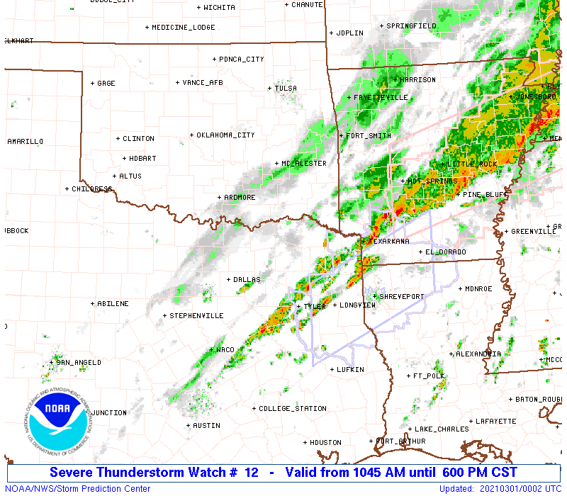
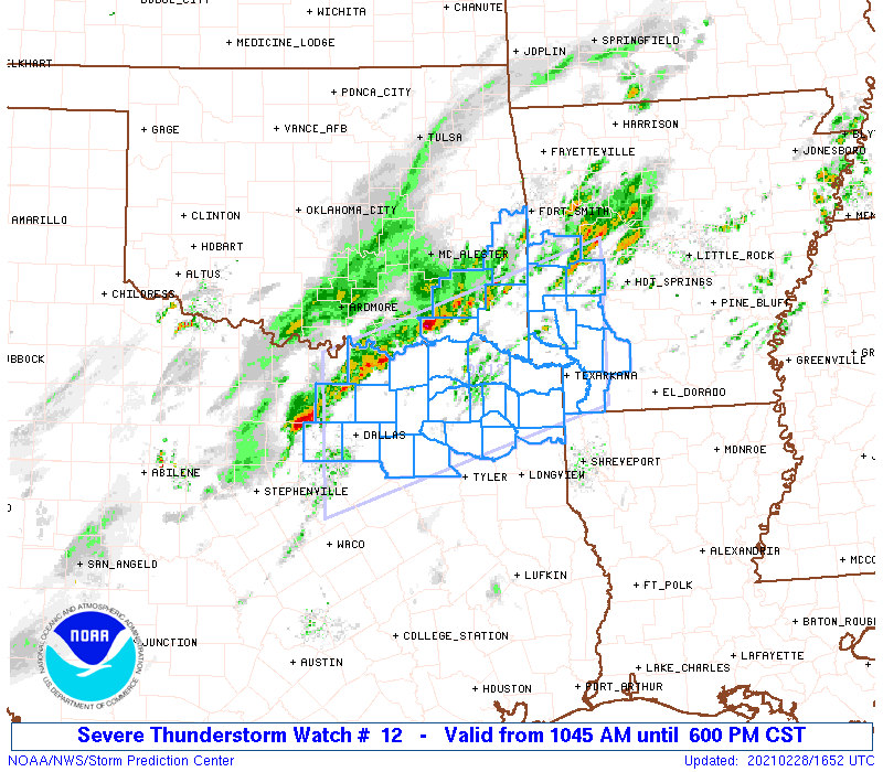
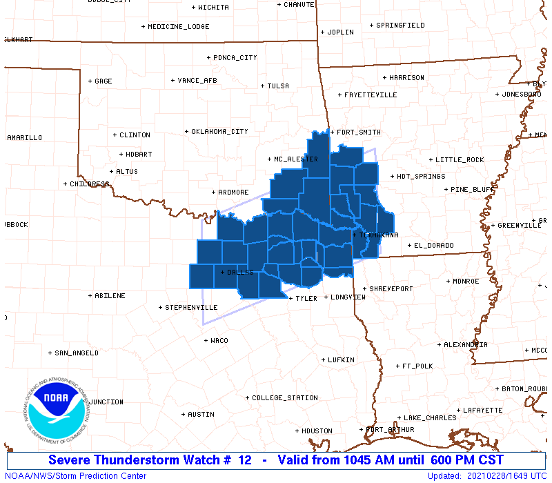
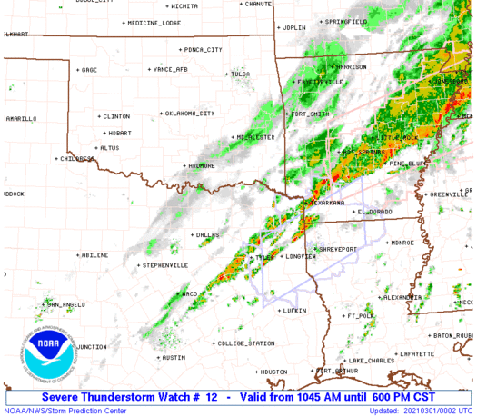
Severe Thunderstorm Watch Number 12
NWS Storm Prediction Center Norman OK
1045 AM CST Sun Feb 28 2021
The NWS Storm Prediction Center has issued a
* Severe Thunderstorm Watch for portions of
Southwest Arkansas
Southeast Oklahoma
Northeast Texas
* Effective this Sunday morning and evening from 1045 AM until
600 PM CST.
* Primary threats include...
Scattered large hail and isolated very large hail events to 2.5
inches in diameter likely
Scattered damaging wind gusts to 70 mph possible
A tornado or two possible
SUMMARY...Thunderstorms will continue to develop and intensify over
parts of northeast Texas and southeast Oklahoma through the
afternoon, posing a risk of large hail and damaging winds. Storms
will spread into western Arkansas in a few hours. An isolated
tornado is also possible.
The severe thunderstorm watch area is approximately along and 65
statute miles north and south of a line from 25 miles west of Dallas
TX to 55 miles east of De Queen AR. For a complete depiction of the
watch see the associated watch outline update (WOUS64 KWNS WOU2).
PRECAUTIONARY/PREPAREDNESS ACTIONS...
REMEMBER...A Severe Thunderstorm Watch means conditions are
favorable for severe thunderstorms in and close to the watch area.
Persons in these areas should be on the lookout for threatening
weather conditions and listen for later statements and possible
warnings. Severe thunderstorms can and occasionally do produce
tornadoes.
&&
AVIATION...A few severe thunderstorms with hail surface and aloft to
2.5 inches. Extreme turbulence and surface wind gusts to 60 knots. A
few cumulonimbi with maximum tops to 450. Mean storm motion vector
25035.
...Hart

   SEL2

   URGENT - IMMEDIATE BROADCAST REQUESTED
   Severe Thunderstorm Watch Number 12
   NWS Storm Prediction Center Norman OK
   1045 AM CST Sun Feb 28 2021

   The NWS Storm Prediction Center has issued a

   * Severe Thunderstorm Watch for portions of
     Southwest Arkansas
     Southeast Oklahoma
     Northeast Texas

   * Effective this Sunday morning and evening from 1045 AM until
     600 PM CST.

   * Primary threats include...
     Scattered large hail and isolated very large hail events to 2.5
       inches in diameter likely
     Scattered damaging wind gusts to 70 mph possible
     A tornado or two possible

   SUMMARY...Thunderstorms will continue to develop and intensify over
   parts of northeast Texas and southeast Oklahoma through the
   afternoon, posing a risk of large hail and damaging winds. Storms
   will spread into western Arkansas in a few hours.  An isolated
   tornado is also possible.

   The severe thunderstorm watch area is approximately along and 65
   statute miles north and south of a line from 25 miles west of Dallas
   TX to 55 miles east of De Queen AR. For a complete depiction of the
   watch see the associated watch outline update (WOUS64 KWNS WOU2).

   PRECAUTIONARY/PREPAREDNESS ACTIONS...

   REMEMBER...A Severe Thunderstorm Watch means conditions are
   favorable for severe thunderstorms in and close to the watch area.
   Persons in these areas should be on the lookout for threatening
   weather conditions and listen for later statements and possible
   warnings. Severe thunderstorms can and occasionally do produce
   tornadoes.

   &&

   AVIATION...A few severe thunderstorms with hail surface and aloft to
   2.5 inches. Extreme turbulence and surface wind gusts to 60 knots. A
   few cumulonimbi with maximum tops to 450. Mean storm motion vector
   25035.

   ...Hart
 Note:
The Aviation Watch (SAW) product is an approximation to the watch area.
The actual watch is depicted by the shaded areas.
Note:
The Aviation Watch (SAW) product is an approximation to the watch area.
The actual watch is depicted by the shaded areas.
   SAW2
   WW 12 SEVERE TSTM AR OK TX 281645Z - 010000Z
   AXIS..65 STATUTE MILES NORTH AND SOUTH OF LINE..
   25W DAL/DALLAS TX/ - 55E DEQ/DE QUEEN AR/
   ..AVIATION COORDS.. 55NM N/S /12W TTT - 45NE TXK/
   HAIL SURFACE AND ALOFT..2.5 INCHES. WIND GUSTS..60 KNOTS.
   MAX TOPS TO 450. MEAN STORM MOTION VECTOR 25035.

   LAT...LON 33799728 34999344 33119344 31919728

   THIS IS AN APPROXIMATION TO THE WATCH AREA.  FOR A
   COMPLETE DEPICTION OF THE WATCH SEE WOUS64 KWNS
   FOR WOU2.
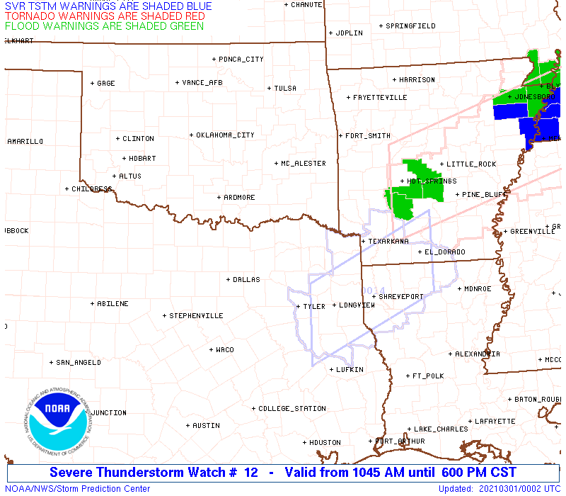
Watch 12 Status Report Messages:
STATUS REPORT #5 ON WW 12

VALID 282135Z - 282240Z

SEVERE WEATHER THREAT CONTINUES RIGHT OF A LINE FROM 20 WNW CRS
TO 45 SW PRX TO 35 WSW DEQ TO 20 WSW HOT.

FOR ADDITIONAL INFORMATION SEE MESOSCALE DISCUSSION 137

..DIAL..02/28/21

ATTN...WFO...SHV...LZK...TSA...FWD...

&&

STATUS REPORT FOR WS 12

SEVERE WEATHER THREAT CONTINUES FOR THE FOLLOWING AREAS

ARC057-061-073-081-091-099-109-133-282240-

AR
.    ARKANSAS COUNTIES INCLUDED ARE

HEMPSTEAD	     HOWARD		 LAFAYETTE
LITTLE RIVER	     MILLER		 NEVADA
PIKE		     SEVIER
$$


TXC037-063-067-119-159-223-231-257-315-343-379-387-449-459-467-
499-282240-

TX
.    TEXAS COUNTIES INCLUDED ARE

BOWIE		     CAMP		 CASS
DELTA		     FRANKLIN		 HOPKINS
HUNT		     KAUFMAN		 MARION
MORRIS		     RAINS		 RED RIVER
TITUS		     UPSHUR		 VAN ZANDT
WOOD
$$


THE WATCH STATUS MESSAGE IS FOR GUIDANCE PURPOSES ONLY.  PLEASE
REFER TO WATCH COUNTY NOTIFICATION STATEMENTS FOR OFFICIAL
INFORMATION ON COUNTIES...INDEPENDENT CITIES AND MARINE ZONES
CLEARED FROM SEVERE THUNDERSTORM AND TORNADO WATCHES.
$$

STATUS REPORT #4 ON WW 12

VALID 282045Z - 282140Z

SEVERE WEATHER THREAT CONTINUES RIGHT OF A LINE FROM 30 S FTW TO
20 W PRX TO 30 NNE DEQ TO 25 NW HOT.

FOR ADDITIONAL INFORMATION SEE MESOSCALE DISCUSSION 137

..DIAL..02/28/21

ATTN...WFO...SHV...LZK...TSA...FWD...

&&

STATUS REPORT FOR WS 12

SEVERE WEATHER THREAT CONTINUES FOR THE FOLLOWING AREAS

ARC057-061-073-081-091-097-099-109-133-282140-

AR
.    ARKANSAS COUNTIES INCLUDED ARE

HEMPSTEAD	     HOWARD		 LAFAYETTE
LITTLE RIVER	     MILLER		 MONTGOMERY
NEVADA		     PIKE		 SEVIER
$$


OKC089-282140-

OK
.    OKLAHOMA COUNTIES INCLUDED ARE

MCCURTAIN
$$


TXC037-063-067-113-119-159-223-231-257-277-315-343-379-387-397-
449-459-467-499-282140-

TX
.    TEXAS COUNTIES INCLUDED ARE

BOWIE		     CAMP		 CASS
DALLAS		     DELTA		 FRANKLIN
HOPKINS 	     HUNT		 KAUFMAN
LAMAR		     MARION		 MORRIS
RAINS		     RED RIVER		 ROCKWALL
TITUS		     UPSHUR		 VAN ZANDT
WOOD
$$


THE WATCH STATUS MESSAGE IS FOR GUIDANCE PURPOSES ONLY.  PLEASE
REFER TO WATCH COUNTY NOTIFICATION STATEMENTS FOR OFFICIAL
INFORMATION ON COUNTIES...INDEPENDENT CITIES AND MARINE ZONES
CLEARED FROM SEVERE THUNDERSTORM AND TORNADO WATCHES.
$$

STATUS REPORT #3 ON WW 12

VALID 281940Z - 282040Z

SEVERE WEATHER THREAT CONTINUES RIGHT OF A LINE FROM 25 SSE FTW
TO 30 N PRX TO 30 N DEQ TO 35 SW RUE.

..DIAL..02/28/21

ATTN...WFO...SHV...LZK...TSA...FWD...

&&

STATUS REPORT FOR WS 12

SEVERE WEATHER THREAT CONTINUES FOR THE FOLLOWING AREAS

ARC057-061-073-081-091-097-099-109-113-133-282040-

AR
.    ARKANSAS COUNTIES INCLUDED ARE

HEMPSTEAD	     HOWARD		 LAFAYETTE
LITTLE RIVER	     MILLER		 MONTGOMERY
NEVADA		     PIKE		 POLK
SEVIER
$$


OKC089-282040-

OK
.    OKLAHOMA COUNTIES INCLUDED ARE

MCCURTAIN
$$


TXC037-063-067-085-113-119-147-159-223-231-257-277-315-343-379-
387-397-439-449-459-467-499-282040-

TX
.    TEXAS COUNTIES INCLUDED ARE

BOWIE		     CAMP		 CASS
COLLIN		     DALLAS		 DELTA
FANNIN		     FRANKLIN		 HOPKINS
HUNT		     KAUFMAN		 LAMAR
MARION		     MORRIS		 RAINS
RED RIVER	     ROCKWALL		 TARRANT
TITUS		     UPSHUR		 VAN ZANDT
WOOD
$$


THE WATCH STATUS MESSAGE IS FOR GUIDANCE PURPOSES ONLY.  PLEASE
REFER TO WATCH COUNTY NOTIFICATION STATEMENTS FOR OFFICIAL
INFORMATION ON COUNTIES...INDEPENDENT CITIES AND MARINE ZONES
CLEARED FROM SEVERE THUNDERSTORM AND TORNADO WATCHES.
$$

STATUS REPORT #2 ON WW 12

VALID 281850Z - 281940Z

SEVERE WEATHER THREAT CONTINUES RIGHT OF A LINE FROM 5 E FTW TO
35 SSW RKR.

..DIAL..02/28/21

ATTN...WFO...SHV...LZK...TSA...FWD...

&&

STATUS REPORT FOR WS 12

SEVERE WEATHER THREAT CONTINUES FOR THE FOLLOWING AREAS

ARC057-061-073-081-091-097-099-109-113-127-133-281940-

AR
.    ARKANSAS COUNTIES INCLUDED ARE

HEMPSTEAD	     HOWARD		 LAFAYETTE
LITTLE RIVER	     MILLER		 MONTGOMERY
NEVADA		     PIKE		 POLK
SCOTT		     SEVIER
$$


OKC023-079-089-127-281940-

OK
.    OKLAHOMA COUNTIES INCLUDED ARE

CHOCTAW 	     LE FLORE		 MCCURTAIN
PUSHMATAHA
$$


TXC037-063-067-085-113-119-147-159-223-231-257-277-315-343-379-
387-397-439-449-459-467-499-281940-

TX
.    TEXAS COUNTIES INCLUDED ARE

BOWIE		     CAMP		 CASS
COLLIN		     DALLAS		 DELTA
FANNIN		     FRANKLIN		 HOPKINS
HUNT		     KAUFMAN		 LAMAR
MARION		     MORRIS		 RAINS
RED RIVER	     ROCKWALL		 TARRANT
TITUS		     UPSHUR		 VAN ZANDT
WOOD
$$


THE WATCH STATUS MESSAGE IS FOR GUIDANCE PURPOSES ONLY.  PLEASE
REFER TO WATCH COUNTY NOTIFICATION STATEMENTS FOR OFFICIAL
INFORMATION ON COUNTIES...INDEPENDENT CITIES AND MARINE ZONES
CLEARED FROM SEVERE THUNDERSTORM AND TORNADO WATCHES.
$$

STATUS REPORT #1 ON WW 12

VALID 281735Z - 281840Z

THE SEVERE WEATHER THREAT CONTINUES ACROSS THE ENTIRE WATCH AREA.

..DIAL..02/28/21

ATTN...WFO...SHV...LZK...TSA...FWD...

&&

STATUS REPORT FOR WS 12

SEVERE WEATHER THREAT CONTINUES FOR THE FOLLOWING AREAS

ARC057-061-073-081-091-097-099-109-113-127-133-281840-

AR
.    ARKANSAS COUNTIES INCLUDED ARE

HEMPSTEAD	     HOWARD		 LAFAYETTE
LITTLE RIVER	     MILLER		 MONTGOMERY
NEVADA		     PIKE		 POLK
SCOTT		     SEVIER
$$


OKC023-079-089-127-281840-

OK
.    OKLAHOMA COUNTIES INCLUDED ARE

CHOCTAW 	     LE FLORE		 MCCURTAIN
PUSHMATAHA
$$


TXC037-063-067-085-113-119-121-147-159-181-223-231-257-277-315-
343-379-387-397-439-449-459-467-499-281840-

TX
.    TEXAS COUNTIES INCLUDED ARE

BOWIE		     CAMP		 CASS
COLLIN		     DALLAS		 DELTA
DENTON		     FANNIN		 FRANKLIN
GRAYSON 	     HOPKINS		 HUNT
KAUFMAN 	     LAMAR		 MARION
MORRIS		     RAINS		 RED RIVER
ROCKWALL	     TARRANT		 TITUS
UPSHUR		     VAN ZANDT		 WOOD
$$


THE WATCH STATUS MESSAGE IS FOR GUIDANCE PURPOSES ONLY.  PLEASE
REFER TO WATCH COUNTY NOTIFICATION STATEMENTS FOR OFFICIAL
INFORMATION ON COUNTIES...INDEPENDENT CITIES AND MARINE ZONES
CLEARED FROM SEVERE THUNDERSTORM AND TORNADO WATCHES.
$$
Note:
Click for Complete Product Text.
Tornadoes
Probability of 2 or more tornadoes
|
Low (20%)
|
Probability of 1 or more strong (EF2-EF5) tornadoes
|
Low (5%)
|
Wind
Probability of 10 or more severe wind events
|
Mod (40%)
|
Probability of 1 or more wind events > 65 knots
|
Low (20%)
|
Hail
Probability of 10 or more severe hail events
|
Mod (60%)
|
Probability of 1 or more hailstones > 2 inches
|
Mod (60%)
|
Combined Severe Hail/Wind
Probability of 6 or more combined severe hail/wind events
|
High (90%)
|
For each watch, probabilities for particular events inside the watch
(listed above in each table) are determined by the issuing forecaster.
The "Low" category contains probability values ranging from less than 2%
to 20% (EF2-EF5 tornadoes), less than 5% to 20% (all other probabilities),
"Moderate" from 30% to 60%, and "High" from 70% to greater than 95%.
High values are bolded and lighter in color to provide awareness of
an increased threat for a particular event.


 @NWSSPC