 Note:
The expiration time in the watch graphic is amended if the watch is
replaced, cancelled or extended.
Note:
Note:
The expiration time in the watch graphic is amended if the watch is
replaced, cancelled or extended.
Note: Click for
Watch Status Reports.
SEL9
URGENT - IMMEDIATE BROADCAST REQUESTED
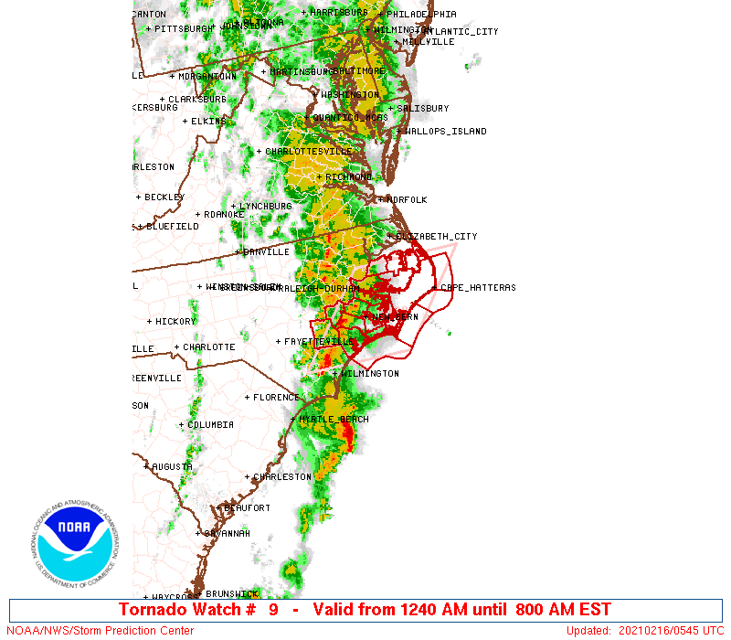
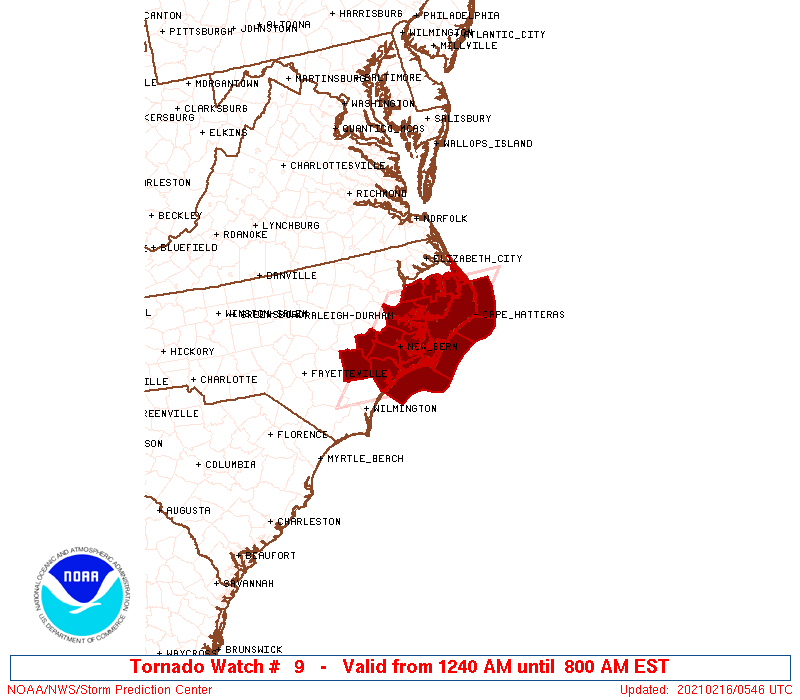
Tornado Watch Number 9
NWS Storm Prediction Center Norman OK
1240 AM EST Tue Feb 16 2021
The NWS Storm Prediction Center has issued a
* Tornado Watch for portions of
Eastern North Carolina
Coastal Waters
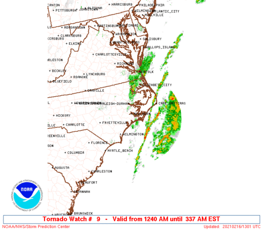
* Effective this Tuesday morning from 1240 AM until 800 AM EST.
* Primary threats include...
A couple tornadoes possible
Isolated damaging wind gusts to 70 mph possible
SUMMARY...A few supercells may develop and quickly move
northeastward across coastal North Carolina overnight as the air
mass steadily moistens and destabilizes near the coast. A tornado or
two could occur along with damaging winds.
The tornado watch area is approximately along and 60 statute miles
east and west of a line from 35 miles south southeast of
Jacksonville NC to 50 miles north northwest of Cape Hatteras NC. For
a complete depiction of the watch see the associated watch outline
update (WOUS64 KWNS WOU9).
PRECAUTIONARY/PREPAREDNESS ACTIONS...
REMEMBER...A Tornado Watch means conditions are favorable for
tornadoes and severe thunderstorms in and close to the watch
area. Persons in these areas should be on the lookout for
threatening weather conditions and listen for later statements
and possible warnings.
&&
AVIATION...Tornadoes and a few severe thunderstorms with hail
surface and aloft to 1 inch. Extreme turbulence and surface wind
gusts to 60 knots. A few cumulonimbi with maximum tops to 450. Mean
storm motion vector 24035.
...Guyer
 Note:
The Aviation Watch (SAW) product is an approximation to the watch area.
The actual watch is depicted by the shaded areas.
Note:
The Aviation Watch (SAW) product is an approximation to the watch area.
The actual watch is depicted by the shaded areas.
   SAW9
   WW 9 TORNADO NC CW 160540Z - 161300Z
   AXIS..60 STATUTE MILES EAST AND WEST OF LINE..
   35SSE OAJ/JACKSONVILLE NC/ - 50NNW HSE/CAPE HATTERAS NC/
   ..AVIATION COORDS.. 50NM E/W /24E ILM - 24SSE ECG/
   HAIL SURFACE AND ALOFT..1 INCH. WIND GUSTS..60 KNOTS.
   MAX TOPS TO 450. MEAN STORM MOTION VECTOR 24035.

   LAT...LON 34367844 35887703 35887489 34367633

   THIS IS AN APPROXIMATION TO THE WATCH AREA.  FOR A
   COMPLETE DEPICTION OF THE WATCH SEE WOUS64 KWNS
   FOR WOU9.
Watch 9 Status Report Messages:
STATUS REPORT #1 ON WW 9

VALID 160645Z - 160715Z

SEVERE WEATHER THREAT CONTINUES RIGHT OF A LINE FROM 30 E ILM TO
15 SW EWN TO 25 SE GSB.

..SMITH..02/16/21

ATTN...WFO...MHX...

&&

STATUS REPORT FOR WT 9

SEVERE WEATHER THREAT CONTINUES FOR THE FOLLOWING AREAS

NCC013-031-049-055-095-103-107-137-177-187-160715-

NC
.    NORTH CAROLINA COUNTIES INCLUDED ARE

BEAUFORT	     CARTERET		 CRAVEN
DARE		     HYDE		 JONES
LENOIR		     PAMLICO		 TYRRELL
WASHINGTON
$$


AMZ131-135-136-137-152-154-156-158-231-160715-

CW

.    ADJACENT COASTAL WATERS INCLUDED ARE

ALLIGATOR RIVER

PAMLICO SOUND

PAMLICO AND PUNGO RIVERS

NEUSE AND BAY RIVERS

S OF OREGON INLET NC TO CAPE HATTERAS NC OUT TO 20 NM

S OF CAPE HATTERAS NC TO OCRACOKE INLET NC OUT TO 20 NM

S OF OCRACOKE INLET NC TO CAPE LOOKOUT NC OUT TO 20 NM

S OF CAPE LOOKOUT NC TO SURF CITY NC OUT TO 20 NM

CROATAN AND ROANOKE SOUNDS

$$
THE WATCH STATUS MESSAGE IS FOR GUIDANCE PURPOSES ONLY.  PLEASE
REFER TO WATCH COUNTY NOTIFICATION STATEMENTS FOR OFFICIAL
INFORMATION ON COUNTIES...INDEPENDENT CITIES AND MARINE ZONES
CLEARED FROM SEVERE THUNDERSTORM AND TORNADO WATCHES.
$$
Note:
Click for Complete Product Text.
Tornadoes
Probability of 2 or more tornadoes
|
Mod (30%)
|
Probability of 1 or more strong (EF2-EF5) tornadoes
|
Low (20%)
|
Wind
Probability of 10 or more severe wind events
|
Low (20%)
|
Probability of 1 or more wind events > 65 knots
|
Low (<5%)
|
Hail
Probability of 10 or more severe hail events
|
Low (<5%)
|
Probability of 1 or more hailstones > 2 inches
|
Low (<5%)
|
Combined Severe Hail/Wind
Probability of 6 or more combined severe hail/wind events
|
Mod (30%)
|
For each watch, probabilities for particular events inside the watch
(listed above in each table) are determined by the issuing forecaster.
The "Low" category contains probability values ranging from less than 2%
to 20% (EF2-EF5 tornadoes), less than 5% to 20% (all other probabilities),
"Moderate" from 30% to 60%, and "High" from 70% to greater than 95%.
High values are bolded and lighter in color to provide awareness of
an increased threat for a particular event.


 @NWSSPC