 Note:
The expiration time in the watch graphic is amended if the watch is
replaced, cancelled or extended.
Note:
Note:
The expiration time in the watch graphic is amended if the watch is
replaced, cancelled or extended.
Note: Click for
Watch Status Reports.
SEL7
URGENT - IMMEDIATE BROADCAST REQUESTED
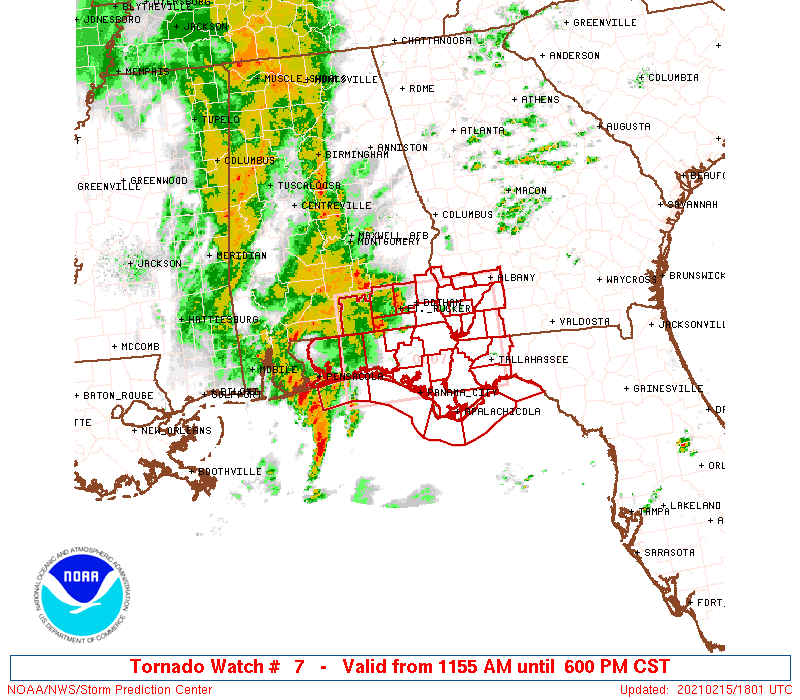
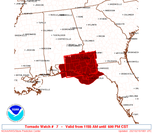
Tornado Watch Number 7
NWS Storm Prediction Center Norman OK
1155 AM CST Mon Feb 15 2021
The NWS Storm Prediction Center has issued a
* Tornado Watch for portions of
Southeast Alabama
Florida Panhandle
Southwest Georgia
Coastal Waters
* Effective this Monday morning and evening from 1155 AM until
600 PM CST.
* Primary threats include...
A few tornadoes likely with a couple intense tornadoes possible
Scattered damaging winds and isolated significant gusts to 80
mph likely
Isolated large hail events to 1.5 inches in diameter possible
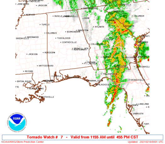
SUMMARY...Supercells are expected to spread inland within a
quasi-linear band of thunderstorms that should sweep eastward this
afternoon.
The tornado watch area is approximately along and 55 statute miles
north and south of a line from 15 miles west of Crestview FL to 30
miles north northeast of Tallahassee FL. For a complete depiction of
the watch see the associated watch outline update (WOUS64 KWNS
WOU7).
PRECAUTIONARY/PREPAREDNESS ACTIONS...
REMEMBER...A Tornado Watch means conditions are favorable for
tornadoes and severe thunderstorms in and close to the watch
area. Persons in these areas should be on the lookout for
threatening weather conditions and listen for later statements
and possible warnings.
&&
AVIATION...Tornadoes and a few severe thunderstorms with hail
surface and aloft to 1.5 inches. Extreme turbulence and surface wind
gusts to 70 knots. A few cumulonimbi with maximum tops to 450. Mean
storm motion vector 23040.
...Grams
 Note:
The Aviation Watch (SAW) product is an approximation to the watch area.
The actual watch is depicted by the shaded areas.
Note:
The Aviation Watch (SAW) product is an approximation to the watch area.
The actual watch is depicted by the shaded areas.
   SAW7
   WW 7 TORNADO AL FL GA CW 151755Z - 160000Z
   AXIS..55 STATUTE MILES NORTH AND SOUTH OF LINE..
   15W CEW/CRESTVIEW FL/ - 30NNE TLH/TALLAHASSEE FL/
   ..AVIATION COORDS.. 50NM N/S /6WSW CEW - 18NE TLH/
   HAIL SURFACE AND ALOFT..1.5 INCHES. WIND GUSTS..70 KNOTS.
   MAX TOPS TO 450. MEAN STORM MOTION VECTOR 23040.

   LAT...LON 31588677 31608416 30008416 29988677

   THIS IS AN APPROXIMATION TO THE WATCH AREA.  FOR A
   COMPLETE DEPICTION OF THE WATCH SEE WOUS64 KWNS
   FOR WOU7.
Watch 7 Status Report Messages:
STATUS REPORT #3 ON WW 7
VALID 152230Z - 160000Z
SEVERE WEATHER THREAT CONTINUES RIGHT OF A LINE FROM 35 S TLH TO
20 NNE TLH TO 25 W MGR TO 20 NW ABY.
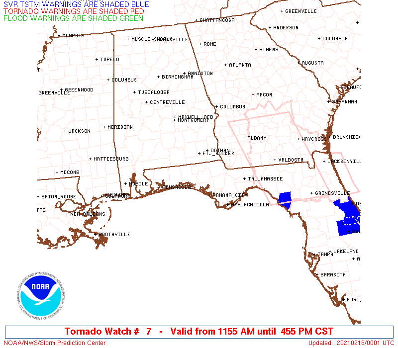
WW 7 WILL BE ALLOWED TO EXPIRE AT 160000Z.
..LYONS..02/15/21
ATTN...WFO...TAE...MOB...
&&
STATUS REPORT FOR WT 7
SEVERE WEATHER THREAT CONTINUES FOR THE FOLLOWING AREAS
GAC095-205-160000-
GA
. GEORGIA COUNTIES INCLUDED ARE
DOUGHERTY MITCHELL
$$
GMZ730-160000-
CW
. ADJACENT COASTAL WATERS INCLUDED ARE
APALACHEE BAY OR COASTAL WATERS FROM KEATON BEACH TO OCHLOCKONEE
RIVER FL OUT TO 20 NM
$$
THE WATCH STATUS MESSAGE IS FOR GUIDANCE PURPOSES ONLY. PLEASE
REFER TO WATCH COUNTY NOTIFICATION STATEMENTS FOR OFFICIAL
INFORMATION ON COUNTIES...INDEPENDENT CITIES AND MARINE ZONES
CLEARED FROM SEVERE THUNDERSTORM AND TORNADO WATCHES.
$$
STATUS REPORT #2 ON WW 7
VALID 152115Z - 152240Z
SEVERE WEATHER THREAT CONTINUES RIGHT OF A LINE FROM 35 WSW AAF
TO 20 ESE PFN TO 10 SSE DHN TO 30 N DHN.
FOR ADDITIONAL INFORMATION SEE MESOSCALE DISCUSSION 94
..LYONS..02/15/21
ATTN...WFO...TAE...MOB...
&&
STATUS REPORT FOR WT 7
SEVERE WEATHER THREAT CONTINUES FOR THE FOLLOWING AREAS
ALC067-069-152240-
AL
. ALABAMA COUNTIES INCLUDED ARE
HENRY HOUSTON
$$
FLC013-037-039-045-063-073-077-129-152240-
FL
. FLORIDA COUNTIES INCLUDED ARE
CALHOUN FRANKLIN GADSDEN
GULF JACKSON LEON
LIBERTY WAKULLA
$$
GAC007-037-061-087-095-099-131-201-205-253-152240-
GA
. GEORGIA COUNTIES INCLUDED ARE
BAKER CALHOUN CLAY
DECATUR DOUGHERTY EARLY
GRADY MILLER MITCHELL
SEMINOLE
$$
GMZ730-752-755-152240-
CW
. ADJACENT COASTAL WATERS INCLUDED ARE
APALACHEE BAY OR COASTAL WATERS FROM KEATON BEACH TO OCHLOCKONEE
RIVER FL OUT TO 20 NM
COASTAL WATERS FROM MEXICO BEACH TO APALACHICOLA OUT 20 NM
COASTAL WATERS FROM OCHLOCKONEE RIVER TO APALACHICOLA FL OUT TO
20 NM
$$
THE WATCH STATUS MESSAGE IS FOR GUIDANCE PURPOSES ONLY. PLEASE
REFER TO WATCH COUNTY NOTIFICATION STATEMENTS FOR OFFICIAL
INFORMATION ON COUNTIES...INDEPENDENT CITIES AND MARINE ZONES
CLEARED FROM SEVERE THUNDERSTORM AND TORNADO WATCHES.
$$
STATUS REPORT #1 ON WW 7
VALID 152020Z - 152140Z
SEVERE WEATHER THREAT CONTINUES RIGHT OF A LINE FROM 30 WSW PFN
TO 30 NNW PFN TO 30 WSW DHN TO 10 SSE TOI TO 20 SE MGM.
..LYONS..02/15/21
ATTN...WFO...TAE...MOB...
&&
STATUS REPORT FOR WT 7
SEVERE WEATHER THREAT CONTINUES FOR THE FOLLOWING AREAS
ALC045-061-067-069-152140-
AL
. ALABAMA COUNTIES INCLUDED ARE
DALE GENEVA HENRY
HOUSTON
$$
FLC005-013-037-039-045-059-063-073-077-129-133-152140-
FL
. FLORIDA COUNTIES INCLUDED ARE
BAY CALHOUN FRANKLIN
GADSDEN GULF HOLMES
JACKSON LEON LIBERTY
WAKULLA WASHINGTON
$$
GAC007-037-061-087-095-099-131-201-205-253-152140-
GA
. GEORGIA COUNTIES INCLUDED ARE
BAKER CALHOUN CLAY
DECATUR DOUGHERTY EARLY
GRADY MILLER MITCHELL
SEMINOLE
$$
GMZ730-750-752-755-152140-
CW
. ADJACENT COASTAL WATERS INCLUDED ARE
APALACHEE BAY OR COASTAL WATERS FROM KEATON BEACH TO OCHLOCKONEE
RIVER FL OUT TO 20 NM
COASTAL WATERS FROM OKALOOSA-WALTON COUNTY LINE TO MEXICO BEACH
OUT 20 NM
COASTAL WATERS FROM MEXICO BEACH TO APALACHICOLA OUT 20 NM
COASTAL WATERS FROM OCHLOCKONEE RIVER TO APALACHICOLA FL OUT TO
20 NM
$$
THE WATCH STATUS MESSAGE IS FOR GUIDANCE PURPOSES ONLY. PLEASE
REFER TO WATCH COUNTY NOTIFICATION STATEMENTS FOR OFFICIAL
INFORMATION ON COUNTIES...INDEPENDENT CITIES AND MARINE ZONES
CLEARED FROM SEVERE THUNDERSTORM AND TORNADO WATCHES.
$$
Note:
Click for Complete Product Text.
Tornadoes
Probability of 2 or more tornadoes
|
Mod (60%)
|
Probability of 1 or more strong (EF2-EF5) tornadoes
|
Mod (40%)
|
Wind
Probability of 10 or more severe wind events
|
High (70%)
|
Probability of 1 or more wind events > 65 knots
|
Mod (60%)
|
Hail
Probability of 10 or more severe hail events
|
Low (20%)
|
Probability of 1 or more hailstones > 2 inches
|
Low (10%)
|
Combined Severe Hail/Wind
Probability of 6 or more combined severe hail/wind events
|
High (90%)
|
For each watch, probabilities for particular events inside the watch
(listed above in each table) are determined by the issuing forecaster.
The "Low" category contains probability values ranging from less than 2%
to 20% (EF2-EF5 tornadoes), less than 5% to 20% (all other probabilities),
"Moderate" from 30% to 60%, and "High" from 70% to greater than 95%.
High values are bolded and lighter in color to provide awareness of
an increased threat for a particular event.


 @NWSSPC