|
| Mesoscale Discussion 1548 |
|
< Previous MD Next MD >
|
|
Mesoscale Discussion 1548
NWS Storm Prediction Center Norman OK
0756 PM CDT Sat Jul 06 2024
Areas affected...Lower Missouri Valley region
Concerning...Severe Thunderstorm Watch 509...
Valid 070056Z - 070200Z
The severe weather threat for Severe Thunderstorm Watch 509
continues.
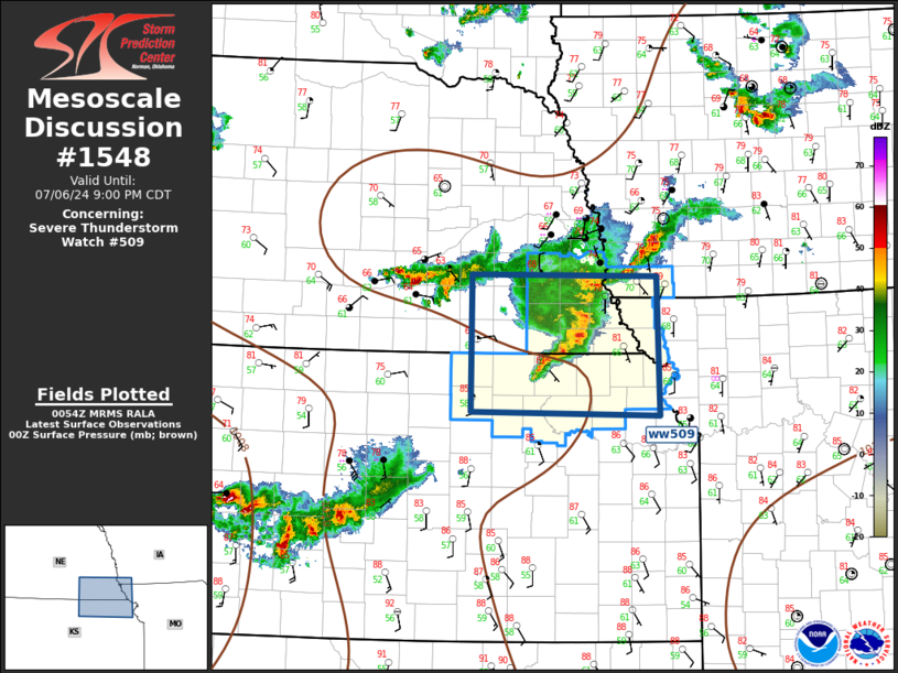
SUMMARY...Damaging wind threat continues this evening.
DISCUSSION...MCS that developed over south-central NE has matured as
it propagates east along the NE/KS border toward southwest
IA/northwest MO. Latest diagnostic data depicts a broad reservoir of
buoyancy (1000-1500 MLCAPE) that has yet to be overturned
immediately ahead of this complex. With the LLJ beginning to
strengthen over northeast KS there is reasonable confidence this MCS
should advance beyond the MO River before any appreciable weakening
occurs. Damaging winds are the primary risk with this convection.
..Darrow.. 07/07/2024
...Please see www.spc.noaa.gov for graphic product...
ATTN...WFO...EAX...OAX...TOP...GID...
LAT...LON 40829765 40799515 39349511 39399765 40829765
|
|
Top/All Mesoscale Discussions/Forecast Products/Home
|
|


 @NWSSPC