|
| Mesoscale Discussion 1301 |
|
< Previous MD Next MD >
|
|
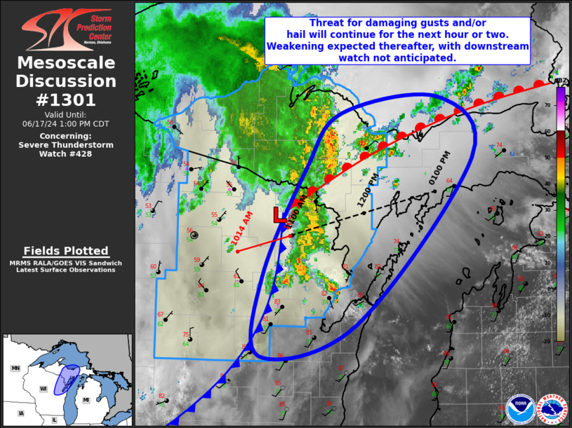
   Mesoscale Discussion 1301
   NWS Storm Prediction Center Norman OK
   1128 AM CDT Mon Jun 17 2024

   Areas affected...Far Northeast WI into Central/Eastern Upper MI

   Concerning...Severe Thunderstorm Watch 428...

   Valid 171628Z - 171800Z

   The severe weather threat for Severe Thunderstorm Watch 428
   continues.

   SUMMARY...Threat for damaging gusts and/or hail will continue for
   the next hour or so. Downstream watch across the eastern UP not
   currently anticipated.

   DISCUSSION...Loosely organized convective cluster continues to
   progress northeastward from far northeastern WI into central Upper
   MI, supported by a eastward-progressing cold front. Modest
   destabilization has occurred downstream across central Upper MI,
   with mid/upper 70s temperatures amid upper 60s/low 70s dewpoints
   current in place. This buoyancy should help maintain the ongoing
   cluster, with some modest intensification possible over the next
   hour or so. Damaging gusts will remain the primary risk, but hail is
   possible with any more cellular development that occurs ahead of the
   cluster.

   Given the increasing cloud cover, destabilization is more uncertain
   farther east into eastern Upper MI, with the storms expected to
   gradually weaken as they encounter the increasing stable airmass
   farther east. As such, a downstream watch across the eastern UP
   appears unlikely.

   ..Mosier.. 06/17/2024

   ...Please see www.spc.noaa.gov for graphic product...

   ATTN...WFO...MQT...GRB...

   LAT...LON   45078885 46158823 46688774 46858639 46248591 44598754
               44298888 45078885
|
|
Top/All Mesoscale Discussions/Forecast Products/Home
|
|


 @NWSSPC