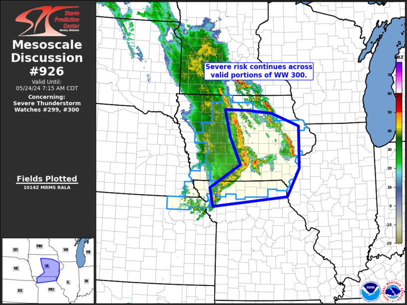
   Mesoscale Discussion 0926
   NWS Storm Prediction Center Norman OK
   0517 AM CDT Fri May 24 2024

   Areas affected...Iowa/northern Missouri

   Concerning...Severe Thunderstorm Watch 299...300...

   Valid 241017Z - 241215Z

   The severe weather threat for Severe Thunderstorm Watch 299, 300
   continues.

   SUMMARY...Severe-weather risk -- including damaging winds, hail, and
   a tornado or two -- continues across WW 300.  Greatest risk is
   evident across central and southern Iowa -- near and south of the
   surface warm front.

   DISCUSSION...Latest radar loop shows the well-established/organized
   convective line moving eastward across Iowa, and now merging (in
   central IA) with cellular convection which had developed east of the
   main line.  A particularly interesting interaction has recently
   occurred south/southeast of Des Moines, where rapid upscale
   supercellular evolution was observed within a bowing segment of the
   line, subsequent to merger of the bow with one of these more
   isolated convective elements.  Radar data from KDMX appeared to
   confirm a brief tornado.

   Elsewhere, damaging winds, and occasional/brief tornadic spin-ups
   remain possible.  Risk appears to wane with northward extent toward
   the Minnesota border, especially into northeastern Iowa where a much
   cooler/more stable airmass exists to the northeast of the
   central/southeastern Iowa warm front.  South of that front however,
   severe weather remains likely as convection continues advancing
   eastward over the next couple of hours.

   ..Goss.. 05/24/2024

   ...Please see www.spc.noaa.gov for graphic product...

   ATTN...WFO...LSX...DVN...ARX...DMX...EAX...

   LAT...LON   39709477 40339493 41149357 42079404 43019429 42999326
               42899216 42459093 41009093 40039148 39709477
|


 @NWSSPC