|
| Mesoscale Discussion 2037 |
|
< Previous MD Next MD >
|
|
Mesoscale Discussion 2037
NWS Storm Prediction Center Norman OK
0624 PM CST Wed Dec 14 2022
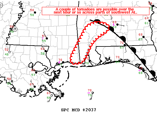
Areas affected...far southeast MS...southwest AL
Concerning...Tornado Watch 588...
Valid 150024Z - 150130Z
The severe weather threat for Tornado Watch 588 continues.
SUMMARY...A couple of tornadoes are possible over the next hour or
so across southwest AL.
DISCUSSION...KMOB radar imagery over the past 1-2 hours has shown an
evolution from a embedded supercell-squall line morphology, to the
convective line growing downscale into quasi-discrete supercells
embedded within a rain shield across the southeast MS into southwest
AL. This appears to be partly related to the approach of a
negatively tilted shortwave trough moving northeast across the lower
MS Valley early this evening and its influence on modifying the wind
profile.
The airmass across southwest AL is very moist with dewpoints in the
upper 60s to 70 deg F to the south of a maritime warm front. RAP
forecast soundings show 0-0.5 km SRH around 300-350 m2/s2 and MLCAPE
ranging from 750 J/kg near the warm front to 1500 J/kg farther south
near Mobile. The enlarged hodographs will support intermittently
strong low-level mesocyclones and a tornado threat.
..Smith.. 12/15/2022
...Please see www.spc.noaa.gov for graphic product...
ATTN...WFO...MOB...LIX...
LAT...LON 31508748 31068785 30518825 30408855 30398879 30528878
31728813 31948760 31898713 31728702 31598712 31508748
|
|
Top/All Mesoscale Discussions/Forecast Products/Home
|
|


 @NWSSPC