Note:
The expiration time in the watch graphic is amended if the watch is
replaced, cancelled or extended.
Note:
Note:
The expiration time in the watch graphic is amended if the watch is
replaced, cancelled or extended.
Note: Click for
Watch Status Reports.
SEL1
URGENT - IMMEDIATE BROADCAST REQUESTED
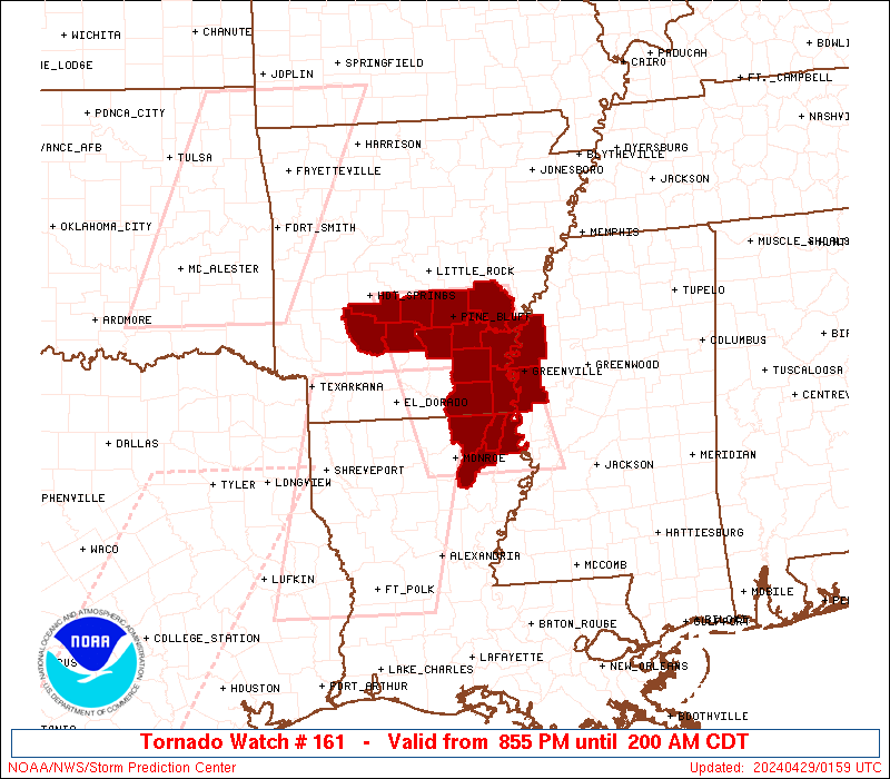
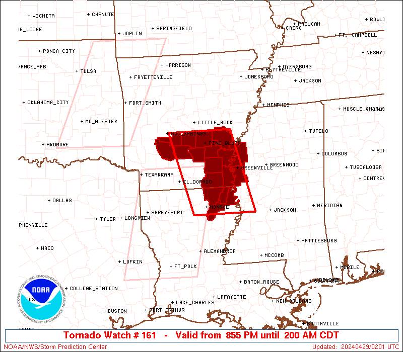
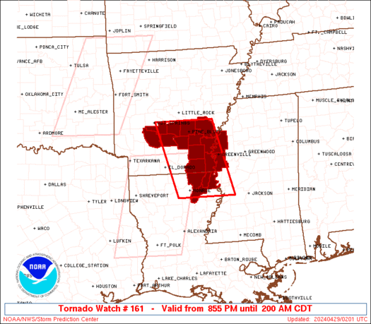
Tornado Watch Number 161
NWS Storm Prediction Center Norman OK
855 PM CDT Sun Apr 28 2024
The NWS Storm Prediction Center has issued a
* Tornado Watch for portions of
Southern Arkansas
Northeast Louisiana
Western Mississippi
* Effective this Sunday night and Monday morning from 855 PM
until 200 AM CDT.
* Primary threats include...
A couple tornadoes possible
Scattered damaging wind gusts to 70 mph likely
Isolated large hail events to 1 inch in diameter possible
SUMMARY...A severe squall line will continue to the northeast across
portions of the Lower Mississippi Valley this evening. Scattered
damaging gusts and a couple of brief tornadoes are possible with the
more intense portions of the bow.
The tornado watch area is approximately along and 55 statute miles
east and west of a line from 25 miles north northwest of Pine Bluff
AR to 35 miles east southeast of Monroe LA. For a complete depiction
of the watch see the associated watch outline update (WOUS64 KWNS
WOU1).
PRECAUTIONARY/PREPAREDNESS ACTIONS...
REMEMBER...A Tornado Watch means conditions are favorable for
tornadoes and severe thunderstorms in and close to the watch
area. Persons in these areas should be on the lookout for
threatening weather conditions and listen for later statements
and possible warnings.
&&
OTHER WATCH INFORMATION...CONTINUE...WW 158...WW 159...WW 160...
AVIATION...Tornadoes and a few severe thunderstorms with hail
surface and aloft to 1 inch. Extreme turbulence and surface wind
gusts to 60 knots. A few cumulonimbi with maximum tops to 400. Mean
storm motion vector 24035.
...Smith
 Note:
The Aviation Watch (SAW) product is an approximation to the watch area.
The actual watch is depicted by the shaded areas.
Note:
The Aviation Watch (SAW) product is an approximation to the watch area.
The actual watch is depicted by the shaded areas.
   SAW1
   WW 161 TORNADO AR LA MS 290155Z - 290700Z
   AXIS..55 STATUTE MILES EAST AND WEST OF LINE..
   25NNW PBF/PINE BLUFF AR/ - 35ESE MLU/MONROE LA/
   ..AVIATION COORDS.. 50NM E/W /11SSE LIT - 30ESE MLU/
   HAIL SURFACE AND ALOFT..1 INCH. WIND GUSTS..60 KNOTS.
   MAX TOPS TO 400. MEAN STORM MOTION VECTOR 24035.

   LAT...LON 34509113 32329053 32329242 34509306

   THIS IS AN APPROXIMATION TO THE WATCH AREA.  FOR A
   COMPLETE DEPICTION OF THE WATCH SEE WOUS64 KWNS
   FOR WOU1.
Watch 161 Status Report Message has not been issued yet.
Note:
Click for Complete Product Text.
Tornadoes
Probability of 2 or more tornadoes
|
Mod (30%)
|
Probability of 1 or more strong (EF2-EF5) tornadoes
|
Low (10%)
|
Wind
Probability of 10 or more severe wind events
|
Mod (60%)
|
Probability of 1 or more wind events > 65 knots
|
Low (20%)
|
Hail
Probability of 10 or more severe hail events
|
Low (20%)
|
Probability of 1 or more hailstones > 2 inches
|
Low (<5%)
|
Combined Severe Hail/Wind
Probability of 6 or more combined severe hail/wind events
|
High (80%)
|
For each watch, probabilities for particular events inside the watch
(listed above in each table) are determined by the issuing forecaster.
The "Low" category contains probability values ranging from less than 2%
to 20% (EF2-EF5 tornadoes), less than 5% to 20% (all other probabilities),
"Moderate" from 30% to 60%, and "High" from 70% to greater than 95%.
High values are bolded and lighter in color to provide awareness of
an increased threat for a particular event.


 @NWSSPC