Note:
The expiration time in the watch graphic is amended if the watch is
replaced, cancelled or extended.
Note:
Note:
The expiration time in the watch graphic is amended if the watch is
replaced, cancelled or extended.
Note: Click for
Watch Status Reports.
SEL8
URGENT - IMMEDIATE BROADCAST REQUESTED
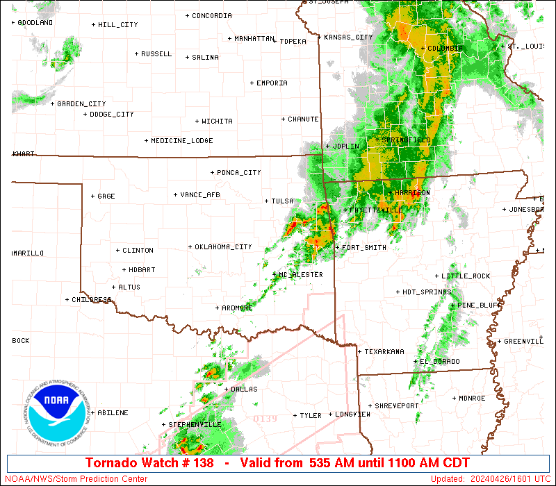
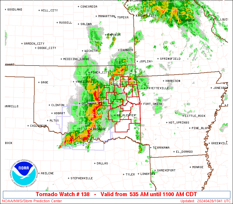
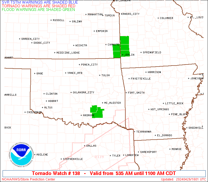
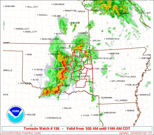
Tornado Watch Number 138
NWS Storm Prediction Center Norman OK
535 AM CDT Fri Apr 26 2024
The NWS Storm Prediction Center has issued a
* Tornado Watch for portions of
Eastern Oklahoma
* Effective this Friday morning from 535 AM until 1100 AM CDT.
* Primary threats include...
A few tornadoes possible
Scattered damaging wind gusts to 70 mph possible
Isolated large hail events to 1 inch in diameter possible
SUMMARY...A squall line with embedded bowing segments/mesovortices
will pose a continued threat for a couple of tornadoes, damaging
gusts of 60-70 mph and isolated large hail near 1 inch diameter
through mid morning.
The tornado watch area is approximately along and 45 statute miles
east and west of a line from 25 miles east northeast of Tulsa OK to
35 miles east southeast of Mcalester OK. For a complete depiction of
the watch see the associated watch outline update (WOUS64 KWNS
WOU8).
PRECAUTIONARY/PREPAREDNESS ACTIONS...
REMEMBER...A Tornado Watch means conditions are favorable for
tornadoes and severe thunderstorms in and close to the watch
area. Persons in these areas should be on the lookout for
threatening weather conditions and listen for later statements
and possible warnings.
&&
OTHER WATCH INFORMATION...CONTINUE...WW 137...
AVIATION...Tornadoes and a few severe thunderstorms with hail
surface and aloft to 1 inch. Extreme turbulence and surface wind
gusts to 60 knots. A few cumulonimbi with maximum tops to 500. Mean
storm motion vector 25040.
...Thompson
   SEL8

   URGENT - IMMEDIATE BROADCAST REQUESTED
   Tornado Watch Number 138
   NWS Storm Prediction Center Norman OK
   535 AM CDT Fri Apr 26 2024

   The NWS Storm Prediction Center has issued a

   * Tornado Watch for portions of
     Eastern Oklahoma

   * Effective this Friday morning from 535 AM until 1100 AM CDT.

   * Primary threats include...
     A few tornadoes possible
     Scattered damaging wind gusts to 70 mph possible
     Isolated large hail events to 1 inch in diameter possible

   SUMMARY...A squall line with embedded bowing segments/mesovortices
   will pose a continued threat for a couple of tornadoes, damaging
   gusts of 60-70 mph and isolated large hail near 1 inch diameter
   through mid morning.

   The tornado watch area is approximately along and 45 statute miles
   east and west of a line from 25 miles east northeast of Tulsa OK to
   35 miles east southeast of Mcalester OK. For a complete depiction of
   the watch see the associated watch outline update (WOUS64 KWNS
   WOU8).

   PRECAUTIONARY/PREPAREDNESS ACTIONS...

   REMEMBER...A Tornado Watch means conditions are favorable for
   tornadoes and severe thunderstorms in and close to the watch
   area. Persons in these areas should be on the lookout for
   threatening weather conditions and listen for later statements
   and possible warnings.

   &&

   OTHER WATCH INFORMATION...CONTINUE...WW 137...

   AVIATION...Tornadoes and a few severe thunderstorms with hail
   surface and aloft to 1 inch. Extreme turbulence and surface wind
   gusts to 60 knots. A few cumulonimbi with maximum tops to 500. Mean
   storm motion vector 25040.

   ...Thompson
 Note:
The Aviation Watch (SAW) product is an approximation to the watch area.
The actual watch is depicted by the shaded areas.
Note:
The Aviation Watch (SAW) product is an approximation to the watch area.
The actual watch is depicted by the shaded areas.
   SAW8
   WW 138 TORNADO OK 261035Z - 261600Z
   AXIS..45 STATUTE MILES EAST AND WEST OF LINE..
   25ENE TUL/TULSA OK/ - 35ESE MLC/MCALESTER OK/
   ..AVIATION COORDS.. 40NM E/W /18ENE TUL - 30ESE MLC/
   HAIL SURFACE AND ALOFT..1 INCH. WIND GUSTS..60 KNOTS.
   MAX TOPS TO 500. MEAN STORM MOTION VECTOR 25040.

   LAT...LON 36349466 34689442 34689600 36349627

   THIS IS AN APPROXIMATION TO THE WATCH AREA.  FOR A
   COMPLETE DEPICTION OF THE WATCH SEE WOUS64 KWNS
   FOR WOU8.
Watch 138 Status Report Messages:
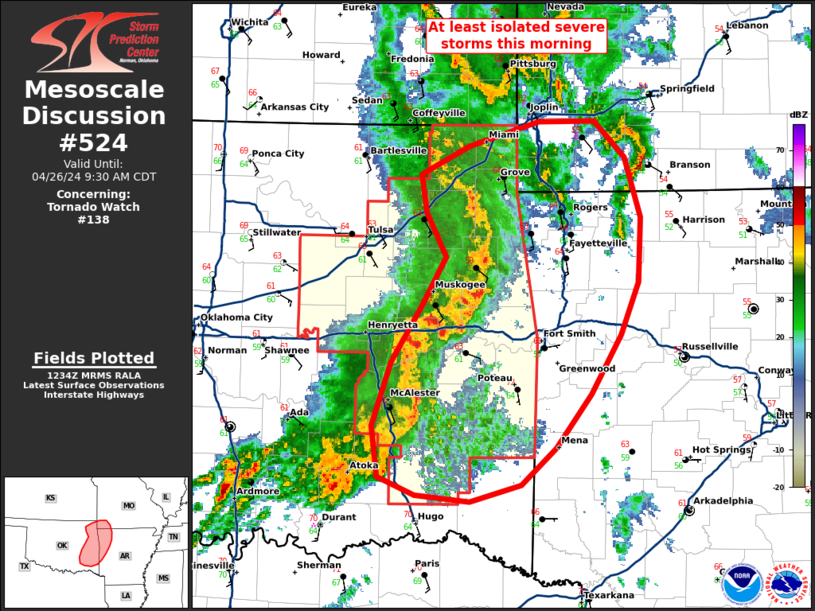
STATUS REPORT #2 ON WW 138

VALID 261345Z - 261440Z

SEVERE WEATHER THREAT CONTINUES RIGHT OF A LINE FROM 35 S MLC TO
20 SE MLC TO 25 ENE MLC TO 25 W RKR TO 20 NW RKR TO 30 WNW FSM TO
25 NNW FSM TO 30 SSW UMN.

..JEWELL..04/26/24

ATTN...WFO...TSA...

&&

STATUS REPORT FOR WT 138

SEVERE WEATHER THREAT CONTINUES FOR THE FOLLOWING AREAS

OKC077-079-127-135-261440-

OK
.    OKLAHOMA COUNTIES INCLUDED ARE

LATIMER 	     LE FLORE		 PUSHMATAHA
SEQUOYAH
$$


THE WATCH STATUS MESSAGE IS FOR GUIDANCE PURPOSES ONLY.  PLEASE
REFER TO WATCH COUNTY NOTIFICATION STATEMENTS FOR OFFICIAL
INFORMATION ON COUNTIES...INDEPENDENT CITIES AND MARINE ZONES
CLEARED FROM SEVERE THUNDERSTORM AND TORNADO WATCHES.
$$

STATUS REPORT #1 ON WW 138

VALID 261245Z - 261340Z

SEVERE WEATHER THREAT CONTINUES RIGHT OF A LINE FROM 30 NW MLC TO
20 NW MKO TO 20 E TUL TO 30 ESE BVO.

FOR ADDITIONAL INFORMATION SEE MESOSCALE DISCUSSION 524

..GUYER..04/26/24

ATTN...WFO...TSA...

&&

STATUS REPORT FOR WT 138

SEVERE WEATHER THREAT CONTINUES FOR THE FOLLOWING AREAS

OKC001-021-035-041-061-077-079-091-097-101-115-121-127-131-135-
145-261340-

OK
.    OKLAHOMA COUNTIES INCLUDED ARE

ADAIR		     CHEROKEE		 CRAIG
DELAWARE	     HASKELL		 LATIMER
LE FLORE	     MCINTOSH		 MAYES
MUSKOGEE	     OTTAWA		 PITTSBURG
PUSHMATAHA	     ROGERS		 SEQUOYAH
WAGONER
$$


THE WATCH STATUS MESSAGE IS FOR GUIDANCE PURPOSES ONLY.  PLEASE
REFER TO WATCH COUNTY NOTIFICATION STATEMENTS FOR OFFICIAL
INFORMATION ON COUNTIES...INDEPENDENT CITIES AND MARINE ZONES
CLEARED FROM SEVERE THUNDERSTORM AND TORNADO WATCHES.
$$
Note:
Click for Complete Product Text.
Tornadoes
Probability of 2 or more tornadoes
|
Mod (50%)
|
Probability of 1 or more strong (EF2-EF5) tornadoes
|
Low (20%)
|
Wind
Probability of 10 or more severe wind events
|
Mod (50%)
|
Probability of 1 or more wind events > 65 knots
|
Low (20%)
|
Hail
Probability of 10 or more severe hail events
|
Mod (30%)
|
Probability of 1 or more hailstones > 2 inches
|
Low (10%)
|
Combined Severe Hail/Wind
Probability of 6 or more combined severe hail/wind events
|
High (70%)
|
For each watch, probabilities for particular events inside the watch
(listed above in each table) are determined by the issuing forecaster.
The "Low" category contains probability values ranging from less than 2%
to 20% (EF2-EF5 tornadoes), less than 5% to 20% (all other probabilities),
"Moderate" from 30% to 60%, and "High" from 70% to greater than 95%.
High values are bolded and lighter in color to provide awareness of
an increased threat for a particular event.


 @NWSSPC