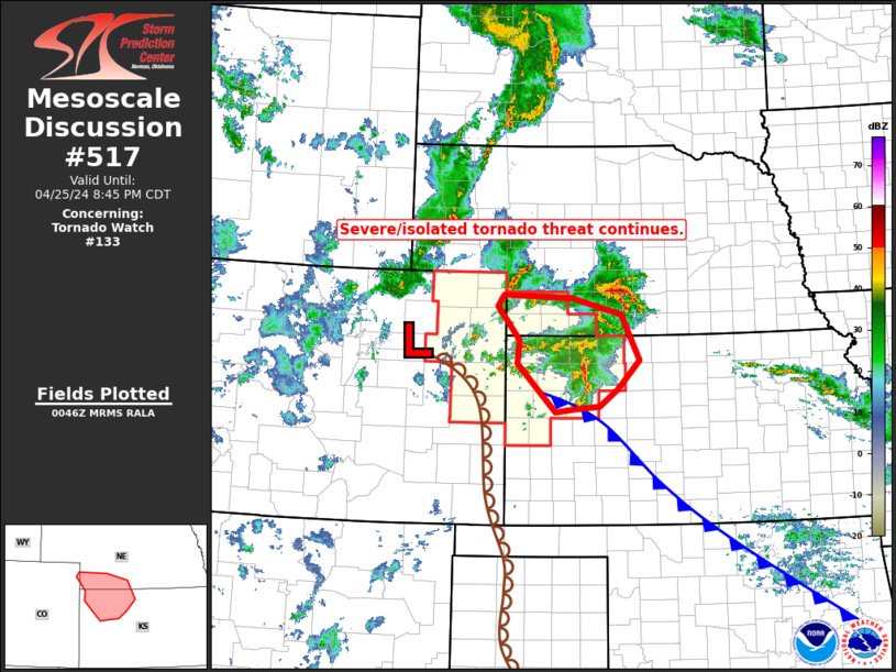
   Mesoscale Discussion 0517
   NWS Storm Prediction Center Norman OK
   0748 PM CDT Thu Apr 25 2024

   Areas affected...southwestern Nebraska...northwestern Kansas

   Concerning...Tornado Watch 133...

   Valid 260048Z - 260145Z

   The severe weather threat for Tornado Watch 133 continues.

   SUMMARY...Storms have diminished in coverage and intensity over the
   past hour, but severe threat will continue locally.

   DISCUSSION...Latest composite radar loop over the central High
   Plains region shows a decrease in convective coverage and intensity
   over the past hour -- especially along the western Kansas dryline.
   The main area of convective persistence is ongoing from northeastern
   Colorado eastward across southwestern Nebraska and northwestern
   Kansas.

   The northwest-to-southeast surface baroclinic zone across western
   Kansas has been making gradual progress southwestward over the past
   couple of hours -- in part due to convective outflow reinforcement.
   As such, convection shifting northeastward across the tornado watch
   continues to encounter a less-unstable environment.  As a result,
   storms have undergone a weakening trend, particularly a decrease in
   the number of storms with supercellular characteristics.

   With that said, local/all-hazards risk continues with stronger
   storms in/near the WW.  Additionally, some CAM runs suggest that as
   the low-level jet increases this evening, likely contributing to an
   increase in storm coverage on the cool side of the front, some
   potential for upscale growth into a bowing line is possible,
   potentially shifting eastward either side of the Nebraska/Kansas
   border.  This could yield a minor increase in wind potential, though
   the stable boundary layer with eastward extent should limit overall
   risk.

   ..Goss.. 04/26/2024

   ...Please see www.spc.noaa.gov for graphic product...

   ATTN...WFO...GID...LBF...DDC...GLD...BOU...

   LAT...LON   40650209 40590068 40339968 39619931 39159974 38870012
               38830061 38790102 39550181 39930177 40460221 40650209
|


 @NWSSPC