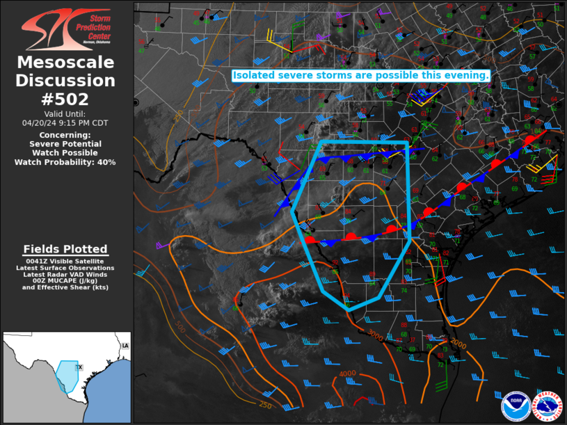
   Mesoscale Discussion 0502
   NWS Storm Prediction Center Norman OK
   0746 PM CDT Sat Apr 20 2024

   Areas affected...South-central into deep south TX

   Concerning...Severe potential...Watch possible

   Valid 210046Z - 210215Z

   Probability of Watch Issuance...40 percent

   SUMMARY...Isolated severe storms may evolve with time this evening,
   with a threat of large hail and localized severe gusts.

   DISCUSSION...Elevated convection has recently increased in coverage
   and intensity north of a cold front across western portions of
   south-central TX, with recent initiation noted farther south near a
   stationary front, north of Laredo. Confidence in greater storm
   coverage this evening is higher with northward extent, where
   elevated convection may continue to evolve within an environment
   characterized by MUCAPE of 1000-1500 J/kg (as noted in the 00Z DRT
   sounding) and sufficient effective shear for some storm
   organization. Isolated hail will be possible within this regime as
   storms spread eastward with time.

   Near-term storm potential farther south remains more uncertain, with
   generally nebulous large-scale ascent across the region, and some
   nocturnal cooling/stabilization expected with time. However, the
   environment south of the deeper post-frontal cold air is
   conditionally favorable for severe storms, with steep midlevel lapse
   rates atop rich low-level moisture supporting MLCAPE in excess of
   2000 J/kg. If a supercell can evolve within this regime, there would
   be at least an isolated threat of large to very large hail
   (approaching 2 inches in diameter), along with some threat for
   severe gusts with convection that remains rooted closer to the
   surface. Watch issuance is possible, if supercell development within
   this more favorable environment appears imminent.

   ..Dean/Guyer.. 04/21/2024

   ...Please see www.spc.noaa.gov for graphic product...

   ATTN...WFO...CRP...EWX...BRO...

   LAT...LON   28050022 28520043 29779985 29769811 28009808 27019871
               26799929 27129981 28050022
|


 @NWSSPC