|
| Mesoscale Discussion 492 |
|
< Previous MD Next MD >
|
|
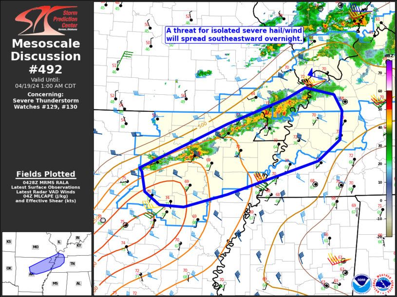
   Mesoscale Discussion 0492
   NWS Storm Prediction Center Norman OK
   1130 PM CDT Thu Apr 18 2024

   Areas affected...North-central/northeast AR into southeast
   MO...western TN...far western KY

   Concerning...Severe Thunderstorm Watch 129...130...

   Valid 190430Z - 190600Z

   The severe weather threat for Severe Thunderstorm Watch 129, 130
   continues.

   SUMMARY...A threat for isolated severe hail and wind will spread
   southeastward overnight.

   DISCUSSION...Occasionally organized convection is ongoing late
   tonight near a southeastward moving cold front from north-central AR
   into southeast MO. While the primary upper-level trough and surface
   low will become increasingly displaced northeast of the region,
   low-level south-southwesterly flow will maintain rich moisture
   along/ahead of the front, with MLCAPE of greater than 1000 J/kg
   potentially spreading from AR into western TN. Deep-layer shear will
   remain modestly favorable for organized storms and somewhat
   orthogonal to the boundary, and a transient supercell or two remains
   possible if deep convection can be sustained. With time, weakening
   ascent and increasing MLCINH with southeastward extent will
   eventually result in a diminishing threat, but isolated hail and
   damaging gusts remain possible into the early overnight hours.

   ..Dean.. 04/19/2024

   ...Please see www.spc.noaa.gov for graphic product...

   ATTN...WFO...PAH...MEG...LZK...

   LAT...LON   35499282 36299094 36738964 36938923 36798861 36518843
               35998850 35628897 35059092 34829187 34849239 35079270
               35429278 35499282
|
|
Top/All Mesoscale Discussions/Forecast Products/Home
|
|


 @NWSSPC