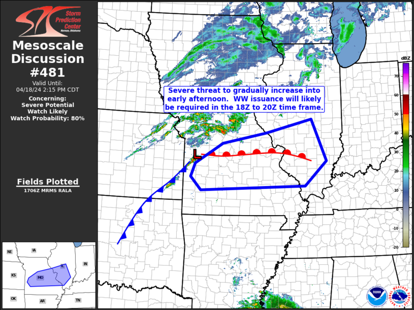
   Mesoscale Discussion 0481
   NWS Storm Prediction Center Norman OK
   1208 PM CDT Thu Apr 18 2024

   Areas affected...parts of central and southern Missouri into western
   Illinois

   Concerning...Severe potential...Watch likely

   Valid 181708Z - 181915Z

   Probability of Watch Issuance...80 percent

   SUMMARY...A gradual increase in thunderstorms is forecast across the
   central Missouri vicinity this afternoon, spreading into western
   Illinois with time.  WW issuance is likely to be required in the
   next 1 to 2 hours.

   DISCUSSION...Latest visible satellite imagery shows a cold front
   extending southwestward from a low southeast of Kansas City, across
   far southeastern Kansas, and a warm front extending eastward across
   central Missouri.  The warm front continues to move slowly
   northward, at the northern edge of a moist (60s dewpoints) boundary
   layer.

   In the wake of a well-defined, southeastward-moving gravity wave,
   preceding the frontal zone by about 100 miles, clearing in the cloud
   cover will continue to allow diurnal heating of the moistening
   boundary layer.  Resulting moderate destabilization through the
   afternoon will support gradual development of storms -- initially in
   proximity to both frontal zones.  With time, CAMs suggest some
   warm-sector/pre-frontal storm development, with any such storm more
   likely to exhibit supercell structures, given a background kinematic
   environment supportive of updraft rotation.  Along with locally
   damaging wind gusts and possibly a tornado or two, large hail near
   or in excess of golf-ball size would be possible.

   However, more widespread severe risk may preferentially evolve with
   upscale-growing convection near the low and trailing cold front.
   Eventually, a broken line of storms is anticipated, accompanied by
   potential for more widespread damaging winds, along with hail and
   perhaps a QLCS tornado or two as it moves eastward across eastern
   Missouri and eventually into Illinois.

   ..Goss/Mosier.. 04/18/2024

   ...Please see www.spc.noaa.gov for graphic product...

   ATTN...WFO...PAH...ILX...LSX...SGF...EAX...

   LAT...LON   38309410 39019288 39389094 39858891 38388828 37518923
               37379383 37839429 38309410
|


 @NWSSPC