|
| Mesoscale Discussion 480 |
|
< Previous MD Next MD >
|
|
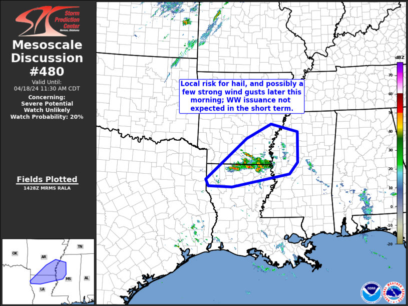
   Mesoscale Discussion 0480
   NWS Storm Prediction Center Norman OK
   0931 AM CDT Thu Apr 18 2024

   Areas affected...northern Louisiana into southern Arkansas and
   western Mississippi

   Concerning...Severe potential...Watch unlikely

   Valid 181431Z - 181630Z

   Probability of Watch Issuance...20 percent

   SUMMARY...Risk for hail -- and eventually locally damaging wind
   gusts -- will gradually expand across southern Arkansas and northern
   Louisiana this morning, spreading into western Mississippi with
   time.  Marginal/localized nature of the risk in the short term
   should preclude any need for short-term WW issuance.

   DISCUSSION...Slightly elevated convection continues to evolve across
   the Arkansas/Louisiana border area this morning, within a zone of QG
   ascent ahead of a subtle mid-level impulse moving across east Texas
   per morning water vapor imagery.  A few transiently stronger cores
   are noted, aided by moderately strong flow through the middle
   troposphere amidst an environment characterized by about 1000 J/kg
   most-unstable CAPE.

   The primary short-term risk remains marginally severe hail, with a
   couple of the more vigorous/long-lived updrafts.  However, filtered
   insolation through an existing high-cloud deck will yield enough
   surface heating to allow storms to become surface-based with time.
   As such, risk for a couple of stronger gusts will manifest as well.
   With that said, risk should remain local/limited, given lack of a
   focused low-level ascent, suggesting that WW issuance remains
   unlikely through midday.

   ..Goss/Mosier.. 04/18/2024

   ...Please see www.spc.noaa.gov for graphic product...

   ATTN...WFO...MEG...JAN...LZK...SHV...

   LAT...LON   32439406 33999225 34549114 34238993 33078995 32639031
               32149288 32179394 32439406
|
|
Top/All Mesoscale Discussions/Forecast Products/Home
|
|


 @NWSSPC