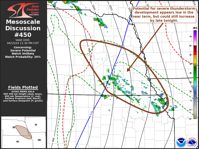
   Mesoscale Discussion 0450
   NWS Storm Prediction Center Norman OK
   0907 PM CDT Mon Apr 15 2024

   Areas affected...eastern Nebraska amd adjacent portions of the
   Missouri Valley

   Concerning...Severe potential...Watch unlikely

   Valid 160207Z - 160430Z

   Probability of Watch Issuance...20 percent

   SUMMARY...An increase in generally weak thunderstorm activity is
   ongoing.  While there is some uncertainty, the risk for severe
   weather still appears limited until late tonight.

   DISCUSSION...Downstream of a significant mid-level trough emerging
   from the Southwest, a developing area of mid-level warm advection is
   becoming focused across the northeastern Kansas/eastern Nebraska
   vicinity of the middle Missouri Valley.  Based on radar, and the
   16/00Z sounding from Topeka, associated lift and moistening are
   contributing to destabilization supportive of an ongoing increase in
   convective development, which is rooted above the inversion
   associated with a prominent elevated mixed-layer.

   Below the capping inversion, boundary-layer moistening, within a
   corridor to the west of the Missouri River, has contributed to
   mixed-layer CAPE in excess of 2000 J/kg.  And, in the presence of
   sizable clockwise-curved low-level hodographs and strong deep-layer
   shear, the environment has become conditionally favorable for
   boundary-layer based supercells.  However, until the leading edge of
   mid-level cooling approaching from the southwest begins to
   overspread the region later tonight, the boundary-layer instability
   and stronger convective potential may remain unrealized.

   ..Kerr/Thompson.. 04/16/2024

   ...Please see www.spc.noaa.gov for graphic product...

   ATTN...WFO...EAX...OAX...TOP...GID...LBF...

   LAT...LON   41929840 41409626 39859488 39369553 40009737 40399786
               41679892 41929840
|


 @NWSSPC