|
| Mesoscale Discussion 441 |
|
< Previous MD Next MD >
|
|
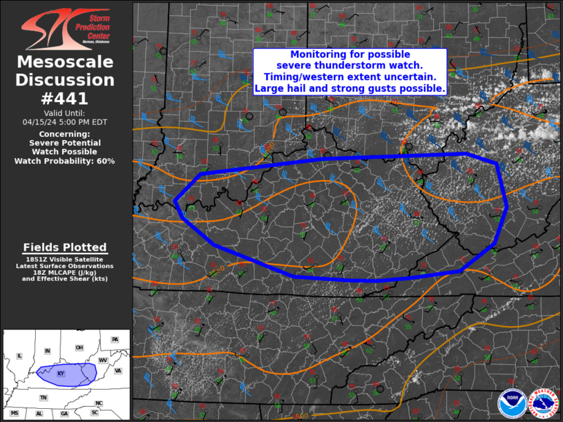
   Mesoscale Discussion 0441
   NWS Storm Prediction Center Norman OK
   0155 PM CDT Mon Apr 15 2024

   Areas affected...far southern IN...central/eastern KY into western
   Virginia/West Virginia

   Concerning...Severe potential...Watch possible

   Valid 151855Z - 152100Z

   Probability of Watch Issuance...60 percent

   SUMMARY...Severe thunderstorms potential may increase over the next
   couple of hours from far southern Indiana into parts of
   central/eastern Kentucky and western Virginia/West Virginia. Large
   hail and strong gusts would accompany any stronger storms that
   develop.

   DISCUSSION...An increase in cumulus has been noted in visible
   satellite imagery over the past hour, especially from eastern KY
   into West Virginia. Strong heating and surface dewpoints in the mid
   50s to mid 60s F beneath very steep midlevel lapse rates are
   resulting in MLCAPE up to 1500 J/kg. While large-scale ascent is
   weak over the region, continued heating and erosion of weak
   inhibition amid 30-40 kt of midlevel northwesterly flow, should
   foster at least isolated thunderstorm development over the next few
   hours. Any storms that develop would have potential to become
   severe, with steep midlevel lapse rates and straight/elongated
   hodographs supporting severe hail. Additionally, steep low-level
   lapse rates also will foster some potential for strong/locally
   damaging gusts.

   Some uncertainty exists in timing and westward extent of severe
   potential. The MCD area will continued to be monitored for possible
   watch issuance over the next few hours.

   ..Leitman/Smith.. 04/15/2024

   ...Please see www.spc.noaa.gov for graphic product...

   ATTN...WFO...RNK...RLX...MRX...JKL...ILN...LMK...PAH...

   LAT...LON   38718176 38548119 37908102 37358127 36958192 36868284
               36838347 36838399 36898501 37338650 37738712 37988726
               38398680 38658449 38718176
|
|
Top/All Mesoscale Discussions/Forecast Products/Home
|
|


 @NWSSPC