 Note:
The expiration time in the watch graphic is amended if the watch is
replaced, cancelled or extended.
Note:
Note:
The expiration time in the watch graphic is amended if the watch is
replaced, cancelled or extended.
Note: Click for
Watch Status Reports.
SEL4
URGENT - IMMEDIATE BROADCAST REQUESTED
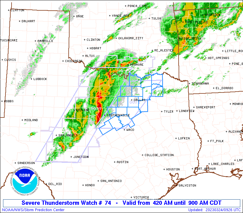
Severe Thunderstorm Watch Number 74
NWS Storm Prediction Center Norman OK
420 AM CDT Fri Mar 24 2023
The NWS Storm Prediction Center has issued a
* Severe Thunderstorm Watch for portions of
North Texas
* Effective this Friday morning from 420 AM until 900 AM CDT.
* Primary threats include...
Scattered damaging wind gusts to 70 mph possible
Isolated large hail events to 1.5 inches in diameter possible
A tornado or two possible
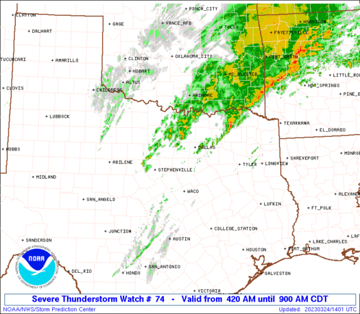
SUMMARY...Organized short-line segment should continue northeast
across north Texas through mid-morning. Primary threat should be
damaging winds.
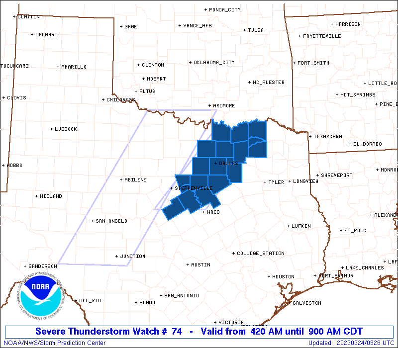
The severe thunderstorm watch area is approximately along and 45
statute miles east and west of a line from 40 miles west of Paris TX
to 85 miles south southwest of Fort Worth TX. For a complete
depiction of the watch see the associated watch outline update
(WOUS64 KWNS WOU4).
PRECAUTIONARY/PREPAREDNESS ACTIONS...
REMEMBER...A Severe Thunderstorm Watch means conditions are
favorable for severe thunderstorms in and close to the watch area.
Persons in these areas should be on the lookout for threatening
weather conditions and listen for later statements and possible
warnings. Severe thunderstorms can and occasionally do produce
tornadoes.
&&
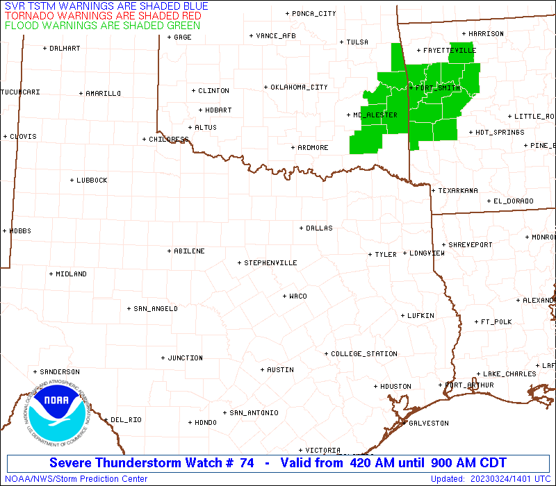
OTHER WATCH INFORMATION...CONTINUE...WW 73...
AVIATION...A few severe thunderstorms with hail surface and aloft to
1.5 inches. Extreme turbulence and surface wind gusts to 60 knots. A
few cumulonimbi with maximum tops to 500. Mean storm motion vector
22040.
...Grams
 Note:
The Aviation Watch (SAW) product is an approximation to the watch area.
The actual watch is depicted by the shaded areas.
Note:
The Aviation Watch (SAW) product is an approximation to the watch area.
The actual watch is depicted by the shaded areas.
   SAW4
   WW 74 SEVERE TSTM TX 240920Z - 241400Z
   AXIS..45 STATUTE MILES EAST AND WEST OF LINE..
   40W PRX/PARIS TX/ - 85SSW FTW/FORT WORTH TX/
   ..AVIATION COORDS.. 40NM E/W /62SE ADM - 33W ACT/
   HAIL SURFACE AND ALOFT..1.5 INCHES. WIND GUSTS..60 KNOTS.
   MAX TOPS TO 500. MEAN STORM MOTION VECTOR 22040.

   LAT...LON 33639536 31689716 31689869 33639693

   THIS IS AN APPROXIMATION TO THE WATCH AREA.  FOR A
   COMPLETE DEPICTION OF THE WATCH SEE WOUS64 KWNS
   FOR WOU4.
Watch 74 Status Report Messages:
STATUS REPORT #3 ON WW 74

VALID 241250Z - 241340Z

SEVERE WEATHER THREAT CONTINUES RIGHT OF A LINE FROM 40 S SEP TO
5 N DAL TO 20 SSE GYI TO 20 SSE DUA.

..GOSS..03/24/23

ATTN...WFO...FWD...

&&

STATUS REPORT FOR WS 74

SEVERE WEATHER THREAT CONTINUES FOR THE FOLLOWING AREAS

TXC035-085-119-139-147-193-217-223-231-251-257-277-397-241340-

TX
.    TEXAS COUNTIES INCLUDED ARE

BOSQUE		     COLLIN		 DELTA
ELLIS		     FANNIN		 HAMILTON
HILL		     HOPKINS		 HUNT
JOHNSON 	     KAUFMAN		 LAMAR
ROCKWALL
$$


THE WATCH STATUS MESSAGE IS FOR GUIDANCE PURPOSES ONLY.  PLEASE
REFER TO WATCH COUNTY NOTIFICATION STATEMENTS FOR OFFICIAL
INFORMATION ON COUNTIES...INDEPENDENT CITIES AND MARINE ZONES
CLEARED FROM SEVERE THUNDERSTORM AND TORNADO WATCHES.
$$

STATUS REPORT #2 ON WW 74

VALID 241130Z - 241240Z

THE SEVERE WEATHER THREAT CONTINUES ACROSS THE ENTIRE WATCH AREA.

..GOSS..03/24/23

ATTN...WFO...FWD...

&&

STATUS REPORT FOR WS 74

SEVERE WEATHER THREAT CONTINUES FOR THE FOLLOWING AREAS

TXC035-085-113-119-121-139-147-181-193-217-221-223-231-251-257-
277-397-425-439-241240-

TX
.    TEXAS COUNTIES INCLUDED ARE

BOSQUE		     COLLIN		 DALLAS
DELTA		     DENTON		 ELLIS
FANNIN		     GRAYSON		 HAMILTON
HILL		     HOOD		 HOPKINS
HUNT		     JOHNSON		 KAUFMAN
LAMAR		     ROCKWALL		 SOMERVELL
TARRANT
$$


THE WATCH STATUS MESSAGE IS FOR GUIDANCE PURPOSES ONLY.  PLEASE
REFER TO WATCH COUNTY NOTIFICATION STATEMENTS FOR OFFICIAL
INFORMATION ON COUNTIES...INDEPENDENT CITIES AND MARINE ZONES
CLEARED FROM SEVERE THUNDERSTORM AND TORNADO WATCHES.
$$

STATUS REPORT #1 ON WW 74

VALID 241050Z - 241140Z

THE SEVERE WEATHER THREAT CONTINUES ACROSS THE ENTIRE WATCH AREA.

..GOSS..03/24/23

ATTN...WFO...FWD...

&&

STATUS REPORT FOR WS 74

SEVERE WEATHER THREAT CONTINUES FOR THE FOLLOWING AREAS

TXC035-085-113-119-121-139-147-181-193-217-221-223-231-251-257-
277-397-425-439-241140-

TX
.    TEXAS COUNTIES INCLUDED ARE

BOSQUE		     COLLIN		 DALLAS
DELTA		     DENTON		 ELLIS
FANNIN		     GRAYSON		 HAMILTON
HILL		     HOOD		 HOPKINS
HUNT		     JOHNSON		 KAUFMAN
LAMAR		     ROCKWALL		 SOMERVELL
TARRANT
$$


THE WATCH STATUS MESSAGE IS FOR GUIDANCE PURPOSES ONLY.  PLEASE
REFER TO WATCH COUNTY NOTIFICATION STATEMENTS FOR OFFICIAL
INFORMATION ON COUNTIES...INDEPENDENT CITIES AND MARINE ZONES
CLEARED FROM SEVERE THUNDERSTORM AND TORNADO WATCHES.
$$
Note:
Click for Complete Product Text.
Tornadoes
Probability of 2 or more tornadoes
|
Low (20%)
|
Probability of 1 or more strong (EF2-EF5) tornadoes
|
Low (10%)
|
Wind
Probability of 10 or more severe wind events
|
Mod (40%)
|
Probability of 1 or more wind events > 65 knots
|
Low (20%)
|
Hail
Probability of 10 or more severe hail events
|
Low (20%)
|
Probability of 1 or more hailstones > 2 inches
|
Low (20%)
|
Combined Severe Hail/Wind
Probability of 6 or more combined severe hail/wind events
|
Mod (60%)
|
For each watch, probabilities for particular events inside the watch
(listed above in each table) are determined by the issuing forecaster.
The "Low" category contains probability values ranging from less than 2%
to 20% (EF2-EF5 tornadoes), less than 5% to 20% (all other probabilities),
"Moderate" from 30% to 60%, and "High" from 70% to greater than 95%.
High values are bolded and lighter in color to provide awareness of
an increased threat for a particular event.


 @NWSSPC