Note:
The expiration time in the watch graphic is amended if the watch is
replaced, cancelled or extended.
Note:
Note:
The expiration time in the watch graphic is amended if the watch is
replaced, cancelled or extended.
Note: Click for
Watch Status Reports.
SEL5
URGENT - IMMEDIATE BROADCAST REQUESTED
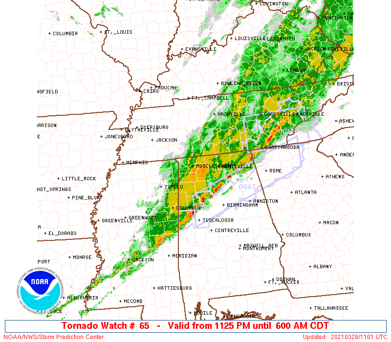
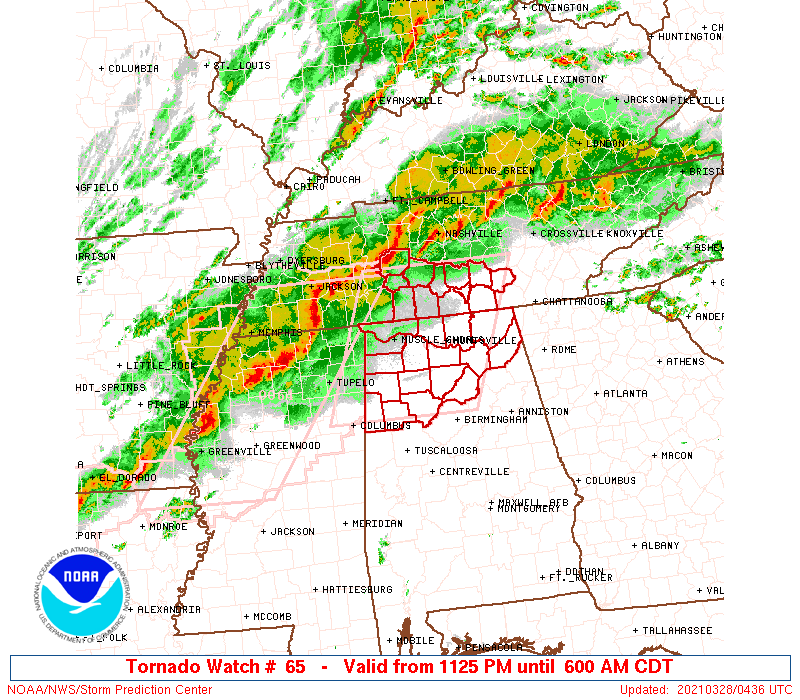
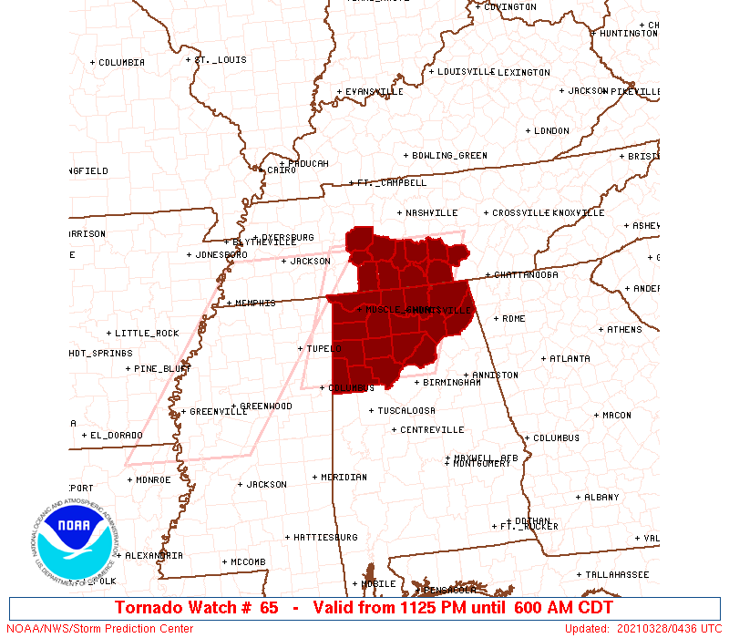
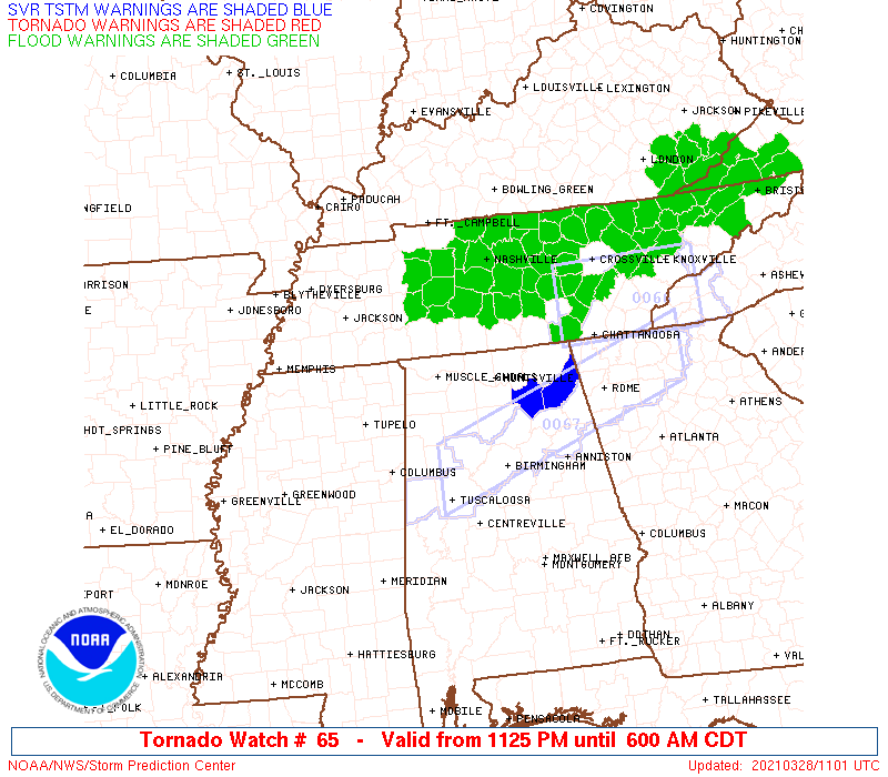
Tornado Watch Number 65
NWS Storm Prediction Center Norman OK
1125 PM CDT Sat Mar 27 2021
The NWS Storm Prediction Center has issued a
* Tornado Watch for portions of
Northern Alabama
Southern Middle Tennessee
* Effective this Saturday night and Sunday morning from 1125 PM
until 600 AM CDT.
* Primary threats include...
A couple tornadoes possible
Scattered damaging winds and isolated significant gusts to 85
mph likely
SUMMARY...Fast-moving bowing QLCS should spread across southern
Middle Tennessee and far northern Alabama. A trailing QLCS with
embedded bows may spread east from northern Mississippi across the
rest of northern Alabama through the pre-dawn hours.
The tornado watch area is approximately along and 70 statute miles
east and west of a line from 75 miles north of Huntsville AL to 75
miles south of Muscle Shoals AL. For a complete depiction of the
watch see the associated watch outline update (WOUS64 KWNS WOU5).
PRECAUTIONARY/PREPAREDNESS ACTIONS...
REMEMBER...A Tornado Watch means conditions are favorable for
tornadoes and severe thunderstorms in and close to the watch
area. Persons in these areas should be on the lookout for
threatening weather conditions and listen for later statements
and possible warnings.
&&
OTHER WATCH INFORMATION...CONTINUE...WW 64...
AVIATION...Tornadoes and a few severe thunderstorms with hail
surface and aloft to 1 inch. Extreme turbulence and surface wind
gusts to 75 knots. A few cumulonimbi with maximum tops to 500. Mean
storm motion vector 25050.
...Grams
 Note:
The Aviation Watch (SAW) product is an approximation to the watch area.
The actual watch is depicted by the shaded areas.
Note:
The Aviation Watch (SAW) product is an approximation to the watch area.
The actual watch is depicted by the shaded areas.
   SAW5
   WW 65 TORNADO AL TN 280425Z - 281100Z
   AXIS..70 STATUTE MILES EAST AND WEST OF LINE..
   75N HSV/HUNTSVILLE AL/ - 75S MSL/MUSCLE SHOALS AL/
   ..AVIATION COORDS.. 60NM E/W /25SSW BNA - 36W VUZ/
   HAIL SURFACE AND ALOFT..1 INCH. WIND GUSTS..75 KNOTS.
   MAX TOPS TO 500. MEAN STORM MOTION VECTOR 25050.

   LAT...LON 35738553 33668640 33668884 35738803

   THIS IS AN APPROXIMATION TO THE WATCH AREA.  FOR A
   COMPLETE DEPICTION OF THE WATCH SEE WOUS64 KWNS
   FOR WOU5.
Watch 65 Status Report Message has not been issued yet.
Note:
Click for Complete Product Text.
Tornadoes
Probability of 2 or more tornadoes
|
Mod (40%)
|
Probability of 1 or more strong (EF2-EF5) tornadoes
|
Low (20%)
|
Wind
Probability of 10 or more severe wind events
|
High (70%)
|
Probability of 1 or more wind events > 65 knots
|
Mod (60%)
|
Hail
Probability of 10 or more severe hail events
|
Low (10%)
|
Probability of 1 or more hailstones > 2 inches
|
Low (10%)
|
Combined Severe Hail/Wind
Probability of 6 or more combined severe hail/wind events
|
High (80%)
|
For each watch, probabilities for particular events inside the watch
(listed above in each table) are determined by the issuing forecaster.
The "Low" category contains probability values ranging from less than 2%
to 20% (EF2-EF5 tornadoes), less than 5% to 20% (all other probabilities),
"Moderate" from 30% to 60%, and "High" from 70% to greater than 95%.
High values are bolded and lighter in color to provide awareness of
an increased threat for a particular event.


 @NWSSPC