SPC AC 250046
Day 1 Convective Outlook
NWS Storm Prediction Center Norman OK
0746 PM CDT Thu Apr 24 2025
Valid 250100Z - 251200Z
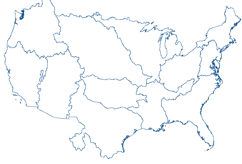
...THERE IS AN ENHANCED RISK OF SEVERE THUNDERSTORMS OVER PARTS OF
THE TEXAS PANHANDLE TO SOUTH PLAINS...
...SUMMARY...
Scattered severe thunderstorms remain possible this evening from
from eastern Colorado and southwest Kansas into western Oklahoma,
the Panhandles and West Texas. Very large hail is possible, along
with a few tornadoes.
...Central and southern Plains...
Scattered severe storms persist this evening over West TX including
the Panhandle, with very large/damaging hail in progress. Other
severe cells, some with tornadic circulation, persist over northwest
OK within a cluster, also with damaging hail and wind potential.
Given the uncapped air mass across most of these areas, storms
should persist for a few hours, and the increasing 850 mb winds out
of the south may favor right moving supercells. The 00Z AMA sounding
confirms the lack of inhibition, showing steep lapse rates through a
deep layer.
Isolated marginally severe storms also persist over eastern CO, and
north of the tornadic northwest OK cluster into southwest KS.
For more information, see mesoscale discussions 548, 549, 550, 551.
..Jewell.. 04/25/2025
CLICK TO GET WUUS01 PTSDY1 PRODUCT
NOTE: THE NEXT DAY 1 OUTLOOK IS SCHEDULED BY 0600Z
|


 @NWSSPC