|
| Mesoscale Discussion 1191 |
|
< Previous MD Next MD >
|
|
Mesoscale Discussion 1191
NWS Storm Prediction Center Norman OK
0343 PM CDT Fri Jun 07 2024
Areas affected...central Nebraska
Concerning...Severe Thunderstorm Watch 395...
Valid 072043Z - 072245Z
The severe weather threat for Severe Thunderstorm Watch 395
continues.
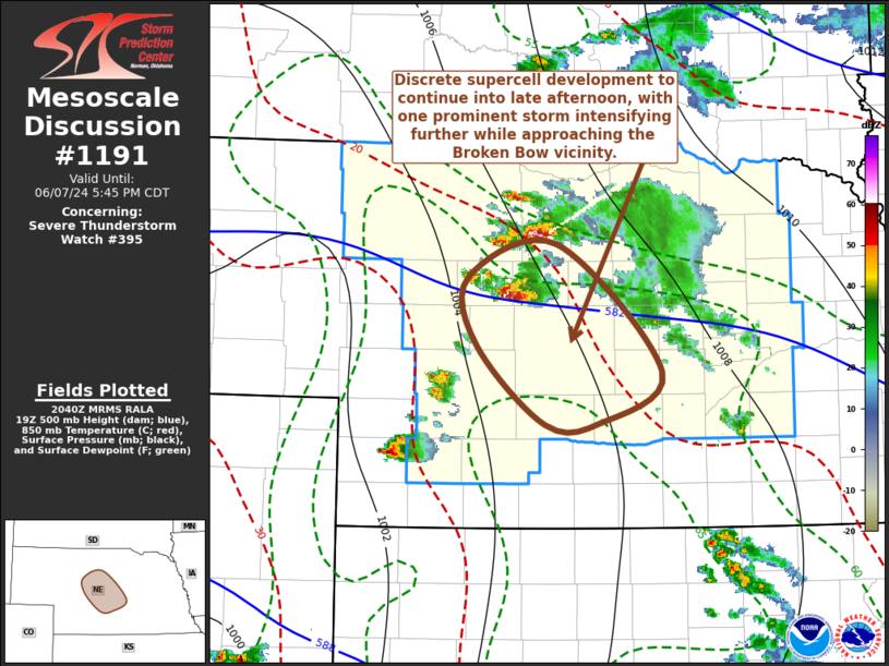
SUMMARY...Discrete ongoing supercell development is likely to
persist through 5-7 PM CDT, with the risk for large hail in excess
of 2 inches in diameter, perhaps a couple of brief tornadoes, then
strong to severe wind gusts with at least one storm approaching the
Broken Bow vicinity.
DISCUSSION...Scattered strong thunderstorms continue to develop,
including one increasingly prominent supercell now turning
southeastward, to the southeast and south of Thedford. This cell
appears most likely to maintain inflow of moist boundary-layer air
characterized by CAPE in excess of 2000 J/kg, and substantive
further intensification appears likely as it propagates
southeastward toward the Broken Bow vicinity through 22-00Z. This
may be aided by strengthening deep-layer shear associated with a
vigorous upstream mid-level jet streak digging east-southeast of the
Nebraska Panhandle. The potential for large, damaging hail seems
likely to continue to increase. Tornado potential is more unclear,
given sizable boundary-layer temperature/dew point spreads. But a
couple of brief tornadoes may be possible, before strong to severe
surface gusts become a more prominent threat with strengthening
outflow by early evening.
..Kerr.. 06/07/2024
...Please see www.spc.noaa.gov for graphic product...
ATTN...WFO...GID...LBF...
LAT...LON 41950073 42229980 41219871 40829937 40809992 41430063
41950073
|
|
Top/All Mesoscale Discussions/Forecast Products/Home
|
|


 @NWSSPC