|
| Mesoscale Discussion 920 |
|
< Previous MD Next MD >
|
|
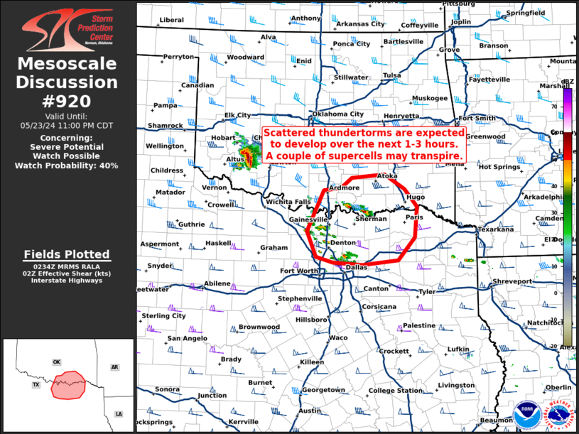
   Mesoscale Discussion 0920
   NWS Storm Prediction Center Norman OK
   0935 PM CDT Thu May 23 2024

   Areas affected...Southeastern Oklahoma and north central Texas near
   the Red River

   Concerning...Severe potential...Watch possible

   Valid 240235Z - 240400Z

   Probability of Watch Issuance...40 percent

   SUMMARY...Scattered thunderstorms are expected to develop across
   portions of north central TX and far southern/southeastern OK near
   the Red River through late tonight.

   DISCUSSION...Recent radar imagery shows an area of ascent slowly
   lifting northeastward out of north central TX. This ascent is
   located near the nose of deeper theta-e advection via a LLJ, on the
   southern fringe of a residual cold pool, and is likely associated
   with isentropic ascent. RAP forecast soundings over the next few
   hours suggest the developing convective environment will support
   storm organization, with effective shear around 50 kt. These
   thunderstorms should remain relatively elevated, rooted around 850
   mb or so, and MUCAPE is expected to be around 3500 J/kg. Isolated
   large hail up to 1.50-2.50" in diameter may accompany any of the
   more discrete updrafts that manage to develop through late tonight.
   Convective trends will be monitored for a possible watch.

   ..Barnes/Thompson.. 05/24/2024

   ...Please see www.spc.noaa.gov for graphic product...

   ATTN...WFO...SHV...TSA...FWD...OUN...

   LAT...LON   32919643 32949703 33059740 33509759 34229724 34259688
               34439664 34499596 34249554 33929528 33399532 32989568
               32919643
|
|
Top/All Mesoscale Discussions/Forecast Products/Home
|
|


 @NWSSPC