|
| Mesoscale Discussion 1621 |
|
< Previous MD Next MD >
|
|
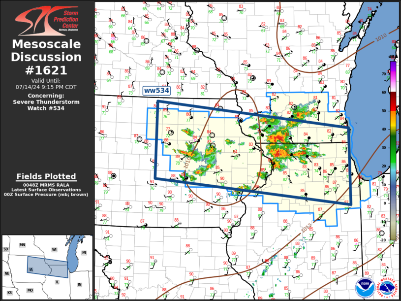
   Mesoscale Discussion 1621
   NWS Storm Prediction Center Norman OK
   0751 PM CDT Sun Jul 14 2024

   Areas affected...Upper Midwest

   Concerning...Severe Thunderstorm Watch 534...

   Valid 150051Z - 150215Z

   The severe weather threat for Severe Thunderstorm Watch 534
   continues.

   SUMMARY...Severe threat will spread across northern
   Illinois/southern Wisconsin this evening.

   DISCUSSION...Remnant MCV, from an early-day MCS, is moving
   east-southeast across central IA. Latest radar/satellite imagery
   suggests this long-lived feature is located northwest of CID. Over
   the last hour or so, considerable amount of convection has
   developed, possibly in response to this MCV. While a few supercells
   are currently observed from southwest WI, arcing southwest along the
   MS River through the middle portions of ww534, a new MCS may soon
   evolve. This developing complex is expected to propagate toward
   southern Lake MI with an attendant risk for hail/wind.

   ..Darrow.. 07/15/2024

   ...Please see www.spc.noaa.gov for graphic product...

   ATTN...WFO...LOT...MKX...DVN...ARX...DMX...

   LAT...LON   43429365 42828780 41098780 41679366 43429365
|
|
Top/All Mesoscale Discussions/Forecast Products/Home
|
|


 @NWSSPC