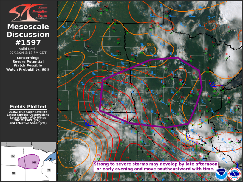
   Mesoscale Discussion 1597
   NWS Storm Prediction Center Norman OK
   0344 PM CDT Sat Jul 13 2024

   Areas affected...Southeast ND...northeast SD...northern/central MN

   Concerning...Severe potential...Watch possible

   Valid 132044Z - 132215Z

   Probability of Watch Issuance...60 percent

   SUMMARY...Strong to severe storms may develop by late afternoon or
   early evening and move southeastward. Large hail, damaging wind, and
   perhaps a tornado or two will all be possible.

   DISCUSSION...Cumulus is gradually increasing this afternoon from
   southeast ND into western MN, in the vicinity of a surface low and
   related surface trough. Rich low-level moisture and rather strong
   heating are supporting moderate to strong buoyancy, with MLCAPE
   generally in the 2000-3500 J/kg range per recent objective
   mesoanalyses. Effective shear of 30-40 kt will be sufficient for
   storm organization, given the favorable instability in place.

   Details regarding storm evolution remain uncertain this afternoon,
   given the presence of multiple surface boundaries and only rather
   subtle large-scale ascent in the short term. However, most guidance
   suggests increasing potential for storm development by late
   afternoon into the early evening from southeast ND into northwest
   MN, as MLCINH continues to decrease. Initial supercell development
   is possible, with a threat of hail, damaging wind, and possibly a
   tornado or two. A tendency for upscale growth is expected later in
   the storm evolution, which could eventually result in a
   southeastward-moving MCS with a continued damaging-wind threat.

   Timing of the primary severe threat remains uncertain, but watch
   issuance will become increasingly possible across the region by late
   afternoon into the early evening.

   ..Dean/Hart.. 07/13/2024

   ...Please see www.spc.noaa.gov for graphic product...

   ATTN...WFO...DLH...MPX...FGF...ABR...BIS...

   LAT...LON   47059822 47769581 47839444 47369336 46789323 46219351
               45549395 45429501 45569682 45989832 47059822
|


 @NWSSPC