Mesoscale Discussion 1596
NWS Storm Prediction Center Norman OK
0335 PM CDT Sat Jul 13 2024
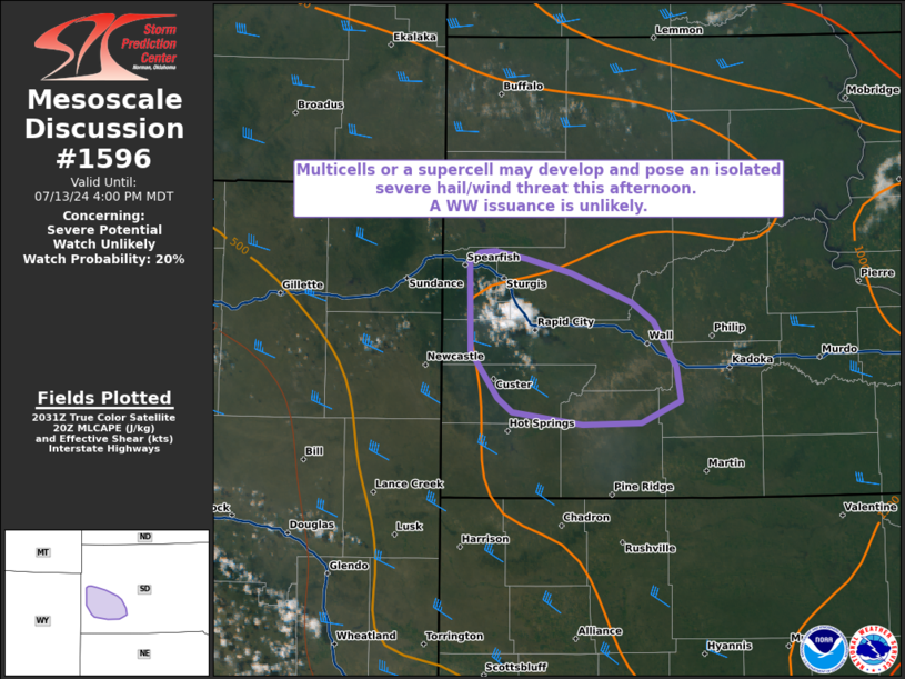
Areas affected...portions of southwestern South Dakota
Concerning...Severe potential...Watch unlikely
Valid 132035Z - 132200Z
Probability of Watch Issuance...20 percent
SUMMARY...An isolated severe hail/wind threat may accompany any
multicell or supercell that can develop and become sustained this
afternoon. Given the spatially and temporally constricted nature of
the severe threat, a WW issuance is not expected.
DISCUSSION...Visible satellite imagery depicts agitated CU/attempt
at convective initiation over the Black Hills of South Dakota,
driven by afternoon peak heating, some orographic lift, and the
approach of a 500 mb vort max (per 20Z mesoanalysis). RAP forecast
soundings depict a well-mixed boundary layer extending to 700 mb,
suggesting that any storms that can become sustained will likely be
high-based in nature. Forecast soundings show hodographs of modest
length and curvature (hence 30 kts of effective bulk shear) that
will gradually enlarge/lengthen through the afternoon, supporting
multicells and perhaps a few splitting supercells. While some MLCINH
remains, over 1000 J/kg MLCAPE is present, which could support
strong enough storms to potentially produce large hail and severe
gusts, especially if a sustained supercell structure can
materialize. Nonetheless, the severe threat should remain isolated,
so a WW issuance is not anticipated.
..Squitieri/Hart.. 07/13/2024
...Please see www.spc.noaa.gov for graphic product...
ATTN...WFO...UNR...
LAT...LON 44510381 44570372 44580358 44520329 44430291 44240236
44120217 43840198 43620194 43480228 43460281 43540342
43630355 43940380 44510381
|


 @NWSSPC