|
| Mesoscale Discussion 1588 |
|
< Previous MD Next MD >
|
|
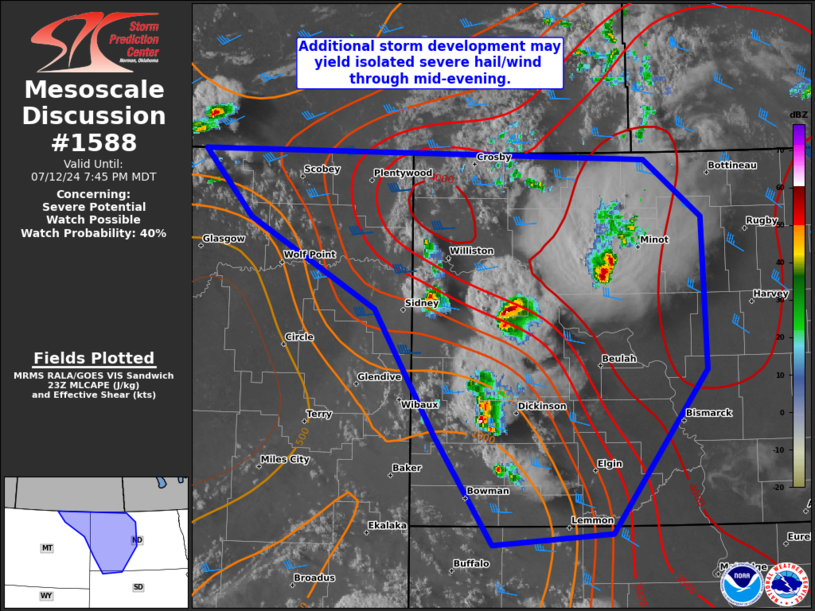
   Mesoscale Discussion 1588
   NWS Storm Prediction Center Norman OK
   0652 PM CDT Fri Jul 12 2024

   Areas affected...western/central ND and far northeast MT

   Concerning...Severe potential...Watch possible

   Valid 122352Z - 130145Z

   Probability of Watch Issuance...40 percent

   SUMMARY...In the wake of a decaying supercell, additional storm
   development is expected through dusk which may consolidate into a
   slow-moving cluster. Isolated severe hail and wind will remain
   possible through at least mid-evening.

   DISCUSSION...A lone discrete supercell produced a multi-county swath
   of large hail between 1-1.75 inches in diameter for a couple hours
   in northwest ND. This cell has weakened, with renewed convective
   development occurring to its west along its trailing outflow near
   the McKenzie/Dunn County line. This updraft will have the best
   near-term potential to produce large hail and localized severe wind
   gusts along the western portion of the tight buoyancy gradient.
   Additional, higher-based updrafts persist across southwest ND and in
   the post-frontal boundary near the northeast MT border with SK.
   Recent HRRR runs remain insistent on potential for consolidating
   storms and a slow-moving cluster or two evolving this evening. This
   would suggest the large hail threat will be greatest through about
   sunset, with localized severe gusts persisting beyond. Still, with a
   relatively modest combination of deep-layer shear and large scale
   forcing for ascent, confidence in greater than isolated severe
   coverage remains low.

   ..Grams/Gleason.. 07/12/2024

   ...Please see www.spc.noaa.gov for graphic product...

   ATTN...WFO...ABR...BIS...UNR...GGW...

   LAT...LON   48940122 48470052 47220047 45880163 45780307 46690377
               47720449 48450602 48990659 48940122
|
|
Top/All Mesoscale Discussions/Forecast Products/Home
|
|


 @NWSSPC