|
| Mesoscale Discussion 1577 |
|
< Previous MD Next MD >
|
|
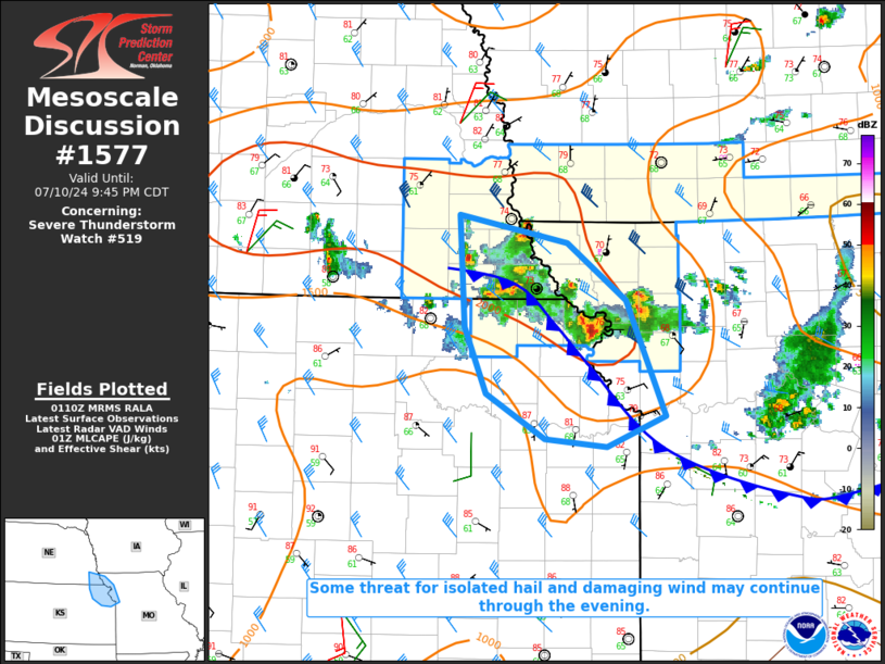
   Mesoscale Discussion 1577
   NWS Storm Prediction Center Norman OK
   0811 PM CDT Wed Jul 10 2024

   Areas affected...Northwest NO...northeast KS...extreme southeast NE

   Concerning...Severe Thunderstorm Watch 519...

   Valid 110111Z - 110245Z

   The severe weather threat for Severe Thunderstorm Watch 519
   continues.

   SUMMARY...Some threat for isolated hail and damaging wind may
   persist through the evening.

   DISCUSSION...While much of the deep convection across the region has
   tended to weaken this evening, a vigorous cell is currently ongoing
   near St. Joseph, MO, with other stronger storms noted across extreme
   southeast NE. There is some potential for the stronger storms from
   extreme northeast KS into northwest MO to continue southeastward for
   another 1-2 hours as they track along or just to the cool side of an
   outflow boundary that is sagging southwestward across the region.
   Moderate buoyancy and effective shear around 30 kt could continue to
   support occasionally organized storms, with an isolated hail and
   damaging-wind threat. Storms should generally weaken by late evening
   due to increasing MLCINH, and additional watch issuance is not
   anticipated. However, some severe threat could spread south of WW
   319 before a more definitive weakening trend occurs.

   ..Dean.. 07/11/2024

   ...Please see www.spc.noaa.gov for graphic product...

   ATTN...WFO...EAX...OAX...TOP...

   LAT...LON   40639634 40419529 39999472 39129434 38899492 38949552
               39299609 39799629 40639634
|
|
Top/All Mesoscale Discussions/Forecast Products/Home
|
|


 @NWSSPC