|
| Mesoscale Discussion 1546 |
|
< Previous MD Next MD >
|
|
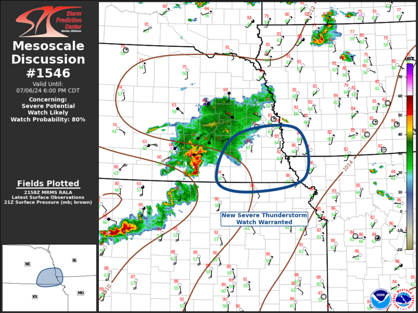
   Mesoscale Discussion 1546
   NWS Storm Prediction Center Norman OK
   0500 PM CDT Sat Jul 06 2024

   Areas affected...Southeast Nebraska...Southwest Iowa...Northeast
   Kansas...Northwest Missouri

   Concerning...Severe potential...Watch likely

   Valid 062200Z - 062300Z

   Probability of Watch Issuance...80 percent

   SUMMARY...New severe thunderstorm watch appears warranted for
   portions of southeast Nebraska region.

   DISCUSSION...Organized complex of severe thunderstorms has matured
   over south-central Nebraska late this afternoon. This MCS is
   propagating east into a reservoir of strong buoyancy represented by
   MLCAPE values on the order of 1500 J/kg. LLJ is forecast to increase
   across northeast KS into southeast NE over the next few hours which
   should encourage downstream propagation and longevity of the MCS.
   Large hail and damaging winds are expected and a new severe
   thunderstorm watch appears warranted.

   ..Darrow/Hart.. 07/06/2024

   ...Please see www.spc.noaa.gov for graphic product...

   ATTN...WFO...EAX...OAX...TOP...GID...

   LAT...LON   41049721 41199544 40099521 39799683 40049776 41049721
|
|
Top/All Mesoscale Discussions/Forecast Products/Home
|
|


 @NWSSPC