|
| Mesoscale Discussion 1524 |
|
< Previous MD Next MD >
|
|
Mesoscale Discussion 1524
NWS Storm Prediction Center Norman OK
0432 PM CDT Wed Jul 03 2024
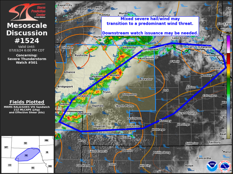
Areas affected...parts of NE...far northeast CO...far southeast SD
Concerning...Severe Thunderstorm Watch 501...
Valid 032132Z - 032300Z
The severe weather threat for Severe Thunderstorm Watch 501
continues.
SUMMARY...A mixed severe hail/wind threat may transition to a
predominant strong to severe wind threat as storms further congeal
from far northeast Colorado into north-central Nebraska. A
downstream watch issuance may be needed as storms approach the east
edge of WW 501.
DISCUSSION...Initial supercells that produced large hail have
largely congealed, especially with southwest extent across parts of
north-central to southwest NE. The northern portion of this
activity, embedded within slightly stronger mid-level flow will
probably exit WW 501 first across parts of northeast NE into far
southeast SD. While this activity will progressively move away from
the peak buoyancy plume centered on the CO/KS border area, presence
of a quasi-stationary front may aid in sustaining strong to isolated
severe storms.
Farther southwest, severe wind gust potential may increase as
clusters further consolidate near the CO/KS/NE border area. These
will probably merge with an agitated cu field over southwest NE and
yield an increasing wind threat later into south-central NE.
..Grams/Hart.. 07/03/2024
...Please see www.spc.noaa.gov for graphic product...
ATTN...WFO...FSD...OAX...GID...LBF...GLD...BOU...CYS...
LAT...LON 42859971 43059857 42959699 42649647 42289640 40979848
40529969 40410212 40670295 41350246 42859971
|
|
Top/All Mesoscale Discussions/Forecast Products/Home
|
|


 @NWSSPC