|
| Mesoscale Discussion 1311 |
|
< Previous MD Next MD >
|
|
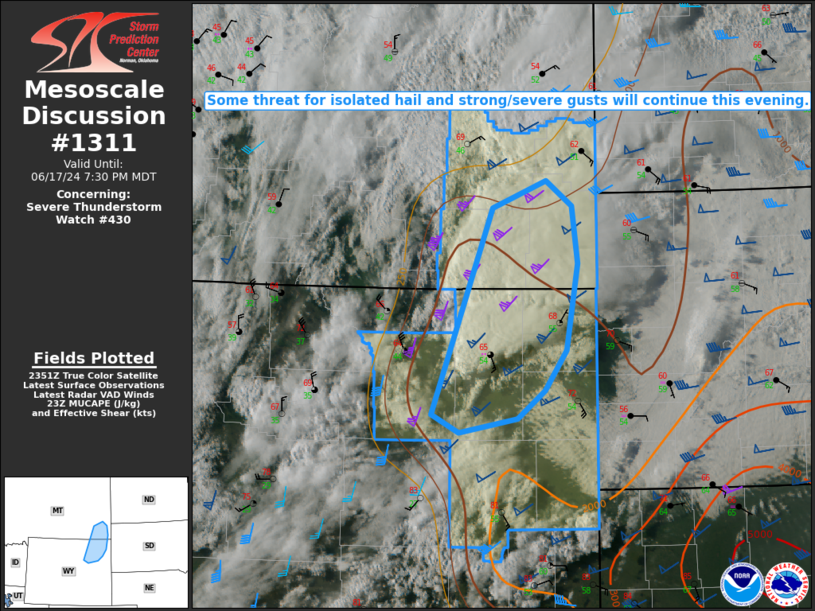
   Mesoscale Discussion 1311
   NWS Storm Prediction Center Norman OK
   0655 PM CDT Mon Jun 17 2024

   Areas affected...Northeast WY into southeast MT

   Concerning...Severe Thunderstorm Watch 430...

   Valid 172355Z - 180130Z

   The severe weather threat for Severe Thunderstorm Watch 430
   continues.

   SUMMARY...Some threat for isolated hail and strong/severe gusts will
   continue this evening.

   DISCUSSION...An earlier supercell over southeast MT has weakened
   upon moving into a cooler and less unstable environment. However, a
   couple stronger cells are ongoing this evening from extreme
   southeast MT into northeast WY, and additional storm development and
   intensification remains possible as a vigorous mid/upper-level
   shortwave trough approaches the region from the interior Northwest.

   Weak to moderate buoyancy and effective shear of 50+ kt will
   continue to support occasional supercell structures, with a threat
   of isolated hail and strong/severe gusts. The eastern extent of the
   short-term severe threat will continue to be limited by strong
   MLCINH.

   ..Dean.. 06/17/2024

   ...Please see www.spc.noaa.gov for graphic product...

   ATTN...WFO...UNR...BYZ...RIW...

   LAT...LON   43750633 45800549 46070475 45810438 45250431 44390447
               43990476 43710515 43560596 43750633
|
|
Top/All Mesoscale Discussions/Forecast Products/Home
|
|


 @NWSSPC