|
| Mesoscale Discussion 1287 |
|
< Previous MD Next MD >
|
|
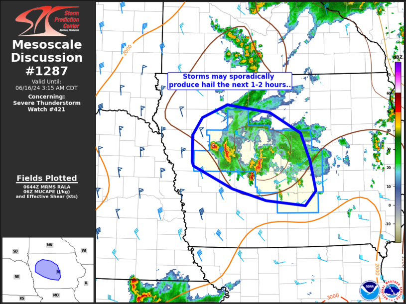
   Mesoscale Discussion 1287
   NWS Storm Prediction Center Norman OK
   0147 AM CDT Sun Jun 16 2024

   Areas affected...portions of IA

   Concerning...Severe Thunderstorm Watch 421...

   Valid 160647Z - 160815Z

   The severe weather threat for Severe Thunderstorm Watch 421
   continues.

   SUMMARY...Isolated thunderstorms may sporadically produce hail the
   next couple hours.

   DISCUSSION...Thunderstorms on the back side of an MCV over
   western/central IA have occasionally intensified the past hour or
   so. Midlevel lapse rates will remain weak over the area due to
   earlier convection. However, sufficient instability is present on
   the periphery of the MCV, along with enhanced vertical shear, to
   sustain briefly strong storms. As convection develops
   east/northeast, overall weakening is expected as the airmass becomes
   less favorable for severe storms. A new watch is not expected, and
   WW 421 will expire at 07z.

   ..Leitman.. 06/16/2024

   ...Please see www.spc.noaa.gov for graphic product...

   ATTN...WFO...DMX...FSD...OAX...

   LAT...LON   42019570 42469571 42779548 42999492 42869394 42519324
               42029304 41539291 41289316 41379404 41569479 41949567
               42019570
|
|
Top/All Mesoscale Discussions/Forecast Products/Home
|
|


 @NWSSPC