|
| Mesoscale Discussion 924 |
|
< Previous MD Next MD >
|
|
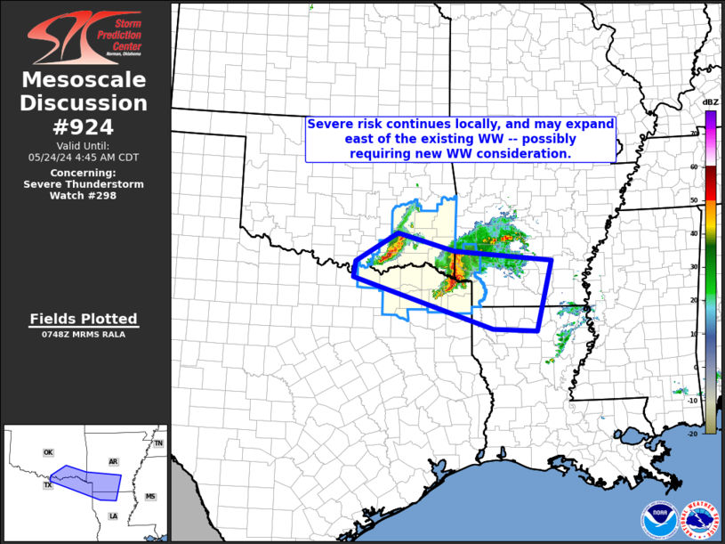
   Mesoscale Discussion 0924
   NWS Storm Prediction Center Norman OK
   0251 AM CDT Fri May 24 2024

   Areas affected...southeastern Oklahoma...northeastern
   Texas...southwestern Arkansas...and northwestern Louisiana

   Concerning...Severe Thunderstorm Watch 298...

   Valid 240751Z - 240945Z

   The severe weather threat for Severe Thunderstorm Watch 298
   continues.

   SUMMARY...Local severe risk continues with clusters of storms moving
   east-southeastward toward/across the Arklatex region and
   southeastern Oklahoma.  New/downstream WW may be required soon.

   DISCUSSION...Latest radar loop shows two distinct clusters of
   strong/potentially severe storms -- one across southeastern
   Oklahoma, and the other moving across far southeastern Oklahoma and
   northeastern Texas, and moving into southwestern Arkansas.  This
   convection remains fairly well-organized, aided by persistent
   low-level warm advection within a thermodynamic environment
   featuring 2000 to 3000 J/kg mixed-layer CAPE, per recent RAP-based
   objective analysis.

   Given ample instability downstream from the ongoing storms, and per
   CAM output, it seems that storms will likely continue moving
   east-southeastward over the next few hours -- with the leading
   cluster to begin exiting the existing WW over the next hour.  As
   such, new/downstream WW issuance may be needed.

   ..Goss.. 05/24/2024

   ...Please see www.spc.noaa.gov for graphic product...

   ATTN...WFO...LZK...SHV...TSA...FWD...OUN...

   LAT...LON   33629704 33969700 34579592 34199448 33989200 32489239
               32549351 33629704
|
|
Top/All Mesoscale Discussions/Forecast Products/Home
|
|


 @NWSSPC