|
| Mesoscale Discussion 198 |
|
< Previous MD Next MD >
|
|
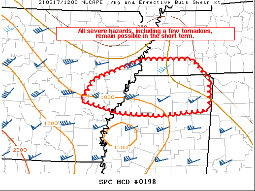
   Mesoscale Discussion 0198
   NWS Storm Prediction Center Norman OK
   0738 AM CDT Wed Mar 17 2021

   Areas affected...Portions of eastern AR...northern MS...and far
   southwestern TN

   Concerning...Tornado Watch 26...

   Valid 171238Z - 171345Z

   The severe weather threat for Tornado Watch 26 continues.

   SUMMARY...All severe hazards, including a few tornadoes, remain
   possible in the short term.

   DISCUSSION...Primary severe risk at the moment across Tornado Watch
   26 remains focused over northern MS with an ongoing supercell. The
   12Z sounding from JAN indicated a favorable low-level wind profile
   for updraft rotation, but instability remains a somewhat limiting
   factor. Low-level southerly flow should continue to gradually
   increase over the next couple of hours, and storms that can interact
   with the warm front may pose a tornado threat given effective SRH of
   200-250 m2/s2. Any semi-discrete supercells may also have an
   isolated large hail and damaging wind threat. The overall severe
   threat this morning should remain fairly isolated, with a much more
   substantial risk for all hazards, including strong tornadoes, likely
   to develop later this afternoon.

   ..Gleason.. 03/17/2021

   ...Please see www.spc.noaa.gov for graphic product...

   ATTN...WFO...MEG...LZK...

   LAT...LON   34439174 34899142 35369007 35348868 34888821 34208826
               34118965 34179070 34439174
|
|
Top/All Mesoscale Discussions/Forecast Products/Home
|
|


 @NWSSPC