|
| Mesoscale Discussion 1599 |
|
< Previous MD Next MD >
|
|
Mesoscale Discussion 1599
NWS Storm Prediction Center Norman OK
0334 PM CDT Thu Aug 27 2020
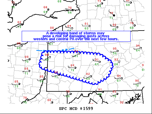
Areas affected...western and central PA
Concerning...Severe potential...Watch possible
Valid 272034Z - 272200Z
Probability of Watch Issuance...60 percent
SUMMARY...A band of developing strong to severe thunderstorms may
continue to pose a risk for damaging gusts across western and
central PA over the next few hours.
DISCUSSION...Radar mosaic shows a band of storms developing from
near Youngstown, OH eastward into northwestern PA. The Youngstown,
OH ASOS recently measured a 52-kt gust at 423pm EDT. KPBZ VAD data
has shown a slight intensification of the wind profile around 3km
ARL during the past 1-2 hours (30 to 40 kt). Given a very
moist/warm boundary layer downstream of the ongoing activity
(surface dewpoints in the lower 70s F), it seems plausible at least
an isolated risk for severe gusts may continue for the next few
hours.
..Smith/Grams.. 08/27/2020
...Please see www.spc.noaa.gov for graphic product...
ATTN...WFO...CTP...PBZ...CLE...
LAT...LON 41198071 41217911 41107780 40767719 40277748 40027810
40638090 41198071
|
|
Top/All Mesoscale Discussions/Forecast Products/Home
|
|


 @NWSSPC