Note:
The expiration time in the watch graphic is amended if the watch is
replaced, cancelled or extended.
Note:
Note:
The expiration time in the watch graphic is amended if the watch is
replaced, cancelled or extended.
Note: Click for
Watch Status Reports.
   SEL4

   URGENT - IMMEDIATE BROADCAST REQUESTED
   Tornado Watch Number 374
   NWS Storm Prediction Center Norman OK
   250 PM CDT Sun Jun 2 2024

   The NWS Storm Prediction Center has issued a

   * Tornado Watch for portions of
     Oklahoma Panhandle
     West and Northwest Texas

   * Effective this Sunday afternoon and evening from 250 PM until
     1100 PM CDT.

   * Primary threats include...
     A few tornadoes possible
     Scattered damaging winds and isolated significant gusts to 75
       mph likely
     Scattered large hail and isolated very large hail events to 3
       inches in diameter likely

   SUMMARY...Scattered severe thunderstorms are forecast to rapidly
   develop this afternoon.  Supercells capable of large to very large
   hail (2 to 3 inches in diameter) and a tornado risk will be the
   primary hazards through the early evening.  The tornado threat will
   likely focus in the vicinity of a modifying outflow boundary draped
   across parts of the Watch area.  Additional storm development into a
   thunderstorm cluster is possible this evening.  Severe gusts and
   hail will likely become the primary severe threats by late evening.

   The tornado watch area is approximately along and 70 statute miles
   east and west of a line from 20 miles north of Guymon OK to 45 miles
   south southeast of Lubbock TX. For a complete depiction of the watch
   see the associated watch outline update (WOUS64 KWNS WOU4).

   PRECAUTIONARY/PREPAREDNESS ACTIONS...

   REMEMBER...A Tornado Watch means conditions are favorable for
   tornadoes and severe thunderstorms in and close to the watch
   area. Persons in these areas should be on the lookout for
   threatening weather conditions and listen for later statements
   and possible warnings.

   &&

   OTHER WATCH INFORMATION...CONTINUE...WW 372...WW 373...

   AVIATION...Tornadoes and a few severe thunderstorms with hail
   surface and aloft to 3 inches. Extreme turbulence and surface wind
   gusts to 65 knots. A few cumulonimbi with maximum tops to 550. Mean
   storm motion vector 27015.

   ...Smith
 Note:
The Aviation Watch (SAW) product is an approximation to the watch area.
The actual watch is depicted by the shaded areas.
Note:
The Aviation Watch (SAW) product is an approximation to the watch area.
The actual watch is depicted by the shaded areas.
   SAW4
   WW 374 TORNADO OK TX 021950Z - 030400Z
   AXIS..70 STATUTE MILES EAST AND WEST OF LINE..
   20N GUY/GUYMON OK/ - 45SSE LBB/LUBBOCK TX/
   ..AVIATION COORDS.. 60NM E/W /26W LBL - 43SSE LBB/
   HAIL SURFACE AND ALOFT..3 INCHES. WIND GUSTS..65 KNOTS.
   MAX TOPS TO 550. MEAN STORM MOTION VECTOR 27015.

   LAT...LON 36960023 33060031 33060273 36960277

   THIS IS AN APPROXIMATION TO THE WATCH AREA.  FOR A
   COMPLETE DEPICTION OF THE WATCH SEE WOUS64 KWNS
   FOR WOU4.
Watch 374 Status Report Messages:
STATUS REPORT #5 ON WW 374
VALID 030135Z - 030240Z
SEVERE WEATHER THREAT CONTINUES RIGHT OF A LINE FROM 50 SSW LBB
TO 20 S AMA TO 25 S GUY TO 20 E LBL.
..BROYLES..06/03/24
ATTN...WFO...AMA...LUB...
&&
STATUS REPORT FOR WT 374
SEVERE WEATHER THREAT CONTINUES FOR THE FOLLOWING AREAS
OKC007-030240-
OK
. OKLAHOMA COUNTIES INCLUDED ARE
BEAVER
$$
TXC011-045-065-075-101-107-125-129-153-169-179-189-191-195-233-
263-269-303-305-345-357-393-433-437-030240-
TX
. TEXAS COUNTIES INCLUDED ARE
ARMSTRONG BRISCOE CARSON
CHILDRESS COTTLE CROSBY
DICKENS DONLEY FLOYD
GARZA GRAY HALE
HALL HANSFORD HUTCHINSON
KENT KING LUBBOCK
LYNN MOTLEY OCHILTREE
ROBERTS STONEWALL SWISHER
$$
THE WATCH STATUS MESSAGE IS FOR GUIDANCE PURPOSES ONLY. PLEASE
REFER TO WATCH COUNTY NOTIFICATION STATEMENTS FOR OFFICIAL
INFORMATION ON COUNTIES...INDEPENDENT CITIES AND MARINE ZONES
CLEARED FROM SEVERE THUNDERSTORM AND TORNADO WATCHES.
$$
STATUS REPORT #4 ON WW 374
VALID 030055Z - 030140Z
SEVERE WEATHER THREAT CONTINUES RIGHT OF A LINE FROM 55 ENE HOB
TO 25 WNW LBL.
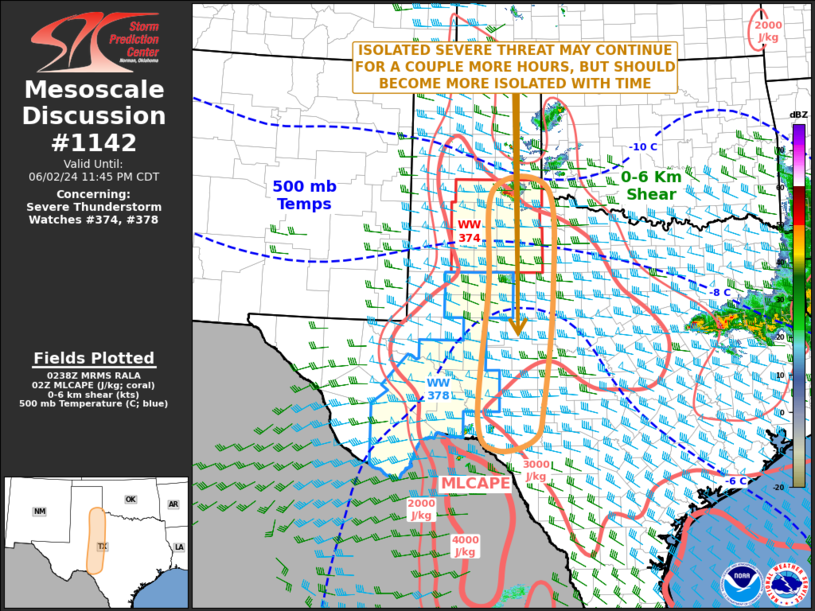
FOR ADDITIONAL INFORMATION SEE MESOSCALE DISCUSSION 1137
..SUPINIE..06/03/24
ATTN...WFO...AMA...LUB...
&&
STATUS REPORT FOR WT 374
SEVERE WEATHER THREAT CONTINUES FOR THE FOLLOWING AREAS
OKC007-030140-
OK
. OKLAHOMA COUNTIES INCLUDED ARE
BEAVER
$$
TXC011-045-065-075-101-107-125-129-153-169-179-189-191-195-233-
263-269-303-305-345-357-393-433-437-030140-
TX
. TEXAS COUNTIES INCLUDED ARE
ARMSTRONG BRISCOE CARSON
CHILDRESS COTTLE CROSBY
DICKENS DONLEY FLOYD
GARZA GRAY HALE
HALL HANSFORD HUTCHINSON
KENT KING LUBBOCK
LYNN MOTLEY OCHILTREE
ROBERTS STONEWALL SWISHER
$$
THE WATCH STATUS MESSAGE IS FOR GUIDANCE PURPOSES ONLY. PLEASE
REFER TO WATCH COUNTY NOTIFICATION STATEMENTS FOR OFFICIAL
INFORMATION ON COUNTIES...INDEPENDENT CITIES AND MARINE ZONES
CLEARED FROM SEVERE THUNDERSTORM AND TORNADO WATCHES.
$$
STATUS REPORT #3 ON WW 374
VALID 022355Z - 030040Z
SEVERE WEATHER THREAT CONTINUES RIGHT OF A LINE FROM 30 ENE HOB
TO 45 SW AMA TO 15 WNW EHA.
FOR ADDITIONAL INFORMATION SEE MESOSCALE DISCUSSION 1137
..SUPINIE..06/02/24
ATTN...WFO...AMA...LUB...
&&
STATUS REPORT FOR WT 374
SEVERE WEATHER THREAT CONTINUES FOR THE FOLLOWING AREAS
OKC007-139-030040-
OK
. OKLAHOMA COUNTIES INCLUDED ARE
BEAVER TEXAS
$$
TXC011-045-065-075-101-107-125-129-153-169-179-189-191-195-219-
233-263-269-279-303-305-341-345-357-375-381-393-421-433-437-445-
030040-
TX
. TEXAS COUNTIES INCLUDED ARE
ARMSTRONG BRISCOE CARSON
CHILDRESS COTTLE CROSBY
DICKENS DONLEY FLOYD
GARZA GRAY HALE
HALL HANSFORD HOCKLEY
HUTCHINSON KENT KING
LAMB LUBBOCK LYNN
MOORE MOTLEY OCHILTREE
POTTER RANDALL ROBERTS
SHERMAN STONEWALL SWISHER
TERRY
$$
THE WATCH STATUS MESSAGE IS FOR GUIDANCE PURPOSES ONLY. PLEASE
REFER TO WATCH COUNTY NOTIFICATION STATEMENTS FOR OFFICIAL
INFORMATION ON COUNTIES...INDEPENDENT CITIES AND MARINE ZONES
CLEARED FROM SEVERE THUNDERSTORM AND TORNADO WATCHES.
$$
STATUS REPORT #2 ON WW 374
VALID 022235Z - 022340Z
THE SEVERE WEATHER THREAT CONTINUES ACROSS THE ENTIRE WATCH AREA.
..SUPINIE..06/02/24
ATTN...WFO...AMA...LUB...
&&
STATUS REPORT FOR WT 374
SEVERE WEATHER THREAT CONTINUES FOR THE FOLLOWING AREAS
OKC007-025-139-022340-
OK
. OKLAHOMA COUNTIES INCLUDED ARE
BEAVER CIMARRON TEXAS
$$
TXC011-017-045-065-069-075-079-101-107-111-117-125-129-153-169-
179-189-191-195-205-219-233-263-269-279-303-305-341-345-357-359-
369-375-381-393-421-433-437-445-501-022340-
TX
. TEXAS COUNTIES INCLUDED ARE
ARMSTRONG BAILEY BRISCOE
CARSON CASTRO CHILDRESS
COCHRAN COTTLE CROSBY
DALLAM DEAF SMITH DICKENS
DONLEY FLOYD GARZA
GRAY HALE HALL
HANSFORD HARTLEY HOCKLEY
HUTCHINSON KENT KING
LAMB LUBBOCK LYNN
MOORE MOTLEY OCHILTREE
OLDHAM PARMER POTTER
RANDALL ROBERTS SHERMAN
STONEWALL SWISHER TERRY
YOAKUM
$$
THE WATCH STATUS MESSAGE IS FOR GUIDANCE PURPOSES ONLY. PLEASE
REFER TO WATCH COUNTY NOTIFICATION STATEMENTS FOR OFFICIAL
INFORMATION ON COUNTIES...INDEPENDENT CITIES AND MARINE ZONES
CLEARED FROM SEVERE THUNDERSTORM AND TORNADO WATCHES.
$$
STATUS REPORT #1 ON WW 374
VALID 022140Z - 022240Z
THE SEVERE WEATHER THREAT CONTINUES ACROSS THE ENTIRE WATCH AREA.
..SUPINIE..06/02/24
ATTN...WFO...AMA...LUB...
&&
STATUS REPORT FOR WT 374
SEVERE WEATHER THREAT CONTINUES FOR THE FOLLOWING AREAS
OKC007-025-139-022240-
OK
. OKLAHOMA COUNTIES INCLUDED ARE
BEAVER CIMARRON TEXAS
$$
TXC011-017-045-065-069-075-079-101-107-111-117-125-129-153-169-
179-189-191-195-205-219-233-263-269-279-303-305-341-345-357-359-
369-375-381-393-421-433-437-445-501-022240-
TX
. TEXAS COUNTIES INCLUDED ARE
ARMSTRONG BAILEY BRISCOE
CARSON CASTRO CHILDRESS
COCHRAN COTTLE CROSBY
DALLAM DEAF SMITH DICKENS
DONLEY FLOYD GARZA
GRAY HALE HALL
HANSFORD HARTLEY HOCKLEY
HUTCHINSON KENT KING
LAMB LUBBOCK LYNN
MOORE MOTLEY OCHILTREE
OLDHAM PARMER POTTER
RANDALL ROBERTS SHERMAN
STONEWALL SWISHER TERRY
YOAKUM
$$
THE WATCH STATUS MESSAGE IS FOR GUIDANCE PURPOSES ONLY. PLEASE
REFER TO WATCH COUNTY NOTIFICATION STATEMENTS FOR OFFICIAL
INFORMATION ON COUNTIES...INDEPENDENT CITIES AND MARINE ZONES
CLEARED FROM SEVERE THUNDERSTORM AND TORNADO WATCHES.
$$
Note:
Click for Complete Product Text.
Tornadoes
Probability of 2 or more tornadoes
|
Mod (50%)
|
Probability of 1 or more strong (EF2-EF5) tornadoes
|
Low (20%)
|
Wind
Probability of 10 or more severe wind events
|
Mod (60%)
|
Probability of 1 or more wind events > 65 knots
|
Mod (60%)
|
Hail
Probability of 10 or more severe hail events
|
Mod (60%)
|
Probability of 1 or more hailstones > 2 inches
|
Mod (60%)
|
Combined Severe Hail/Wind
Probability of 6 or more combined severe hail/wind events
|
High (>95%)
|
For each watch, probabilities for particular events inside the watch
(listed above in each table) are determined by the issuing forecaster.
The "Low" category contains probability values ranging from less than 2%
to 20% (EF2-EF5 tornadoes), less than 5% to 20% (all other probabilities),
"Moderate" from 30% to 60%, and "High" from 70% to greater than 95%.
High values are bolded and lighter in color to provide awareness of
an increased threat for a particular event.


 @NWSSPC