Note:
The expiration time in the watch graphic is amended if the watch is
replaced, cancelled or extended.
Note:
Note:
The expiration time in the watch graphic is amended if the watch is
replaced, cancelled or extended.
Note: Click for
Watch Status Reports.
SEL8
URGENT - IMMEDIATE BROADCAST REQUESTED
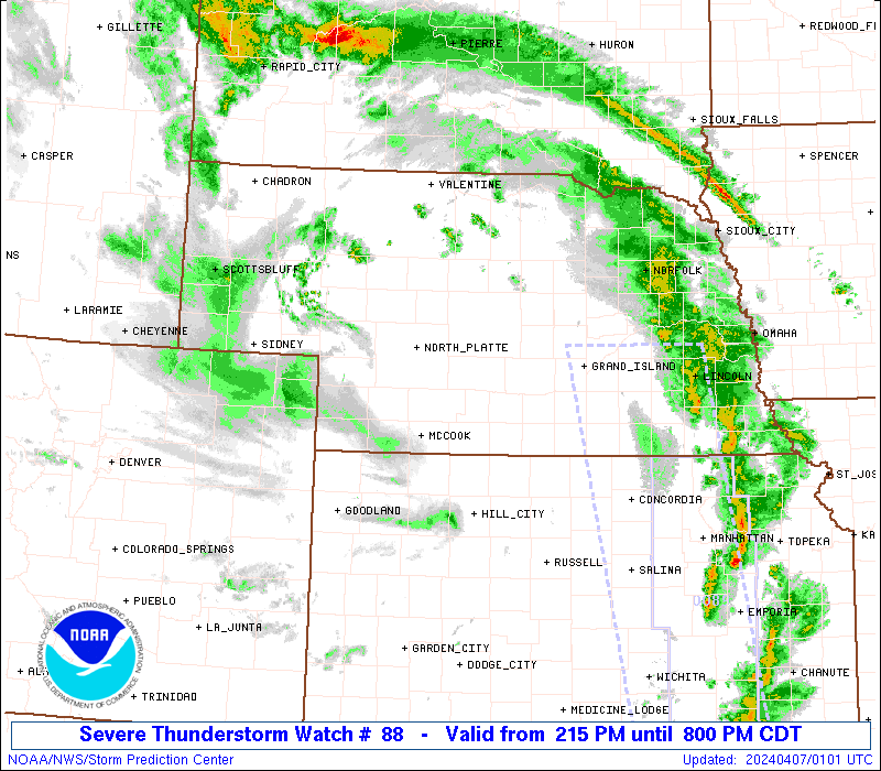
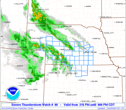
Severe Thunderstorm Watch Number 88
NWS Storm Prediction Center Norman OK
215 PM CDT Sat Apr 6 2024
The NWS Storm Prediction Center has issued a
* Severe Thunderstorm Watch for portions of
Northern Kansas
Western and Central Nebraska
* Effective this Saturday afternoon and evening from 215 PM until
800 PM CDT.
* Primary threats include...
Scattered damaging winds likely with isolated significant gusts
to 75 mph possible
Isolated large hail events to 1 inch in diameter possible
A tornado or two possible
SUMMARY...An arcing band of thunderstorms is expected to initially
intensify across southwest/west-central Nebraska, and into central
Nebraska and north-central Kansas by late afternoon. Some severe
hail is possible, and perhaps a brief tornado risk, but
severe-caliber wind gusts/wind damage should be the primary impact.
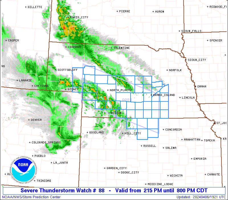
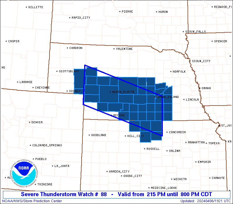
The severe thunderstorm watch area is approximately along and 55
statute miles north and south of a line from 65 miles north
northwest of Imperial NE to 40 miles southeast of Hastings NE. For a
complete depiction of the watch see the associated watch outline
update (WOUS64 KWNS WOU8).
PRECAUTIONARY/PREPAREDNESS ACTIONS...
REMEMBER...A Severe Thunderstorm Watch means conditions are
favorable for severe thunderstorms in and close to the watch area.
Persons in these areas should be on the lookout for threatening
weather conditions and listen for later statements and possible
warnings. Severe thunderstorms can and occasionally do produce
tornadoes.
&&
AVIATION...A few severe thunderstorms with hail surface and aloft to
1 inch. Extreme turbulence and surface wind gusts to 65 knots. A few
cumulonimbi with maximum tops to 400. Mean storm motion vector
20040.
...Guyer
   SEL8

   URGENT - IMMEDIATE BROADCAST REQUESTED
   Severe Thunderstorm Watch Number 88
   NWS Storm Prediction Center Norman OK
   215 PM CDT Sat Apr 6 2024

   The NWS Storm Prediction Center has issued a

   * Severe Thunderstorm Watch for portions of
     Northern Kansas
     Western and Central Nebraska

   * Effective this Saturday afternoon and evening from 215 PM until
     800 PM CDT.

   * Primary threats include...
     Scattered damaging winds likely with isolated significant gusts
       to 75 mph possible
     Isolated large hail events to 1 inch in diameter possible
     A tornado or two possible

   SUMMARY...An arcing band of thunderstorms is expected to initially
   intensify across southwest/west-central Nebraska, and into central
   Nebraska and north-central Kansas by late afternoon. Some severe
   hail is possible, and perhaps a brief tornado risk, but
   severe-caliber wind gusts/wind damage should be the primary impact.

   The severe thunderstorm watch area is approximately along and 55
   statute miles north and south of a line from 65 miles north
   northwest of Imperial NE to 40 miles southeast of Hastings NE. For a
   complete depiction of the watch see the associated watch outline
   update (WOUS64 KWNS WOU8).

   PRECAUTIONARY/PREPAREDNESS ACTIONS...

   REMEMBER...A Severe Thunderstorm Watch means conditions are
   favorable for severe thunderstorms in and close to the watch area.
   Persons in these areas should be on the lookout for threatening
   weather conditions and listen for later statements and possible
   warnings. Severe thunderstorms can and occasionally do produce
   tornadoes.

   &&

   AVIATION...A few severe thunderstorms with hail surface and aloft to
   1 inch. Extreme turbulence and surface wind gusts to 65 knots. A few
   cumulonimbi with maximum tops to 400. Mean storm motion vector
   20040.

   ...Guyer
 Note:
The Aviation Watch (SAW) product is an approximation to the watch area.
The actual watch is depicted by the shaded areas.
Note:
The Aviation Watch (SAW) product is an approximation to the watch area.
The actual watch is depicted by the shaded areas.
   SAW8
   WW 88 SEVERE TSTM KS NE 061915Z - 070100Z
   AXIS..55 STATUTE MILES NORTH AND SOUTH OF LINE..
   65NNW IML/IMPERIAL NE/ - 40SE HSI/HASTINGS NE/
   ..AVIATION COORDS.. 50NM N/S /43ENE SNY - 74SSE OBH/
   HAIL SURFACE AND ALOFT..1 INCH. WIND GUSTS..65 KNOTS.
   MAX TOPS TO 400. MEAN STORM MOTION VECTOR 20040.

   LAT...LON 42180210 40999789 39399789 40590210

   THIS IS AN APPROXIMATION TO THE WATCH AREA.  FOR A
   COMPLETE DEPICTION OF THE WATCH SEE WOUS64 KWNS
   FOR WOU8.
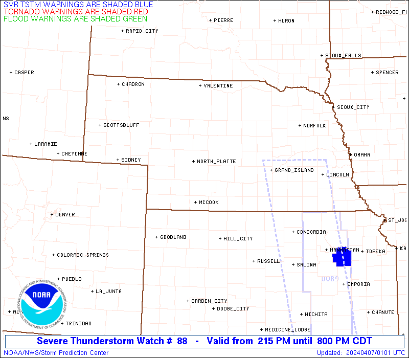
Watch 88 Status Report Messages:
STATUS REPORT #2 ON WW 88

VALID 062300Z - 070040Z

SEVERE WEATHER THREAT CONTINUES RIGHT OF A LINE FROM 10 WSW CNK
TO 40 SE HSI TO 10 SSE GRI TO 15 NW BUB.

..LYONS..04/06/24

ATTN...WFO...GID...LBF...

&&

STATUS REPORT FOR WS 88

SEVERE WEATHER THREAT CONTINUES FOR THE FOLLOWING AREAS

NEC035-059-075-077-079-081-093-121-125-143-163-169-175-185-
070040-

NE
.    NEBRASKA COUNTIES INCLUDED ARE

CLAY		     FILLMORE		 GRANT
GREELEY 	     HALL		 HAMILTON
HOWARD		     MERRICK		 NANCE
POLK		     SHERMAN		 THAYER
VALLEY		     YORK
$$


THE WATCH STATUS MESSAGE IS FOR GUIDANCE PURPOSES ONLY.  PLEASE
REFER TO WATCH COUNTY NOTIFICATION STATEMENTS FOR OFFICIAL
INFORMATION ON COUNTIES...INDEPENDENT CITIES AND MARINE ZONES
CLEARED FROM SEVERE THUNDERSTORM AND TORNADO WATCHES.
$$

STATUS REPORT #1 ON WW 88

VALID 062120Z - 062240Z

SEVERE WEATHER THREAT CONTINUES RIGHT OF A LINE FROM 50 ENE HLC
TO 35 SW EAR TO 10 SSE LBF TO 50 WNW LBF TO 5 E AIA.

..LYONS..04/06/24

ATTN...WFO...GID...LBF...

&&

STATUS REPORT FOR WS 88

SEVERE WEATHER THREAT CONTINUES FOR THE FOLLOWING AREAS

KSC089-123-141-183-062240-

KS
.    KANSAS COUNTIES INCLUDED ARE

JEWELL		     MITCHELL		 OSBORNE
SMITH
$$


NEC001-005-019-035-041-047-059-061-069-073-075-077-079-081-083-
093-099-111-113-117-121-125-129-137-143-163-169-175-181-185-
062240-

NE
.    NEBRASKA COUNTIES INCLUDED ARE

ADAMS		     ARTHUR		 BUFFALO
CLAY		     CUSTER		 DAWSON
FILLMORE	     FRANKLIN		 GARDEN
GOSPER		     GRANT		 GREELEY
HALL		     HAMILTON		 HARLAN
HOWARD		     KEARNEY		 LINCOLN
LOGAN		     MCPHERSON		 MERRICK
NANCE		     NUCKOLLS		 PHELPS
POLK		     SHERMAN		 THAYER
VALLEY		     WEBSTER		 YORK
$$


THE WATCH STATUS MESSAGE IS FOR GUIDANCE PURPOSES ONLY.  PLEASE
REFER TO WATCH COUNTY NOTIFICATION STATEMENTS FOR OFFICIAL
INFORMATION ON COUNTIES...INDEPENDENT CITIES AND MARINE ZONES
CLEARED FROM SEVERE THUNDERSTORM AND TORNADO WATCHES.
$$
Note:
Click for Complete Product Text.
Tornadoes
Probability of 2 or more tornadoes
|
Low (20%)
|
Probability of 1 or more strong (EF2-EF5) tornadoes
|
Low (5%)
|
Wind
Probability of 10 or more severe wind events
|
High (70%)
|
Probability of 1 or more wind events > 65 knots
|
Mod (30%)
|
Hail
Probability of 10 or more severe hail events
|
Low (20%)
|
Probability of 1 or more hailstones > 2 inches
|
Low (<5%)
|
Combined Severe Hail/Wind
Probability of 6 or more combined severe hail/wind events
|
High (80%)
|
For each watch, probabilities for particular events inside the watch
(listed above in each table) are determined by the issuing forecaster.
The "Low" category contains probability values ranging from less than 2%
to 20% (EF2-EF5 tornadoes), less than 5% to 20% (all other probabilities),
"Moderate" from 30% to 60%, and "High" from 70% to greater than 95%.
High values are bolded and lighter in color to provide awareness of
an increased threat for a particular event.


 @NWSSPC