 Note:
The expiration time in the watch graphic is amended if the watch is
replaced, cancelled or extended.
Note:
Note:
The expiration time in the watch graphic is amended if the watch is
replaced, cancelled or extended.
Note: Click for
Watch Status Reports.
   SEL6

   URGENT - IMMEDIATE BROADCAST REQUESTED
   Severe Thunderstorm Watch Number 86
   NWS Storm Prediction Center Norman OK
   605 AM CDT Mon Mar 31 2025

   The NWS Storm Prediction Center has issued a

   * Severe Thunderstorm Watch for portions of
     Southern Alabama
     The Western Florida Panhandle
     Southeast Mississippi
     Coastal Waters

   * Effective this Monday morning and afternoon from 605 AM until
     100 PM CDT.

   * Primary threats include...
     Scattered damaging wind gusts to 70 mph likely
     Isolated large hail events to 1.5 inches in diameter possible
     A tornado or two possible

   SUMMARY...A line of thunderstorms will move eastward over the next
   several hours. Scattered severe/damaging winds with peak gusts up to
   60-70 mph should be the main threat, although a tornado or two may
   also occur.

   The severe thunderstorm watch area is approximately along and 75
   statute miles east and west of a line from 45 miles north northwest
   of Evergreen AL to 30 miles southeast of Mobile AL. For a complete
   depiction of the watch see the associated watch outline update
   (WOUS64 KWNS WOU6).

   PRECAUTIONARY/PREPAREDNESS ACTIONS...

   REMEMBER...A Severe Thunderstorm Watch means conditions are
   favorable for severe thunderstorms in and close to the watch area.
   Persons in these areas should be on the lookout for threatening
   weather conditions and listen for later statements and possible
   warnings. Severe thunderstorms can and occasionally do produce
   tornadoes.

   &&

   OTHER WATCH INFORMATION...CONTINUE...WW 83...WW 84...WW 85...

   AVIATION...A few severe thunderstorms with hail surface and aloft to
   1.5 inches. Extreme turbulence and surface wind gusts to 60 knots. A
   few cumulonimbi with maximum tops to 500. Mean storm motion vector
   27035.

   ...Gleason
 Note:
The Aviation Watch (SAW) product is an approximation to the watch area.
The actual watch is depicted by the shaded areas.
Note:
The Aviation Watch (SAW) product is an approximation to the watch area.
The actual watch is depicted by the shaded areas.
SAW6
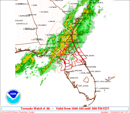
WW 86 SEVERE TSTM AL FL MS CW 311105Z - 311800Z
AXIS..75 STATUTE MILES EAST AND WEST OF LINE..
45NNW GZH/EVERGREEN AL/ - 30SE MOB/MOBILE AL/
..AVIATION COORDS.. 65NM E/W /53WSW MGM - 32SE SJI/
HAIL SURFACE AND ALOFT..1.5 INCHES. WIND GUSTS..60 KNOTS.
MAX TOPS TO 500. MEAN STORM MOTION VECTOR 27035.
LAT...LON 32008605 30378664 30378915 32008861
THIS IS AN APPROXIMATION TO THE WATCH AREA. FOR A
COMPLETE DEPICTION OF THE WATCH SEE WOUS64 KWNS
FOR WOU6.
Watch 86 Status Report Messages:
STATUS REPORT #5 ON WW 86

VALID 311635Z - 311740Z

SEVERE WEATHER THREAT CONTINUES RIGHT OF A LINE FROM 45 SSW PNS
TO 10 ENE PNS TO 30 N CEW TO 20 ESE MGM.

..WENDT..03/31/25

ATTN...WFO...MOB...

&&

STATUS REPORT FOR WS 86

SEVERE WEATHER THREAT CONTINUES FOR THE FOLLOWING AREAS

ALC039-311740-

AL
.    ALABAMA COUNTIES INCLUDED ARE

COVINGTON
$$


FLC091-311740-

FL
.    FLORIDA COUNTIES INCLUDED ARE

OKALOOSA
$$


GMZ634-635-636-655-311740-

CW

.    ADJACENT COASTAL WATERS INCLUDED ARE

PENSACOLA BAY AREA INCLUDING SANTA ROSA SOUND

WESTERN CHOCTAWHATCHEE BAY

EASTERN CHOCTAWHATCHEE BAY

COASTAL WATERS FROM OKALOOSA-WALTON COUNTY LINE TO PENSACOLA FL
OUT 20 NM

$$
THE WATCH STATUS MESSAGE IS FOR GUIDANCE PURPOSES ONLY.  PLEASE
REFER TO WATCH COUNTY NOTIFICATION STATEMENTS FOR OFFICIAL
INFORMATION ON COUNTIES...INDEPENDENT CITIES AND MARINE ZONES
CLEARED FROM SEVERE THUNDERSTORM AND TORNADO WATCHES.
$$

STATUS REPORT #4 ON WW 86

VALID 311535Z - 311640Z

SEVERE WEATHER THREAT CONTINUES RIGHT OF A LINE FROM 40 S MOB TO
25 E MOB TO 25 SW GZH TO 10 E GZH TO 15 SSW MGM.

..WENDT..03/31/25

ATTN...WFO...MOB...

&&

STATUS REPORT FOR WS 86

SEVERE WEATHER THREAT CONTINUES FOR THE FOLLOWING AREAS

ALC003-013-039-041-053-311640-

AL
.    ALABAMA COUNTIES INCLUDED ARE

BALDWIN 	     BUTLER		 COVINGTON
CRENSHAW	     ESCAMBIA
$$


FLC033-091-113-311640-

FL
.    FLORIDA COUNTIES INCLUDED ARE

ESCAMBIA	     OKALOOSA		 SANTA ROSA
$$


GMZ631-633-634-635-636-650-655-311640-

CW

.    ADJACENT COASTAL WATERS INCLUDED ARE

SOUTH MOBILE BAY

PERDIDO BAY AREA

PENSACOLA BAY AREA INCLUDING SANTA ROSA SOUND

WESTERN CHOCTAWHATCHEE BAY

EASTERN CHOCTAWHATCHEE BAY

COASTAL WATERS FROM PENSACOLA FL TO PASCAGOULA MS OUT 20 NM

COASTAL WATERS FROM OKALOOSA-WALTON COUNTY LINE TO PENSACOLA FL
OUT 20 NM

$$
THE WATCH STATUS MESSAGE IS FOR GUIDANCE PURPOSES ONLY.  PLEASE
REFER TO WATCH COUNTY NOTIFICATION STATEMENTS FOR OFFICIAL
INFORMATION ON COUNTIES...INDEPENDENT CITIES AND MARINE ZONES
CLEARED FROM SEVERE THUNDERSTORM AND TORNADO WATCHES.
$$

STATUS REPORT #3 ON WW 86

VALID 311425Z - 311540Z

SEVERE WEATHER THREAT CONTINUES RIGHT OF A LINE FROM 15 NE GPT TO
35 NNW MOB TO 45 W GZH TO 25 SW SEM.

..WENDT..03/31/25

ATTN...WFO...MOB...

&&

STATUS REPORT FOR WS 86

SEVERE WEATHER THREAT CONTINUES FOR THE FOLLOWING AREAS

ALC003-013-035-039-041-053-097-099-131-311540-

AL
.    ALABAMA COUNTIES INCLUDED ARE

BALDWIN 	     BUTLER		 CONECUH
COVINGTON	     CRENSHAW		 ESCAMBIA
MOBILE		     MONROE		 WILCOX
$$


FLC033-091-113-311540-

FL
.    FLORIDA COUNTIES INCLUDED ARE

ESCAMBIA	     OKALOOSA		 SANTA ROSA
$$


MSC039-311540-

MS
.    MISSISSIPPI COUNTIES INCLUDED ARE

GEORGE
$$


GMZ630-631-632-633-634-635-636-650-655-311540-

CW

.    ADJACENT COASTAL WATERS INCLUDED ARE

NORTH MOBILE BAY

SOUTH MOBILE BAY

MISSISSIPPI SOUND

PERDIDO BAY AREA

PENSACOLA BAY AREA INCLUDING SANTA ROSA SOUND

WESTERN CHOCTAWHATCHEE BAY

EASTERN CHOCTAWHATCHEE BAY

COASTAL WATERS FROM PENSACOLA FL TO PASCAGOULA MS OUT 20 NM

COASTAL WATERS FROM OKALOOSA-WALTON COUNTY LINE TO PENSACOLA FL
OUT 20 NM

$$
THE WATCH STATUS MESSAGE IS FOR GUIDANCE PURPOSES ONLY.  PLEASE
REFER TO WATCH COUNTY NOTIFICATION STATEMENTS FOR OFFICIAL
INFORMATION ON COUNTIES...INDEPENDENT CITIES AND MARINE ZONES
CLEARED FROM SEVERE THUNDERSTORM AND TORNADO WATCHES.
$$

STATUS REPORT #2 ON WW 86

VALID 311240Z - 311340Z

THE SEVERE WEATHER THREAT CONTINUES ACROSS THE ENTIRE WATCH AREA.

..LEITMAN..03/31/25

ATTN...WFO...MOB...

&&

STATUS REPORT FOR WS 86

SEVERE WEATHER THREAT CONTINUES FOR THE FOLLOWING AREAS

ALC003-013-023-025-035-039-041-053-097-099-129-131-311340-

AL
.    ALABAMA COUNTIES INCLUDED ARE

BALDWIN 	     BUTLER		 CHOCTAW
CLARKE		     CONECUH		 COVINGTON
CRENSHAW	     ESCAMBIA		 MOBILE
MONROE		     WASHINGTON 	 WILCOX
$$


FLC033-091-113-311340-

FL
.    FLORIDA COUNTIES INCLUDED ARE

ESCAMBIA	     OKALOOSA		 SANTA ROSA
$$


MSC039-041-111-131-153-311340-

MS
.    MISSISSIPPI COUNTIES INCLUDED ARE

GEORGE		     GREENE		 PERRY
STONE		     WAYNE
$$


GMZ630-631-632-633-634-635-636-650-655-311340-

CW

.    ADJACENT COASTAL WATERS INCLUDED ARE

NORTH MOBILE BAY

SOUTH MOBILE BAY

MISSISSIPPI SOUND

PERDIDO BAY AREA

PENSACOLA BAY AREA INCLUDING SANTA ROSA SOUND

WESTERN CHOCTAWHATCHEE BAY

EASTERN CHOCTAWHATCHEE BAY

COASTAL WATERS FROM PENSACOLA FL TO PASCAGOULA MS OUT 20 NM

COASTAL WATERS FROM OKALOOSA-WALTON COUNTY LINE TO PENSACOLA FL
OUT 20 NM

$$
THE WATCH STATUS MESSAGE IS FOR GUIDANCE PURPOSES ONLY.  PLEASE
REFER TO WATCH COUNTY NOTIFICATION STATEMENTS FOR OFFICIAL
INFORMATION ON COUNTIES...INDEPENDENT CITIES AND MARINE ZONES
CLEARED FROM SEVERE THUNDERSTORM AND TORNADO WATCHES.
$$

STATUS REPORT #1 ON WW 86

VALID 311135Z - 311240Z

THE SEVERE WEATHER THREAT CONTINUES ACROSS THE ENTIRE WATCH AREA.

..LEITMAN..03/31/25

ATTN...WFO...MOB...

&&

STATUS REPORT FOR WS 86

SEVERE WEATHER THREAT CONTINUES FOR THE FOLLOWING AREAS

ALC003-013-023-025-035-039-041-053-097-099-129-131-311240-

AL
.    ALABAMA COUNTIES INCLUDED ARE

BALDWIN 	     BUTLER		 CHOCTAW
CLARKE		     CONECUH		 COVINGTON
CRENSHAW	     ESCAMBIA		 MOBILE
MONROE		     WASHINGTON 	 WILCOX
$$


FLC033-091-113-311240-

FL
.    FLORIDA COUNTIES INCLUDED ARE

ESCAMBIA	     OKALOOSA		 SANTA ROSA
$$


MSC039-041-111-131-153-311240-

MS
.    MISSISSIPPI COUNTIES INCLUDED ARE

GEORGE		     GREENE		 PERRY
STONE		     WAYNE
$$


GMZ630-631-632-633-634-635-636-650-655-311240-

CW

.    ADJACENT COASTAL WATERS INCLUDED ARE

NORTH MOBILE BAY

SOUTH MOBILE BAY

MISSISSIPPI SOUND

PERDIDO BAY AREA

PENSACOLA BAY AREA INCLUDING SANTA ROSA SOUND

WESTERN CHOCTAWHATCHEE BAY

EASTERN CHOCTAWHATCHEE BAY

COASTAL WATERS FROM PENSACOLA FL TO PASCAGOULA MS OUT 20 NM

COASTAL WATERS FROM OKALOOSA-WALTON COUNTY LINE TO PENSACOLA FL
OUT 20 NM

$$
THE WATCH STATUS MESSAGE IS FOR GUIDANCE PURPOSES ONLY.  PLEASE
REFER TO WATCH COUNTY NOTIFICATION STATEMENTS FOR OFFICIAL
INFORMATION ON COUNTIES...INDEPENDENT CITIES AND MARINE ZONES
CLEARED FROM SEVERE THUNDERSTORM AND TORNADO WATCHES.
$$
Note:
Click for Complete Product Text.
Tornadoes
Probability of 2 or more tornadoes
|
Low (20%)
|
Probability of 1 or more strong (EF2-EF5) tornadoes
|
Low (10%)
|
Wind
Probability of 10 or more severe wind events
|
Mod (60%)
|
Probability of 1 or more wind events > 65 knots
|
Low (20%)
|
Hail
Probability of 10 or more severe hail events
|
Low (20%)
|
Probability of 1 or more hailstones > 2 inches
|
Low (10%)
|
Combined Severe Hail/Wind
Probability of 6 or more combined severe hail/wind events
|
High (80%)
|
For each watch, probabilities for particular events inside the watch
(listed above in each table) are determined by the issuing forecaster.
The "Low" category contains probability values ranging from less than 2%
to 20% (EF2-EF5 tornadoes), less than 5% to 20% (all other probabilities),
"Moderate" from 30% to 60%, and "High" from 70% to greater than 95%.
High values are bolded and lighter in color to provide awareness of
an increased threat for a particular event.


 @NWSSPC


