Note:
The expiration time in the watch graphic is amended if the watch is
replaced, cancelled or extended.
Note:
Note:
The expiration time in the watch graphic is amended if the watch is
replaced, cancelled or extended.
Note: Click for
Watch Status Reports.
   SEL0

   URGENT - IMMEDIATE BROADCAST REQUESTED
   Severe Thunderstorm Watch Number 30
   NWS Storm Prediction Center Norman OK
   225 PM CST Thu Mar 7 2024

   The NWS Storm Prediction Center has issued a

   * Severe Thunderstorm Watch for portions of
     Southeast Kansas
     Northern Oklahoma

   * Effective this Thursday afternoon and evening from 225 PM until
     900 PM CST.

   * Primary threats include...
     Scattered large hail and isolated very large hail events to 2.5
       inches in diameter likely
     Scattered damaging wind gusts to 70 mph possible
     A tornado or two possible

   SUMMARY...Thunderstorms are expected to intensify this afternoon
   along a warm front near the Kansas/Oklahoma border.  Supercells
   capable of large hail and perhaps a tornado or two are the main
   concern.

   The severe thunderstorm watch area is approximately along and 40
   statute miles north and south of a line from 45 miles west southwest
   of Wichita KS to 30 miles southeast of Chanute KS. For a complete
   depiction of the watch see the associated watch outline update
   (WOUS64 KWNS WOU0).

   PRECAUTIONARY/PREPAREDNESS ACTIONS...

   REMEMBER...A Severe Thunderstorm Watch means conditions are
   favorable for severe thunderstorms in and close to the watch area.
   Persons in these areas should be on the lookout for threatening
   weather conditions and listen for later statements and possible
   warnings. Severe thunderstorms can and occasionally do produce
   tornadoes.

   &&

   AVIATION...A few severe thunderstorms with hail surface and aloft to
   2.5 inches. Extreme turbulence and surface wind gusts to 60 knots. A
   few cumulonimbi with maximum tops to 400. Mean storm motion vector
   27035.

   ...Hart
 Note:
The Aviation Watch (SAW) product is an approximation to the watch area.
The actual watch is depicted by the shaded areas.
Note:
The Aviation Watch (SAW) product is an approximation to the watch area.
The actual watch is depicted by the shaded areas.
   SAW0
   WW 30 SEVERE TSTM KS OK 072025Z - 080300Z
   AXIS..40 STATUTE MILES NORTH AND SOUTH OF LINE..
   45WSW ICT/WICHITA KS/ - 30SE CNU/CHANUTE KS/
   ..AVIATION COORDS.. 35NM N/S /36SW ICT - 14NNE OSW/
   HAIL SURFACE AND ALOFT..2.5 INCHES. WIND GUSTS..60 KNOTS.
   MAX TOPS TO 400. MEAN STORM MOTION VECTOR 27035.

   LAT...LON 37989819 37939509 36789509 36829819

   THIS IS AN APPROXIMATION TO THE WATCH AREA.  FOR A
   COMPLETE DEPICTION OF THE WATCH SEE WOUS64 KWNS
   FOR WOU0.
Watch 30 Status Report Messages:
STATUS REPORT #5 ON WW 30
VALID 080135Z - 080240Z
SEVERE WEATHER THREAT CONTINUES RIGHT OF A LINE FROM 20 WSW PNC
TO 10 NW PNC TO 25 SE ICT TO 5 SW EMP.
..THORNTON..03/08/24
ATTN...WFO...ICT...OUN...TSA...
&&
STATUS REPORT FOR WS 30
SEVERE WEATHER THREAT CONTINUES FOR THE FOLLOWING AREAS
KSC001-019-035-049-073-099-125-133-205-207-080240-
KS
. KANSAS COUNTIES INCLUDED ARE
ALLEN CHAUTAUQUA COWLEY
ELK GREENWOOD LABETTE
MONTGOMERY NEOSHO WILSON
WOODSON
$$
OKC035-071-105-113-147-080240-
OK
. OKLAHOMA COUNTIES INCLUDED ARE
CRAIG KAY NOWATA
OSAGE WASHINGTON
$$
THE WATCH STATUS MESSAGE IS FOR GUIDANCE PURPOSES ONLY. PLEASE
REFER TO WATCH COUNTY NOTIFICATION STATEMENTS FOR OFFICIAL
INFORMATION ON COUNTIES...INDEPENDENT CITIES AND MARINE ZONES
CLEARED FROM SEVERE THUNDERSTORM AND TORNADO WATCHES.
$$
STATUS REPORT #4 ON WW 30
VALID 080040Z - 080140Z
SEVERE WEATHER THREAT CONTINUES RIGHT OF A LINE FROM 25 ENE AVK
TO 30 NNW PNC TO 10 SW EMP.
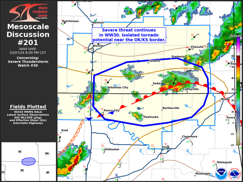
FOR ADDITIONAL INFORMATION SEE MESOSCALE DISCUSSION 201
..THORNTON..03/08/24
ATTN...WFO...ICT...OUN...TSA...
&&
STATUS REPORT FOR WS 30
SEVERE WEATHER THREAT CONTINUES FOR THE FOLLOWING AREAS
KSC001-019-035-049-073-099-125-133-205-207-080140-
KS
. KANSAS COUNTIES INCLUDED ARE
ALLEN CHAUTAUQUA COWLEY
ELK GREENWOOD LABETTE
MONTGOMERY NEOSHO WILSON
WOODSON
$$
OKC003-035-053-071-105-113-147-080140-
OK
. OKLAHOMA COUNTIES INCLUDED ARE
ALFALFA CRAIG GRANT
KAY NOWATA OSAGE
WASHINGTON
$$
THE WATCH STATUS MESSAGE IS FOR GUIDANCE PURPOSES ONLY. PLEASE
REFER TO WATCH COUNTY NOTIFICATION STATEMENTS FOR OFFICIAL
INFORMATION ON COUNTIES...INDEPENDENT CITIES AND MARINE ZONES
CLEARED FROM SEVERE THUNDERSTORM AND TORNADO WATCHES.
$$
STATUS REPORT #3 ON WW 30
VALID 072335Z - 080040Z
THE SEVERE WEATHER THREAT CONTINUES ACROSS THE ENTIRE WATCH AREA.
..THORNTON..03/07/24
ATTN...WFO...ICT...OUN...TSA...
&&
STATUS REPORT FOR WS 30
SEVERE WEATHER THREAT CONTINUES FOR THE FOLLOWING AREAS
KSC001-015-019-035-049-073-077-099-125-133-173-191-205-207-
080040-
KS
. KANSAS COUNTIES INCLUDED ARE
ALLEN BUTLER CHAUTAUQUA
COWLEY ELK GREENWOOD
HARPER LABETTE MONTGOMERY
NEOSHO SEDGWICK SUMNER
WILSON WOODSON
$$
OKC003-035-053-071-105-113-147-080040-
OK
. OKLAHOMA COUNTIES INCLUDED ARE
ALFALFA CRAIG GRANT
KAY NOWATA OSAGE
WASHINGTON
$$
THE WATCH STATUS MESSAGE IS FOR GUIDANCE PURPOSES ONLY. PLEASE
REFER TO WATCH COUNTY NOTIFICATION STATEMENTS FOR OFFICIAL
INFORMATION ON COUNTIES...INDEPENDENT CITIES AND MARINE ZONES
CLEARED FROM SEVERE THUNDERSTORM AND TORNADO WATCHES.
$$
STATUS REPORT #2 ON WW 30
VALID 072245Z - 072340Z
THE SEVERE WEATHER THREAT CONTINUES ACROSS THE ENTIRE WATCH AREA.
..THORNTON..03/07/24
ATTN...WFO...ICT...OUN...TSA...
&&
STATUS REPORT FOR WS 30
SEVERE WEATHER THREAT CONTINUES FOR THE FOLLOWING AREAS
KSC001-015-019-035-049-073-077-099-125-133-173-191-205-207-
072340-
KS
. KANSAS COUNTIES INCLUDED ARE
ALLEN BUTLER CHAUTAUQUA
COWLEY ELK GREENWOOD
HARPER LABETTE MONTGOMERY
NEOSHO SEDGWICK SUMNER
WILSON WOODSON
$$
OKC003-035-053-071-105-113-147-072340-
OK
. OKLAHOMA COUNTIES INCLUDED ARE
ALFALFA CRAIG GRANT
KAY NOWATA OSAGE
WASHINGTON
$$
THE WATCH STATUS MESSAGE IS FOR GUIDANCE PURPOSES ONLY. PLEASE
REFER TO WATCH COUNTY NOTIFICATION STATEMENTS FOR OFFICIAL
INFORMATION ON COUNTIES...INDEPENDENT CITIES AND MARINE ZONES
CLEARED FROM SEVERE THUNDERSTORM AND TORNADO WATCHES.
$$
STATUS REPORT #1 ON WW 30
VALID 072135Z - 072240Z
THE SEVERE WEATHER THREAT CONTINUES ACROSS THE ENTIRE WATCH AREA.
..MOORE..03/07/24
ATTN...WFO...ICT...OUN...TSA...
&&
STATUS REPORT FOR WS 30
SEVERE WEATHER THREAT CONTINUES FOR THE FOLLOWING AREAS
KSC001-015-019-035-049-073-077-099-125-133-173-191-205-207-
072240-
KS
. KANSAS COUNTIES INCLUDED ARE
ALLEN BUTLER CHAUTAUQUA
COWLEY ELK GREENWOOD
HARPER LABETTE MONTGOMERY
NEOSHO SEDGWICK SUMNER
WILSON WOODSON
$$
OKC003-035-053-071-105-113-147-072240-
OK
. OKLAHOMA COUNTIES INCLUDED ARE
ALFALFA CRAIG GRANT
KAY NOWATA OSAGE
WASHINGTON
$$
THE WATCH STATUS MESSAGE IS FOR GUIDANCE PURPOSES ONLY. PLEASE
REFER TO WATCH COUNTY NOTIFICATION STATEMENTS FOR OFFICIAL
INFORMATION ON COUNTIES...INDEPENDENT CITIES AND MARINE ZONES
CLEARED FROM SEVERE THUNDERSTORM AND TORNADO WATCHES.
$$
Note:
Click for Complete Product Text.
Tornadoes
Probability of 2 or more tornadoes
|
Low (20%)
|
Probability of 1 or more strong (EF2-EF5) tornadoes
|
Low (5%)
|
Wind
Probability of 10 or more severe wind events
|
Mod (40%)
|
Probability of 1 or more wind events > 65 knots
|
Low (20%)
|
Hail
Probability of 10 or more severe hail events
|
High (70%)
|
Probability of 1 or more hailstones > 2 inches
|
Mod (60%)
|
Combined Severe Hail/Wind
Probability of 6 or more combined severe hail/wind events
|
High (90%)
|
For each watch, probabilities for particular events inside the watch
(listed above in each table) are determined by the issuing forecaster.
The "Low" category contains probability values ranging from less than 2%
to 20% (EF2-EF5 tornadoes), less than 5% to 20% (all other probabilities),
"Moderate" from 30% to 60%, and "High" from 70% to greater than 95%.
High values are bolded and lighter in color to provide awareness of
an increased threat for a particular event.


 @NWSSPC