|
| Mesoscale Discussion 625 |
|
< Previous MD Next MD >
|
|
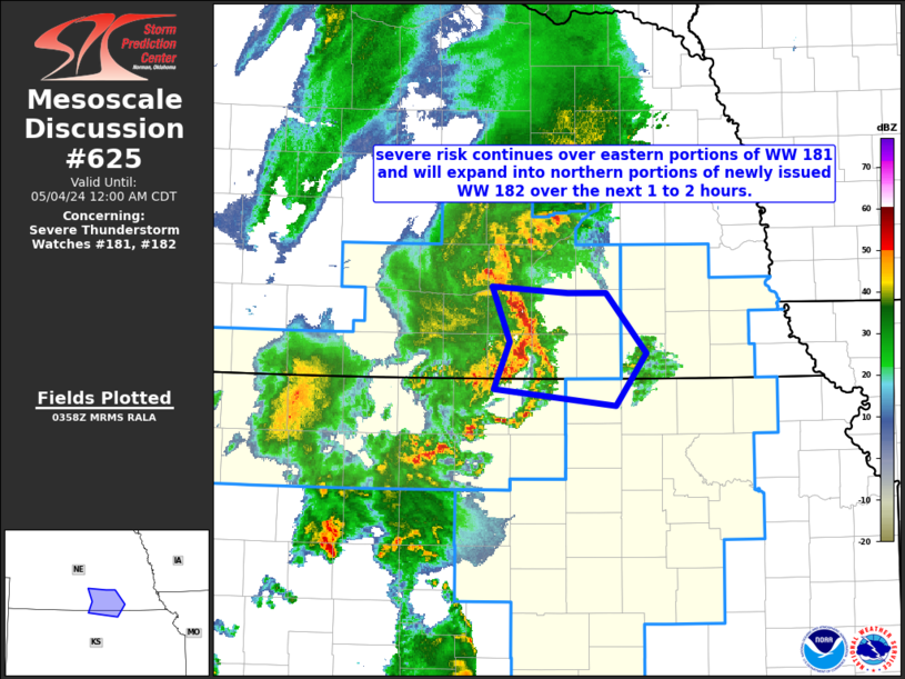
   Mesoscale Discussion 0625
   NWS Storm Prediction Center Norman OK
   1101 PM CDT Fri May 03 2024

   Areas affected...parts of southern Nebraska and adjacent
   north-central Kansas

   Concerning...Severe Thunderstorm Watch 181...182...

   Valid 040401Z - 040500Z

   The severe weather threat for Severe Thunderstorm Watch 181, 182
   continues.

   SUMMARY...A bowing band of severe storms -- capable of producing
   damaging wind gusts and possibly a brief tornado -- will continue
   moving eastward near and just north of the Nebraska/Kansas border.

   DISCUSSION...Latest radar loop shows a bowing band of strong/severe
   storms crossing south-central Nebraska at this time.  The convection
   is situated just east of a weak frontal wave, and riding along the
   surface warm front.  With weaker instability with eastward extent,
   storms may diminish somewhat over the next 1 to 2 hours, though a
   slight east-southeastward turn -- along the instability gradient --
   is also anticipated.  Damaging wind gusts will be possible over the
   next 1 to 2 hours, along with potential for a brief tornado.

   ..Goss.. 05/04/2024

   ...Please see www.spc.noaa.gov for graphic product...

   ATTN...WFO...OAX...TOP...GID...

   LAT...LON   39919865 40289850 40719867 40679791 40679751 40209710
               39799741 39919865
|
|
Top/All Mesoscale Discussions/Forecast Products/Home
|
|


 @NWSSPC